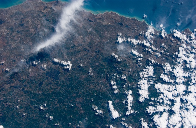
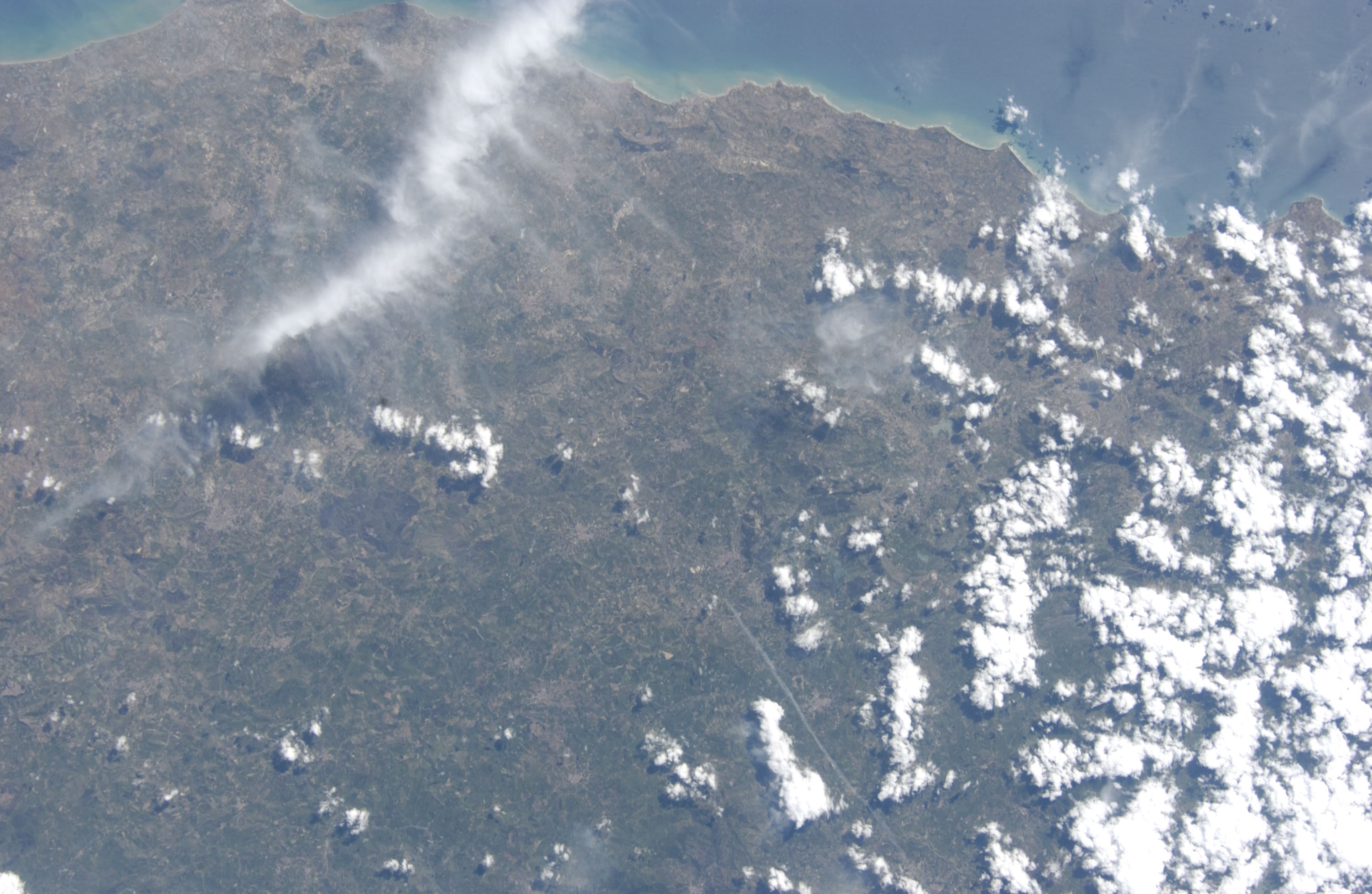
ISS011-E-15400
| NASA Photo ID | ISS011-E-15400 |
| Focal Length | 80mm |
| Date taken | 2005.05.18 |
| Time taken | 13:23:43 GMT |
Cloud masks available for this image:
Spacecraft nadir point: 38.5° N, 14.2° E
Photo center point: 37.5° N, 15.0° E
Photo center point by machine learning:
Photo center point: 37.5° N, 15.0° E
Photo center point by machine learning:
Nadir to Photo Center: Southeast
Spacecraft Altitude: 188 nautical miles (348km)
Country or Geographic Name: | SICILY |
Features: | MOUNT ETNA, VOLCANIC PLUME, BELPASSO, CATANIA, GIARRE |
| Features Found Using Machine Learning: | |
Cloud Cover Percentage: | 10 (1-10)% |
Sun Elevation Angle: | 54° |
Sun Azimuth: | 249° |
Camera: | Nikon D1 Electronic Still Camera |
Focal Length: | 80mm |
Camera Tilt: | 22 degrees |
Format: | 2000E: 2000 x 1312 pixel CCD, RGBG imager color filter |
Film Exposure: | |
| Additional Information | |
| Width | Height | Annotated | Cropped | Purpose | Links |
|---|---|---|---|---|---|
| 3008 pixels | 1960 pixels | No | No | Not enhanced | Download Image |
| 640 pixels | 417 pixels | No | No | Download Image |
Download Packaged File
Download a Google Earth KML for this Image
View photo footprint information
Download a GeoTIFF for this photo
Image Caption: none
