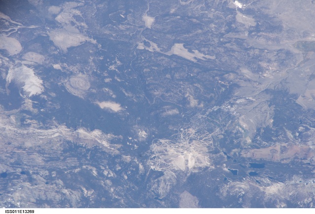
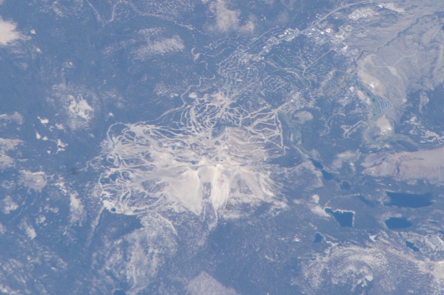
ISS011-E-13269
| NASA Photo ID | ISS011-E-13269 |
| Focal Length | 800mm |
| Date taken | 2005.09.19 |
| Time taken | 19:39:56 GMT |
Cloud masks available for this image:
Spacecraft nadir point: 36.0° N, 122.6° W
Photo center point: 37.9° N, 119.2° W
Photo center point by machine learning:
Photo center point: 37.9° N, 119.2° W
Photo center point by machine learning:
Nadir to Photo Center: Northeast
Spacecraft Altitude: 186 nautical miles (344km)
Country or Geographic Name: | USA-CALIFORNIA |
Features: | MAMMOTH MT., SKI SLOPES, FOR. |
| Features Found Using Machine Learning: | |
Cloud Cover Percentage: | 10 (1-10)% |
Sun Elevation Angle: | 55° |
Sun Azimuth: | 169° |
Camera: | Kodak DCS760c Electronic Still Camera |
Focal Length: | 800mm |
Camera Tilt: | 52 degrees |
Format: | 3060E: 3060 x 2036 pixel CCD, RGBG array |
Film Exposure: | |
| Additional Information | |
| Width | Height | Annotated | Cropped | Purpose | Links |
|---|---|---|---|---|---|
| 1486 pixels | 990 pixels | No | No | Not enhanced | Download Image |
| 639 pixels | 435 pixels | No | No | Download Image |
Download Packaged File
Download a Google Earth KML for this Image
View photo footprint information
Download a GeoTIFF for this photo
Image Caption: none
