ISS011-E-11844

| NASA Photo ID | ISS011-E-11844 |
| Focal Length | 180mm |
| Date taken | 2005.06.08 |
| Time taken | 20:29:15 GMT |
Cloud masks available for this image:
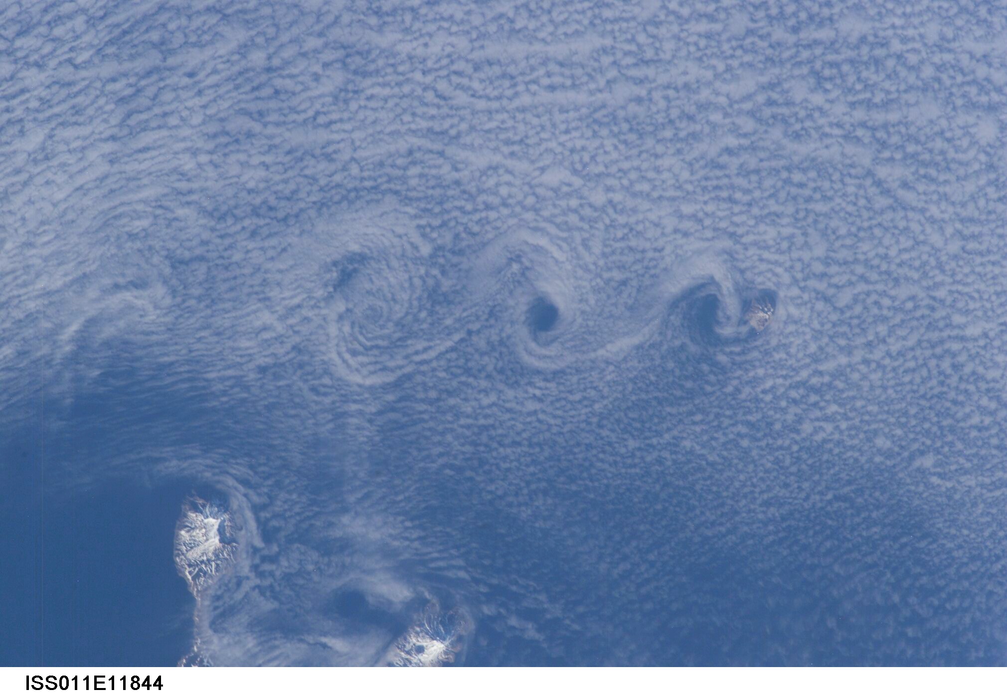
Spacecraft nadir point: 46.1° N, 153.8° E
Photo center point: 49.0° N, 153.5° E
Photo center point by machine learning:
Photo center point: 49.0° N, 153.5° E
Photo center point by machine learning:
Nadir to Photo Center: North
Spacecraft Altitude: 188 nautical miles (348km)
Country or Geographic Name: | RUSSIAN FEDERATION |
Features: | CLOUD VORTICES, SHIASHKOTAN I. |
| Features Found Using Machine Learning: | |
Cloud Cover Percentage: | 75 (51-75)% |
Sun Elevation Angle: | 24° |
Sun Azimuth: | 81° |
Camera: | Kodak DCS760c Electronic Still Camera |
Focal Length: | 180mm |
Camera Tilt: | 43 degrees |
Format: | 3060E: 3060 x 2036 pixel CCD, RGBG array |
Film Exposure: | |
| Additional Information | |
| Width | Height | Annotated | Cropped | Purpose | Links |
|---|---|---|---|---|---|
| 2020 pixels | 1338 pixels | No | No | Original file from camera | Download Image |
| 639 pixels | 441 pixels | No | No | Download Image |
Download Packaged File
Download a Google Earth KML for this Image
View photo footprint information
Download a GeoTIFF for this photo
Image Caption: none
