ISS010-E-9287
| NASA Photo ID | ISS010-E-9287 |
| Focal Length | 800mm |
| Date taken | 2004.12.03 |
| Time taken | 18:55:48 GMT |
540 x 510 pixels 1004 x 948 pixels 540 x 540 pixels 3032 x 2064 pixels 639 x 435 pixels
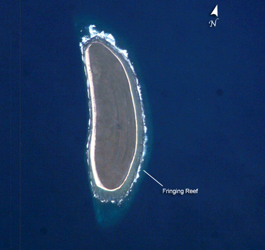
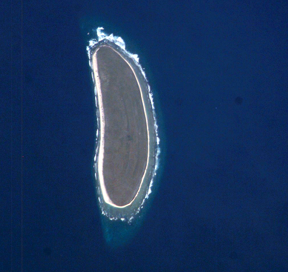
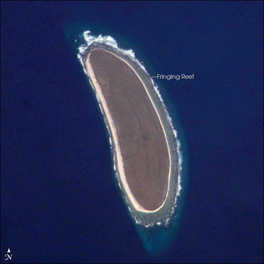
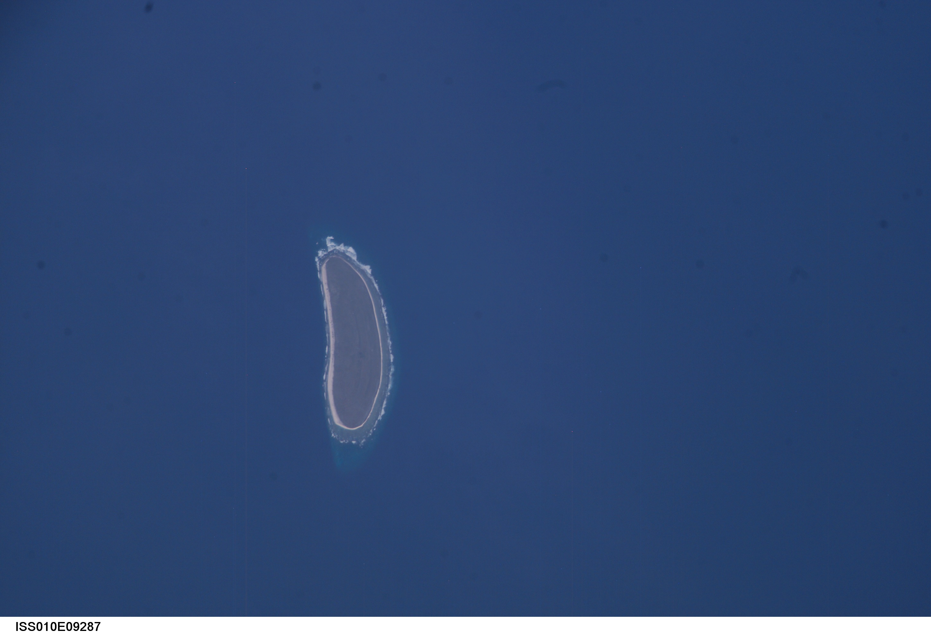
Photo center point: 0.8° N, 176.6° W
Photo center point by machine learning:
Country or Geographic Name: | HOWLAND ISLAND |
Features: | HOWLAND ISLAND |
| Features Found Using Machine Learning: | |
Cloud Cover Percentage: | 10 (1-10)% |
Sun Elevation Angle: | 19° |
Sun Azimuth: | 115° |
Camera: | Kodak DCS760c Electronic Still Camera |
Focal Length: | 800mm |
Camera Tilt: | 41 degrees |
Format: | 3060E: 3060 x 2036 pixel CCD, RGBG array |
Film Exposure: | |
| Additional Information | |
| Width | Height | Annotated | Cropped | Purpose | Links |
|---|---|---|---|---|---|
| 540 pixels | 510 pixels | Yes | Yes | Earth From Space collection | Download Image |
| 1004 pixels | 948 pixels | No | Yes | NASA's Earth Observatory web site | Download Image |
| 540 pixels | 540 pixels | Yes | Yes | NASA's Earth Observatory web site | Download Image |
| 3032 pixels | 2064 pixels | No | No | Download Image | |
| 639 pixels | 435 pixels | No | No | Download Image |
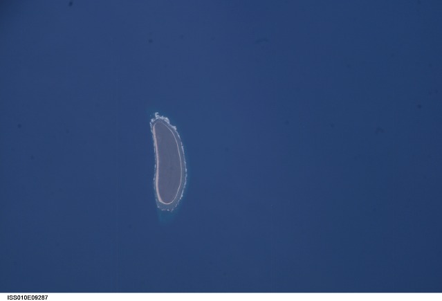
Howland Island is a United States possession located in the north Pacific between Australia and the Hawaiian Islands. Prior to 1890, organic nitrate (guano) was mined from the island by both the United States and the British. This tiny island (1.6 km2) is currently part of the U.S. National Wildlife Refuge system, and provides nesting areas and forage for a variety of birds and marine wildlife.
The island is composed of coral fragments and is surrounded by an active fringing reef. White breakers encircling the island indicate the position of the reef. Astronauts aboard the International Space Station photograph numerous reefs around the world as part of a global mapping and monitoring program. High-resolution images such as this one are used to update geographic maps of reefs and islands, assess the health of reef ecosystems, and calculate bathymetry of the surrounding ocean bottom.
