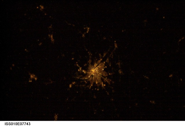
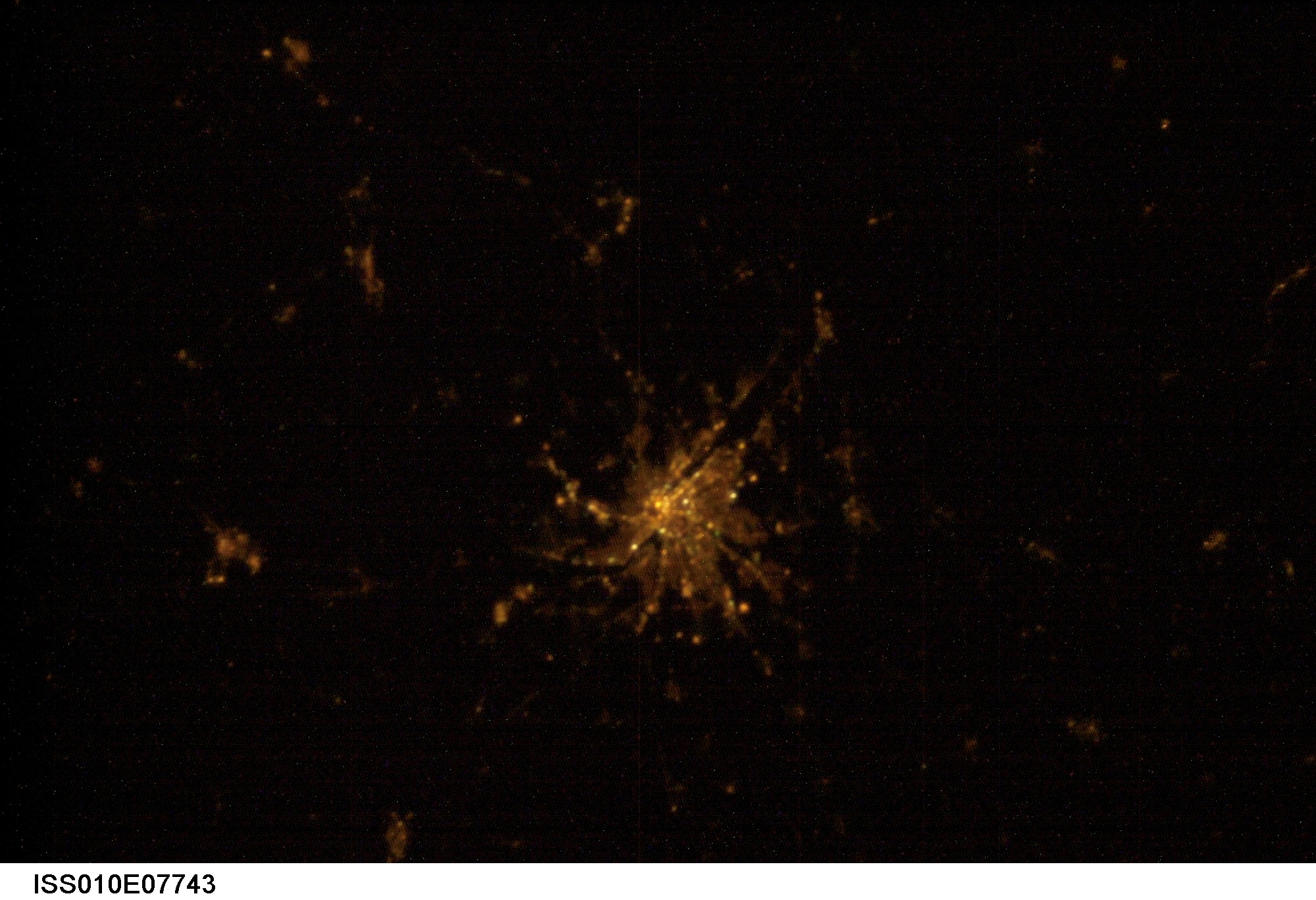
ISS010-E-7743
| NASA Photo ID | ISS010-E-7743 |
| Focal Length | mm |
| Date taken | 2004.11.19 |
| Time taken | 19:25:34 GMT |
Cloud masks available for this image:
Spacecraft nadir point: 48.8° N, 17.2° E
Photo center point: 47.5° N, 19.0° E
Photo center point by machine learning:
Photo center point: 47.5° N, 19.0° E
Photo center point by machine learning:
Nadir to Photo Center: Southeast
Spacecraft Altitude: 190 nautical miles (352km)
Country or Geographic Name: | HUNGARY |
Features: | BUDAPEST AT NIGHT |
| Features Found Using Machine Learning: | |
Cloud Cover Percentage: | 0 (no clouds present) |
Sun Elevation Angle: | -42° |
Sun Azimuth: | 290° |
Camera: | Nikon D1 Electronic Still Camera |
Focal Length: | mm |
Camera Tilt: | 35 degrees |
Format: | 2000E: 2000 x 1312 pixel CCD, RGBG imager color filter |
Film Exposure: | |
| Additional Information | |
| Width | Height | Annotated | Cropped | Purpose | Links |
|---|---|---|---|---|---|
| 2000 pixels | 1368 pixels | No | No | Download Image | |
| 639 pixels | 437 pixels | No | No | Download Image |
Download Packaged File
Download a Google Earth KML for this Image
View photo footprint information
Download a GeoTIFF for this photo
Image Caption: none
