ISS010-E-5072
| NASA Photo ID | ISS010-E-5072 |
| Focal Length | 800mm |
| Date taken | 2004.10.25 |
| Time taken | 16:37:12 GMT |
1000 x 661 pixels 540 x 357 pixels 1000 x 661 pixels 540 x 357 pixels 540 x 405 pixels 3032 x 2064 pixels 639 x 435 pixels
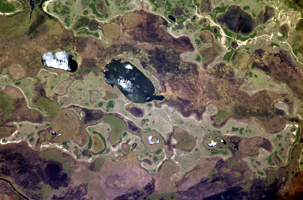
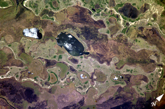


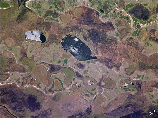
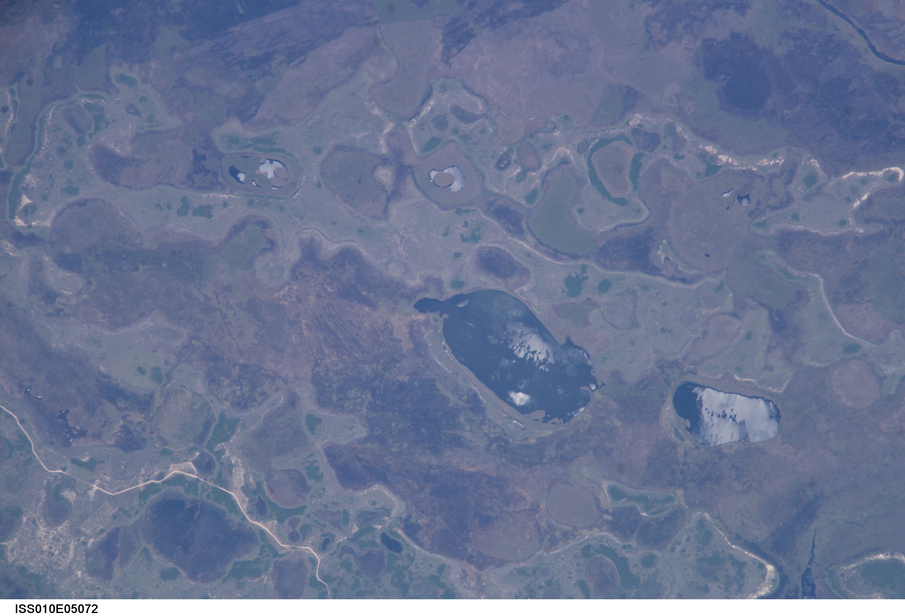
Photo center point: 28.7° S, 58.4° W
Photo center point by machine learning:
Country or Geographic Name: | ARGENTINA |
Features: | IBERA SWAMP, LAKES, ROAD, GLINT |
| Features Found Using Machine Learning: | |
Cloud Cover Percentage: | 10 (1-10)% |
Sun Elevation Angle: | 69° |
Sun Azimuth: | 316° |
Camera: | Kodak DCS760c Electronic Still Camera |
Focal Length: | 800mm |
Camera Tilt: | 2 degrees |
Format: | 3060E: 3060 x 2036 pixel CCD, RGBG array |
Film Exposure: | |
| Additional Information | |
| Width | Height | Annotated | Cropped | Purpose | Links |
|---|---|---|---|---|---|
| 1000 pixels | 661 pixels | No | Yes | Earth From Space collection | Download Image |
| 540 pixels | 357 pixels | Yes | Yes | Earth From Space collection | Download Image |
| 1000 pixels | 661 pixels | No | Yes | NASA's Earth Observatory web site | Download Image |
| 540 pixels | 357 pixels | Yes | Yes | NASA's Earth Observatory web site | Download Image |
| 540 pixels | 405 pixels | Yes | Yes | NASA's Earth Observatory web site | Download Image |
| 3032 pixels | 2064 pixels | No | No | Download Image | |
| 639 pixels | 435 pixels | No | No | Download Image |
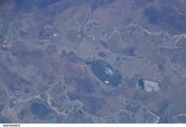
The central lake in this astronaut photograph is one of hundreds in the Ibera swamplands that were formed by South America's second largest river, the Parana. Although this great river now lies 120 kilometers to the north of this area today, its channel has swung over a great "inland delta" in the recent geological past.
This and other lakes were captured by the astronaut in the camera's sunglint region (the area where the Sun reflects directly back toward the camera ) as the International Space Station passed over this remote but vast swampland in northeast Argentina. The glint pattern gives the lakes a slivery appearance, and shows winds ruffling the water surfaces. The lakes in this image lie within side channels of the Parana that formed when the river flowed through the region from the northeast. The center coordinates of this enhanced image are 28.7degS 58.4degW. The central lake in the image is about 2 km long.
Forest, swamp, and prairie vegetation outline the low topography which consists of lakes, low swells, and depressions. The rounded shape of the topography probably relates to the effects of wind. Evidence from areas both north and south of the swamps suggests that these parts of South America were climatically drier during several periods in the last couple of million years (while North America and Europe were experiencing glaciations). Aridity allows the effects of wind to become pronounced. Wind builds elliptical sand dunes and scours out rounded depressions. Wind also generates waves on lakes that smooth sandy and muddy lake shores.
