ISS010-E-24596
| NASA Photo ID | ISS010-E-24596 |
| Focal Length | 180mm |
| Date taken | 2005.04.14 |
| Time taken | 17:51:57 GMT |
1000 x 660 pixels 540 x 356 pixels 540 x 358 pixels 3032 x 2064 pixels 639 x 435 pixels
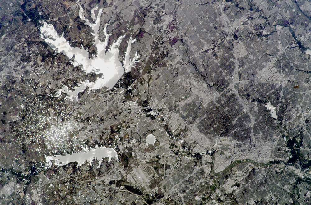
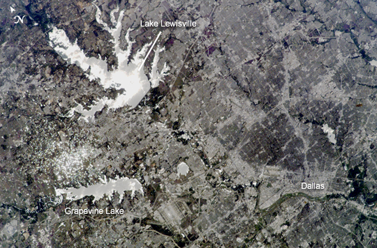
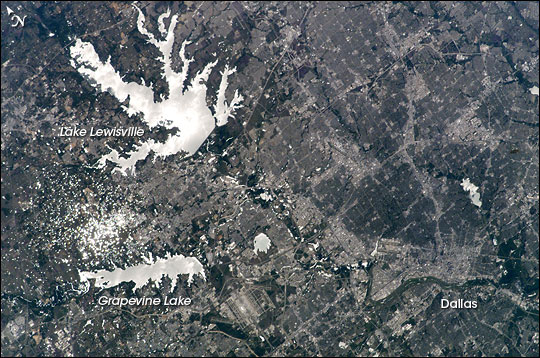

Photo center point: 33.0° N, 97.0° W
Photo center point by machine learning:
Country or Geographic Name: | USA-TEXAS |
Features: | DALLAS, TRINITY R., RES., GLINT |
| Features Found Using Machine Learning: | |
Cloud Cover Percentage: | 10 (1-10)% |
Sun Elevation Angle: | 65° |
Sun Azimuth: | 160° |
Camera: | Kodak DCS760c Electronic Still Camera |
Focal Length: | 180mm |
Camera Tilt: | 12 degrees |
Format: | 3060E: 3060 x 2036 pixel CCD, RGBG array |
Film Exposure: | |
| Additional Information | |
| Width | Height | Annotated | Cropped | Purpose | Links |
|---|---|---|---|---|---|
| 1000 pixels | 660 pixels | No | Yes | Earth From Space collection | Download Image |
| 540 pixels | 356 pixels | Yes | Yes | Earth From Space collection | Download Image |
| 540 pixels | 358 pixels | Yes | Yes | NASA's Earth Observatory web site | Download Image |
| 3032 pixels | 2064 pixels | No | No | Download Image | |
| 639 pixels | 435 pixels | No | No | Download Image |
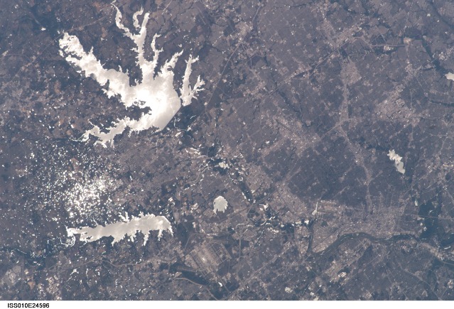
The Dallas-Fort Worth metropolitan area is the largest in Texas, with an approximate population of 6 million people in 2005. Founded by John Neely Bryan in 1841, the city became the center for the United States oil economy with the discovery of oilfields to the east of the city in 1930. The darkest day in the city's history occurred on November 22, 1963 when President John F. Kennedy was assassinated while traveling by motorcade through Dealey Plaza. The Dallas-Forth Worth region today is a major corporate, banking, and technological center.
This astronaut photograph captures the northwestern portion of the metropolitan area. Standing water bodies such as Lake Lewisville and Grapevine Lake are highlighted by sunglint, where the surface of the water acts as a mirror reflecting sunlight back towards the astronauts in the International Space Station (read Sunglint in Astronaut Photography of Earth for a more detailed explanation of sunglint). Using the sunglint to define edges of water helps when mapping water bodies and stream courses on a landscape--note the region of small ponds to the north of Grapevine Lake highlighted by sunglint. Images such as these help characterize surface hydrology and areas of potential flooding hazard.
