ISS010-E-14618

| NASA Photo ID | ISS010-E-14618 |
| Focal Length | 400mm |
| Date taken | 2005.01.23 |
| Time taken | 09:51:35 GMT |
Resolutions offered for this image:
1000 x 660 pixels 540 x 356 pixels 3032 x 2064 pixels 639 x 435 pixels
1000 x 660 pixels 540 x 356 pixels 3032 x 2064 pixels 639 x 435 pixels

Cloud masks available for this image:
Spacecraft nadir point: 26.7° N, 33.8° E
Photo center point: 22.5° N, 32.5° E
Photo center point by machine learning:
Photo center point: 22.5° N, 32.5° E
Photo center point by machine learning:
Nadir to Photo Center: South
Spacecraft Altitude: 188 nautical miles (348km)
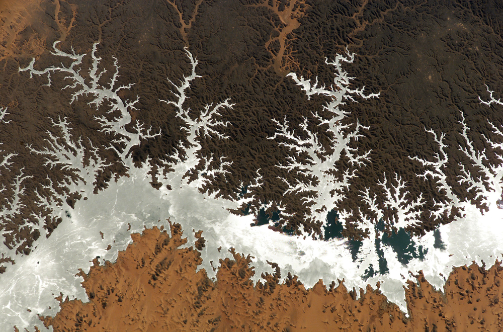
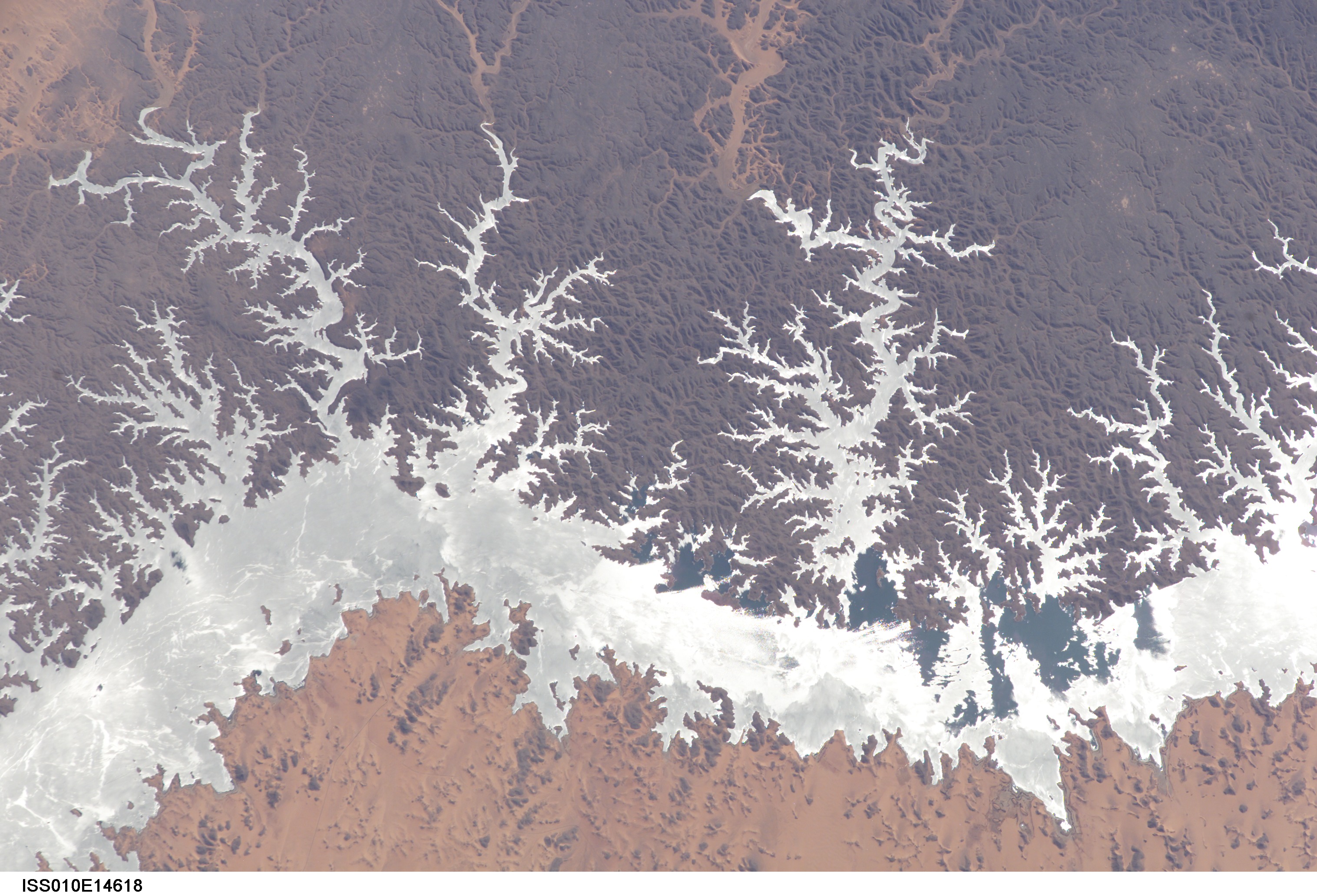
Country or Geographic Name: | EGYPT |
Features: | LAKE NASSER, SUNGLINT |
| Features Found Using Machine Learning: | |
Cloud Cover Percentage: | 10 (1-10)% |
Sun Elevation Angle: | 44° |
Sun Azimuth: | 178° |
Camera: | Kodak DCS760c Electronic Still Camera |
Focal Length: | 400mm |
Camera Tilt: | 54 degrees |
Format: | 3060E: 3060 x 2036 pixel CCD, RGBG array |
Film Exposure: | |
| Additional Information | |
| Width | Height | Annotated | Cropped | Purpose | Links |
|---|---|---|---|---|---|
| 1000 pixels | 660 pixels | No | Yes | Earth From Space collection | Download Image |
| 540 pixels | 356 pixels | Yes | Yes | Earth From Space collection | Download Image |
| 3032 pixels | 2064 pixels | No | No | Download Image | |
| 639 pixels | 435 pixels | No | No | Download Image |
Download Packaged File
Download a Google Earth KML for this Image
View photo footprint information
Download a GeoTIFF for this photo
Image Caption: ISS010-E-14618 (23 January 2005) --- Egypt's Lake Nasser, centered roughly at 22.64 degrees north latitude and 32.45 degrees east longitude, was captured with an electronic still camera by the Expedition 10 crew onboard the International Space Station. Sunglint on the lake makes it more easily visible.
