ISS010-E-13029
| NASA Photo ID | ISS010-E-13029 |
| Focal Length | 400mm |
| Date taken | 2005.01.13 |
| Time taken | 17:35:26 GMT |
540 x 622 pixels 1000 x 1152 pixels 540 x 405 pixels 3032 x 2064 pixels 639 x 435 pixels
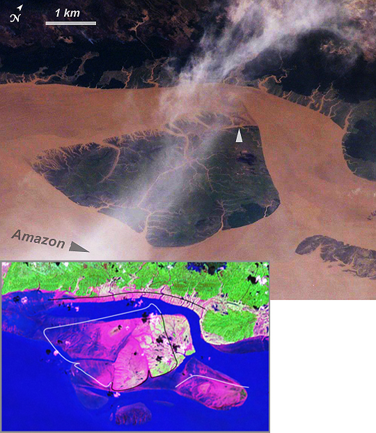
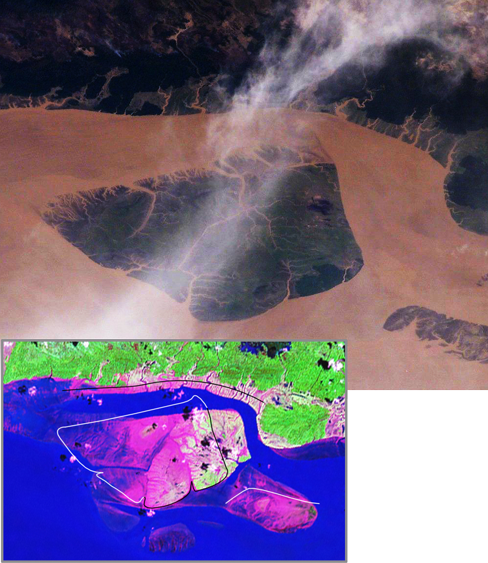
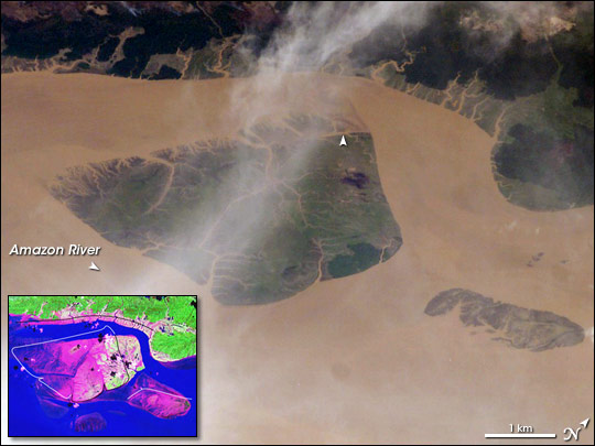
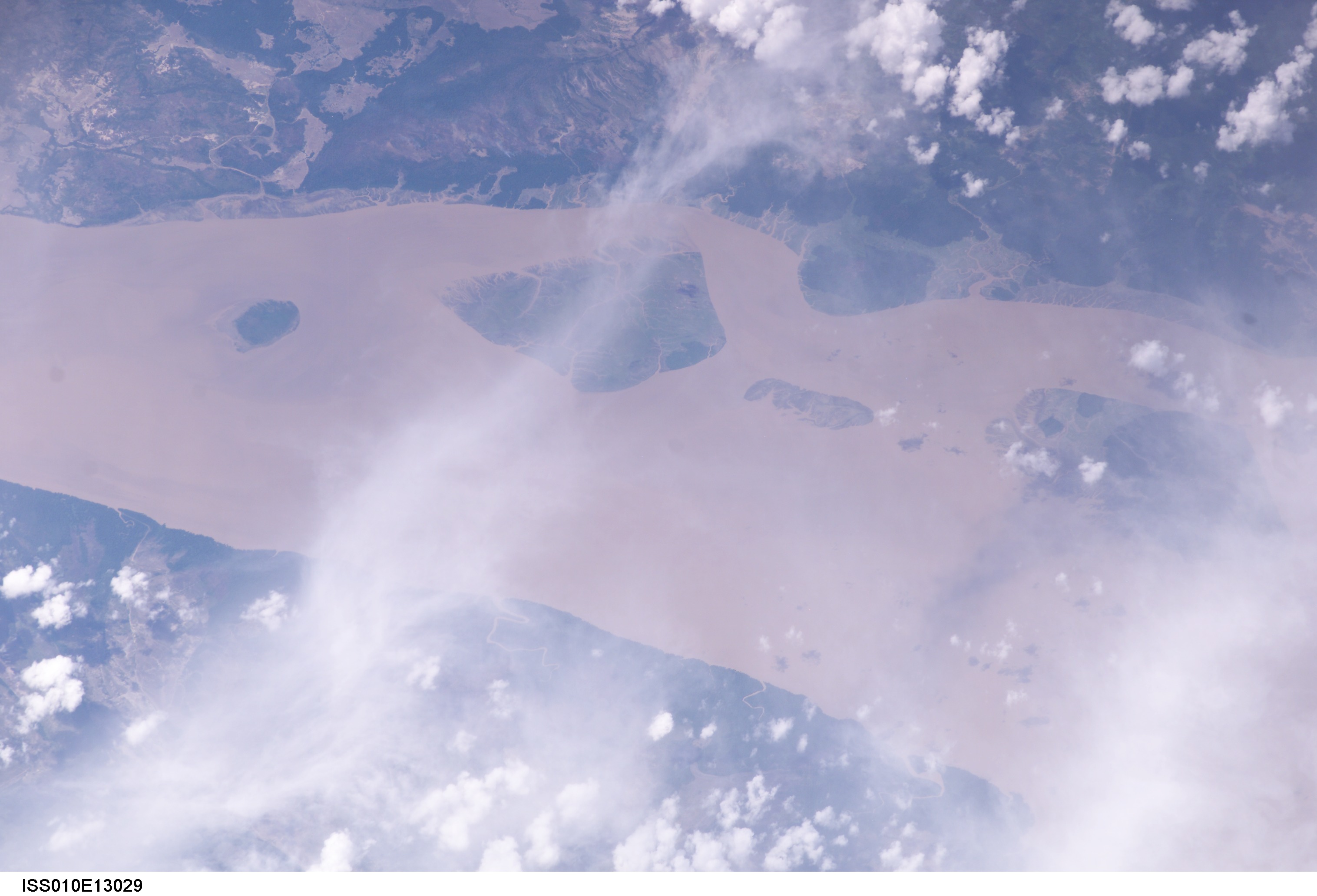
Photo center point: 0.1° N, 49.7° W
Photo center point by machine learning:
Country or Geographic Name: | BRAZIL |
Features: | CANAL PERIGOSO, CAVIANA I. |
| Features Found Using Machine Learning: | |
Cloud Cover Percentage: | 50 (26-50)% |
Sun Elevation Angle: | 50° |
Sun Azimuth: | 236° |
Camera: | Kodak DCS760c Electronic Still Camera |
Focal Length: | 400mm |
Camera Tilt: | 43 degrees |
Format: | 3060E: 3060 x 2036 pixel CCD, RGBG array |
Film Exposure: | |
| Additional Information | |
| Width | Height | Annotated | Cropped | Purpose | Links |
|---|---|---|---|---|---|
| 540 pixels | 622 pixels | Yes | Yes | Earth From Space collection | Download Image |
| 1000 pixels | 1152 pixels | Yes | Yes | NASA's Earth Observatory web site | Download Image |
| 540 pixels | 405 pixels | Yes | Yes | NASA's Earth Observatory web site | Download Image |
| 3032 pixels | 2064 pixels | No | No | Download Image | |
| 639 pixels | 435 pixels | No | No | Download Image |
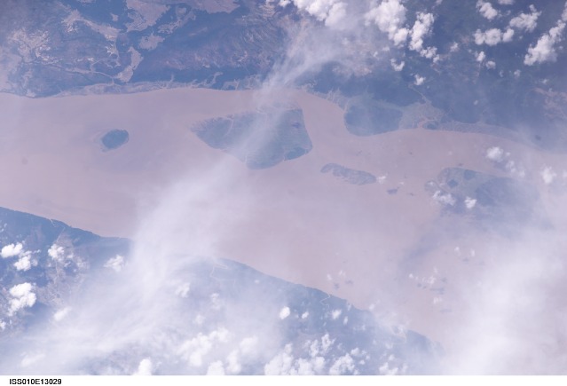
Over a period of approximately four years a major island near the mouth of the Amazon River has been dramatically modified as the arms of the river have shifted. In the image above, an oblique image, captured by an astronaut with a handheld camera in January 2005 (base image), is contrasted with a false-color Landsat Enhanced Thematic Mapper plus (ETM+) image from 2000 (inset). In the Landsat inset, green indicates rainforest, pinks and mauves are low-growing, colonizing vegetation on tidally inundated areas, and the Amazon River is blue.
The island is about 5 kilometers long and is located near 0.1deg N 49.7deg W). Between 2000 and 2005 the channel on the west side of the island has shifted to the northwest by eroding ~200 meters of the mainland shoreline and accreting (depositing) sediment on the west side of the island, broadly maintaining the width of the channel. White lines around the island in the inset image indicate the modern shorelines captured in the astronaut photograph. In the handheld photograph, the island shoreline of 2000 prominently demarcates older vegetated from new, not-yet-vegetated land surfaces (top arrow).
By contrast, the northern channel (to the right of the island) has significantly widened, eroding almost 1 kilometer of the northern end of the island, as well as narrowing a smaller island downstream (lower right). A more important but subtler effect has been the accumulation of sediment on the upstream (left-hand) two-thirds of the island, accompanied by the establishment of permanent vegetation (dark green).
Vegetation appears to anchor small streams in place, but discharge in major arms of the Amazon overcomes the cohesive power of vegetation so that large channels can be comparatively mobile. Other islands in the Amazon mouth are also known to have moved by hundreds of meters per year due to the processes of erosion and deposition.
