ISS010-E-12738

| NASA Photo ID | ISS010-E-12738 |
| Focal Length | 400mm |
| Date taken | 2005.01.11 |
| Time taken | 09:12:08 GMT |
Cloud masks available for this image:
Spacecraft nadir point: 6.5° N, 98.8° E
Photo center point: 8.1° N, 98.6° E
Photo center point by machine learning:
Photo center point: 8.1° N, 98.6° E
Photo center point by machine learning:
Nadir to Photo Center: North
Spacecraft Altitude: 191 nautical miles (354km)
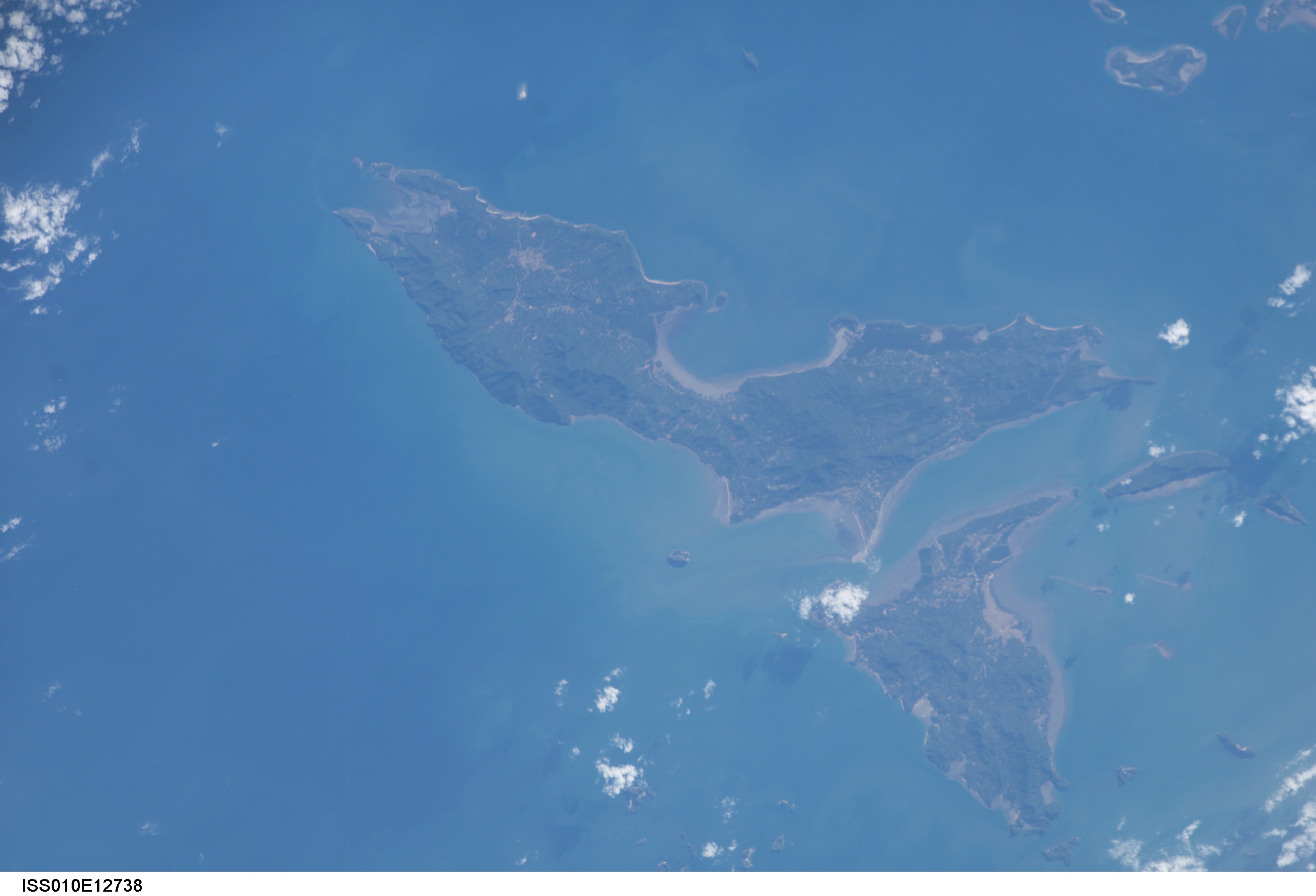
Country or Geographic Name: | THAILAND |
Features: | KO YAO YAI, ISLANDS, COAST |
| Features Found Using Machine Learning: | |
Cloud Cover Percentage: | 10 (1-10)% |
Sun Elevation Angle: | 29° |
Sun Azimuth: | 241° |
Camera: | Kodak DCS760c Electronic Still Camera |
Focal Length: | 400mm |
Camera Tilt: | 27 degrees |
Format: | 3060E: 3060 x 2036 pixel CCD, RGBG array |
Film Exposure: | |
| Additional Information | |
| Width | Height | Annotated | Cropped | Purpose | Links |
|---|---|---|---|---|---|
| 3032 pixels | 2064 pixels | No | No | Download Image | |
| 639 pixels | 435 pixels | No | No | Download Image |
Download Packaged File
Download a Google Earth KML for this Image
View photo footprint information
Download a GeoTIFF for this photo
Image Caption: ISS010-E-12738 (11 January 2005) --- One of a series of post-tsunami digital still images photographed by the Expedition 10 crew aboard the International Space Station. This image, recorded on January 11, 2005 and centered at 8.00 degrees north latitude and 98.60 degrees east longitude, is Ko Yao Yai, northwest of Phuket (Thailand).
