ISS009-E-28346

| NASA Photo ID | ISS009-E-28346 |
| Focal Length | 400mm |
| Date taken | 2004.10.13 |
| Time taken | 19:53:48 GMT |
1000 x 661 pixels 357 x 540 pixels 540 x 540 pixels 3032 x 2064 pixels 639 x 435 pixels

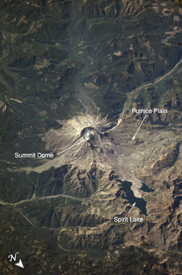
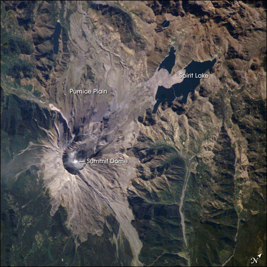
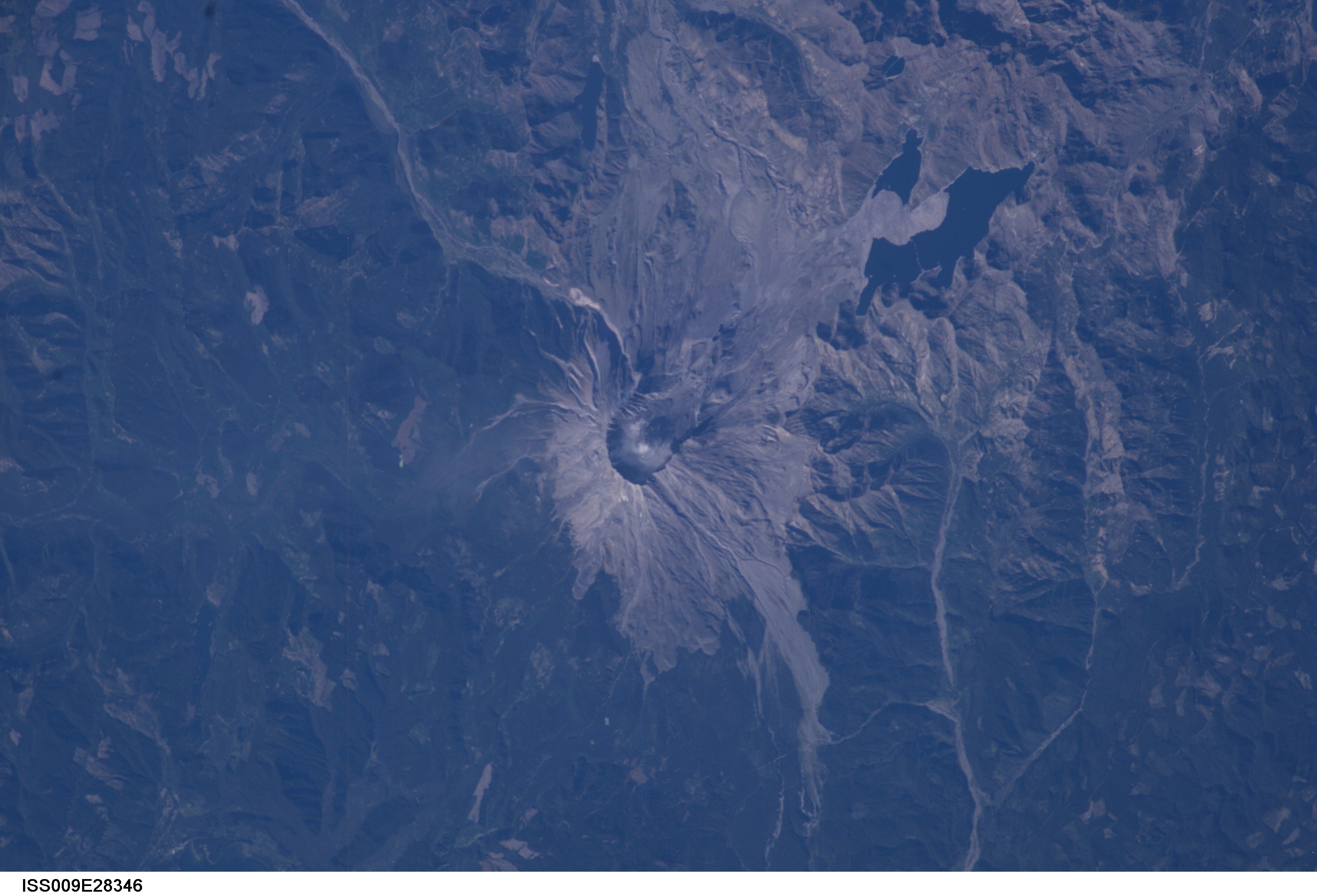
Photo center point: 46.2° N, 122.2° W
Photo center point by machine learning:
Country or Geographic Name: | USA-WASHINGTON |
Features: | MT. ST. HELENS, STEAM |
| Features Found Using Machine Learning: | |
Cloud Cover Percentage: | 10 (1-10)% |
Sun Elevation Angle: | 35° |
Sun Azimuth: | 183° |
Camera: | Kodak DCS760c Electronic Still Camera |
Focal Length: | 400mm |
Camera Tilt: | 45 degrees |
Format: | 3060E: 3060 x 2036 pixel CCD, RGBG array |
Film Exposure: | |
| Additional Information | |
| Width | Height | Annotated | Cropped | Purpose | Links |
|---|---|---|---|---|---|
| 1000 pixels | 661 pixels | No | No | Earth From Space collection | Download Image |
| 357 pixels | 540 pixels | Yes | Yes | Earth From Space collection | Download Image |
| 540 pixels | 540 pixels | Yes | Yes | NASA's Earth Observatory web site | Download Image |
| 3032 pixels | 2064 pixels | No | No | Download Image | |
| 639 pixels | 435 pixels | No | No | Download Image |
Early in October 2004 Mt. St. Helens rumbled back to life with earthquakes, minor eruptions of steam and ash, and renewed growth of the summit lava dome. Fortuitous trajectories of the International Space Station provided the ISS crew excellent views of the area, and they proceeded to collect a suite of images of Mount St. Helens over several days from different vantage points. This south-viewing image was acquired on October 13, 2004 following recent steam eruptions; two white steam plumes are visible to the south of the summit dome. While lava dome growth continues the current eruptive activity has not significantly altered the morphology of the volcano. Several mudflows and deposition of minor amounts of ash close to the cone have occurred as a result of current activity.
The main features visible in this image are the result of a cataclysmic 1980 eruption resulting from landslide failure of the northern flank of the volcano. The resulting directed blast of suddenly exposed gas-rich magma devastated a region of 20 km to the north and raised the bed level of Spirit Lake by 60 meters. The grayish Pumice Plain is mainly comprised of pyroclastic and mudflow deposits from the 1980 eruption. Today, the volcano is being intensively monitored by United States Geological Survey scientists for indications of further increases in activity and hazard potential.
