ISS009-E-20447
| NASA Photo ID | ISS009-E-20447 |
| Focal Length | 180mm |
| Date taken | 2004.08.27 |
| Time taken | 14:02:31 GMT |
Cloud masks available for this image:
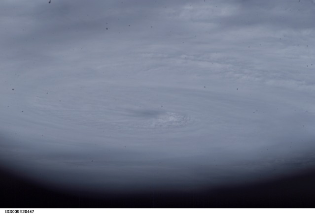
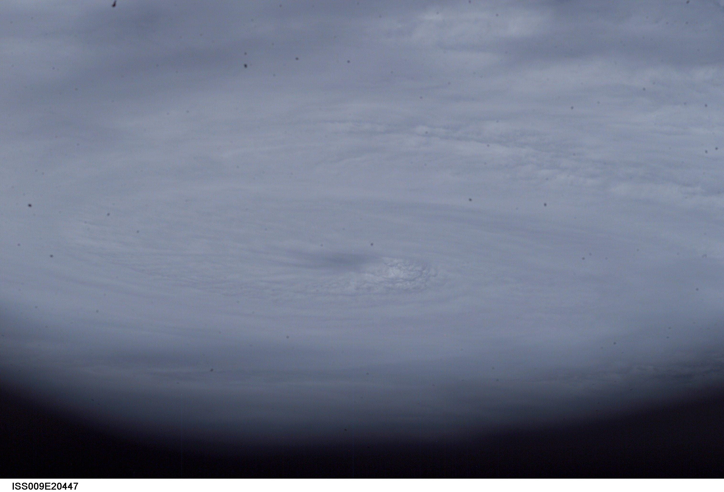
Spacecraft nadir point: 4.7° N, 49.2° W
Photo center point: 15.0° N, 49.0° W
Photo center point by machine learning:
Photo center point: 15.0° N, 49.0° W
Photo center point by machine learning:
Nadir to Photo Center: North
Spacecraft Altitude: 195 nautical miles (361km)
Country or Geographic Name: | ATLANTIC OCEAN |
Features: | HURRICANE FRANCES, EYE |
| Features Found Using Machine Learning: | |
Cloud Cover Percentage: | 100 (76-100)% |
Sun Elevation Angle: | 71° |
Sun Azimuth: | 74° |
Camera: | Kodak DCS760c Electronic Still Camera |
Focal Length: | 180mm |
Camera Tilt: | High Oblique |
Format: | 3060E: 3060 x 2036 pixel CCD, RGBG array |
Film Exposure: | |
| Additional Information | |
| Width | Height | Annotated | Cropped | Purpose | Links |
|---|---|---|---|---|---|
| 3032 pixels | 2064 pixels | No | No | Download Image | |
| 639 pixels | 435 pixels | No | No | Download Image |
Download Packaged File
Download a Google Earth KML for this Image
View photo footprint information
Download a GeoTIFF for this photo
Image Caption: ISS009E20447 (27 August 2004) --- This photo of Hurricane Frances was taken by Astronaut Mike Fincke aboard the International Space Station as he flew 230 statute miles above the storm at about 9 a.m. CDT Friday, Aug. 27, 2004. At the time, Frances was located 820 miles east of the Lesser Antilles in the Atlantic Ocean, moving west-northwest at 10 miles per hour, with maximum sustained winds of 105 miles per hour. Fincke, the NASA ISS Science Officer and Flight Engineer, and Expedition 9 Commander Gennady Padalka are in the fifth month of a six-month flight aboard the Station.
