ISS008-E-19233
| NASA Photo ID | ISS008-E-19233 |
| Focal Length | 195mm |
| Date taken | 2004.03.25 |
| Time taken | 10:04:26 GMT |
Resolutions offered for this image:
540 x 361 pixels 1000 x 662 pixels 3032 x 2064 pixels 639 x 435 pixels
540 x 361 pixels 1000 x 662 pixels 3032 x 2064 pixels 639 x 435 pixels
Cloud masks available for this image:
Spacecraft nadir point: 13.7° S, 47.2° E
Photo center point: 16.0° S, 46.5° E
Photo center point by machine learning:
Photo center point: 16.0° S, 46.5° E
Photo center point by machine learning:
Nadir to Photo Center: South
Spacecraft Altitude: 196 nautical miles (363km)
Country or Geographic Name: | MADAGASCAR |
Features: | BETSIBOKA RIVER DELTA, MAJUNGA |
| Features Found Using Machine Learning: | |
Cloud Cover Percentage: | 10 (1-10)% |
Sun Elevation Angle: | 67° |
Sun Azimuth: | 312° |
Camera: | Kodak DCS760c Electronic Still Camera |
Focal Length: | 195mm |
Camera Tilt: | 36 degrees |
Format: | 3060E: 3060 x 2036 pixel CCD, RGBG array |
Film Exposure: | |
| Additional Information | |
| Width | Height | Annotated | Cropped | Purpose | Links |
|---|---|---|---|---|---|
| 540 pixels | 361 pixels | Earth From Space collection | Download Image | ||
| 1000 pixels | 662 pixels | No | No | NASA's Earth Observatory web site | Download Image |
| 3032 pixels | 2064 pixels | No | No | Download Image | |
| 639 pixels | 435 pixels | No | No | Download Image |
Download Packaged File
Download a Google Earth KML for this Image
View photo footprint information
Download a GeoTIFF for this photo
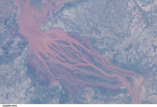
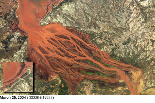
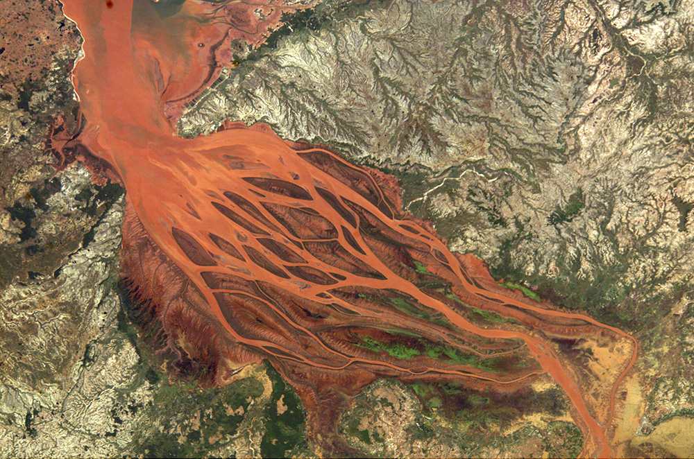
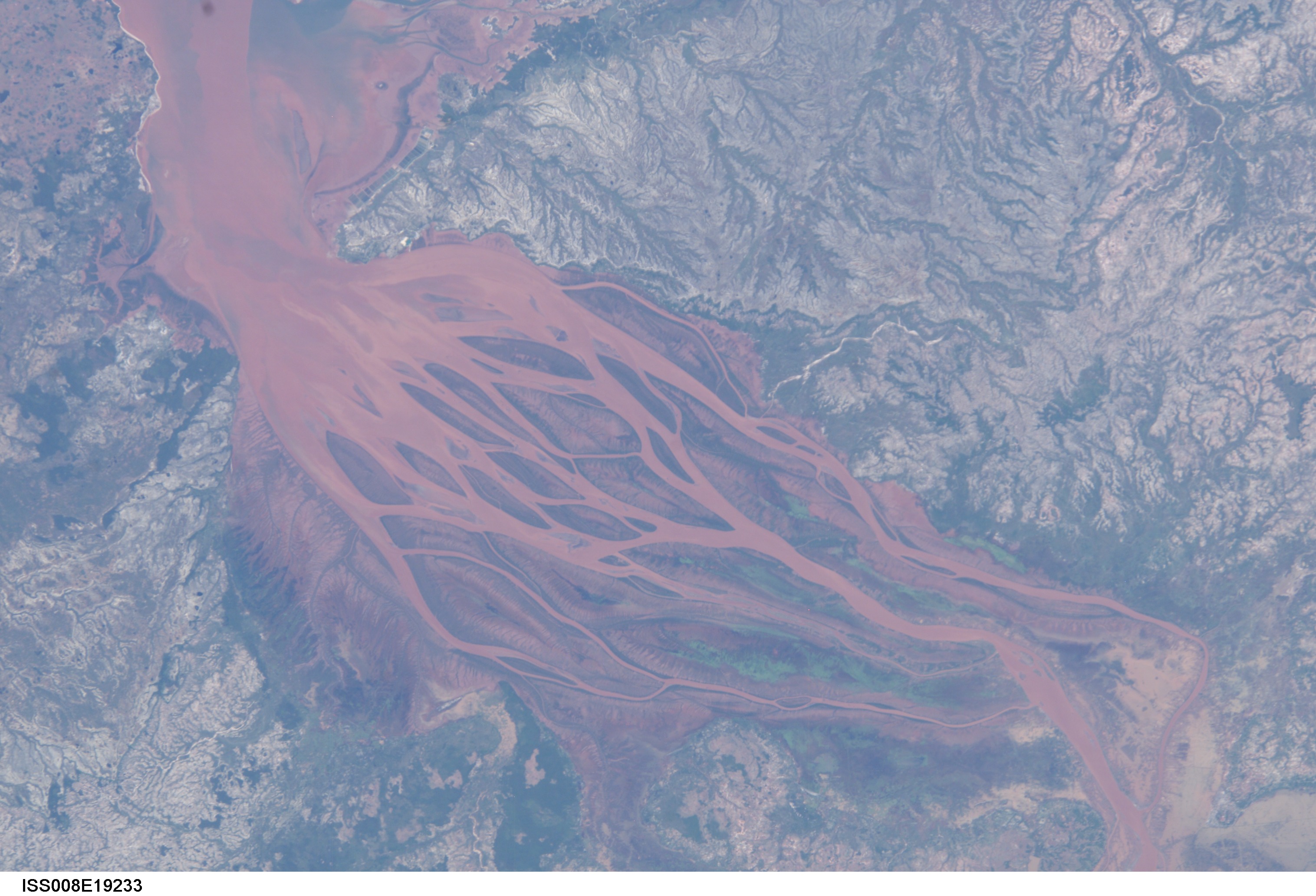
Image Caption: Betsiboka Estuary, Madagascar:
The Betsiboka Estuary on the northwest coast of Madagascar is the mouth of Madagascar's largest river and one of the world's fast-changing coastlines. Nearly a century of extensive logging of Madagascar's rainforests and coastal mangroves has resulted in nearly complete clearing of the land and fantastic rates of erosion. After every heavy rain, the bright red soils are washed from the hillsides into the streams and rivers to the coast. Astronauts describe their view of Madagascar as "bleeding into the ocean." One impact of the extensive 20th century erosion is the filling and clogging of coastal waterways with sediment--a process that is well illustrated in the Betsiboka estuary. In fact, ocean-going ships were once able to travel up the Betsiboka estuary, but must now berth at the coast.
A bad situation is made worse when tropical storms bring severe rainfall, greatly accelerating the rates of erosion. As an illustration, astronauts aboard the International Space Station documented widespread flooding and a massive red sediment plume flowing into the Bestiboka estuary and the ocean in the wake of Tropical Cyclone Gafilo, which hit northern Madagascar on March 7th and 8th, 2004. A comparative image (ISS007-E-14344) taken in September 2003 shows normal water levels in the estuary.
Despite the heavy coastal flooding in the top image, new coastal developments can be seen. The Mahajanga Aquaculture Development Project, a joint venture between Madagascar and the Japan International Cooperative Agency, strings along the coastal region at the mouth of the estuary (inset images). This project is a shrimp farm and has been developed since 1999. Successive images taken by astronauts show increasing numbers of ponds constructed between 2000 and the present. Coastal aquaculture projects are frequently controversial, pitting the protection and viability of coastal ecosystems (especially rapidly disappearing mangrove environments), against badly needed industry in developing countries.
