ISS008-E-18938

| NASA Photo ID | ISS008-E-18938 |
| Focal Length | 400mm |
| Date taken | 2004.03.24 |
| Time taken | 12:55:__ GMT |
Resolutions offered for this image:
2000 x 1308 pixels 1024 x 768 pixels 2000 x 1368 pixels 639 x 437 pixels
2000 x 1308 pixels 1024 x 768 pixels 2000 x 1368 pixels 639 x 437 pixels
Cloud masks available for this image:
Spacecraft nadir point:
Photo center point: 30.5° N, 48.5° E
Photo center point by machine learning:
Photo center point: 30.5° N, 48.5° E
Photo center point by machine learning:
Nadir to Photo Center:
Spacecraft Altitude: 196 nautical miles (363km)
Country or Geographic Name: | IRAN |
Features: | SMOKE PLUME, SHATT AL ARAB |
| Features Found Using Machine Learning: | |
Cloud Cover Percentage: | 10 (1-10)% |
Sun Elevation Angle: | 21° |
Sun Azimuth: | 257° |
Camera: | Nikon D1 Electronic Still Camera |
Focal Length: | 400mm |
Camera Tilt: | Low Oblique |
Format: | 2000E: 2000 x 1312 pixel CCD, RGBG imager color filter |
Film Exposure: | |
| Additional Information | |
| Width | Height | Annotated | Cropped | Purpose | Links |
|---|---|---|---|---|---|
| 2000 pixels | 1308 pixels | No | No | Earth From Space collection | Download Image |
| 1024 pixels | 768 pixels | No | Yes | NASA's Earth Observatory web site | Download Image |
| 2000 pixels | 1368 pixels | No | No | Download Image | |
| 639 pixels | 437 pixels | No | No | Download Image |
Download Packaged File
Download a Google Earth KML for this Image
View photo footprint information
Download a GeoTIFF for this photo
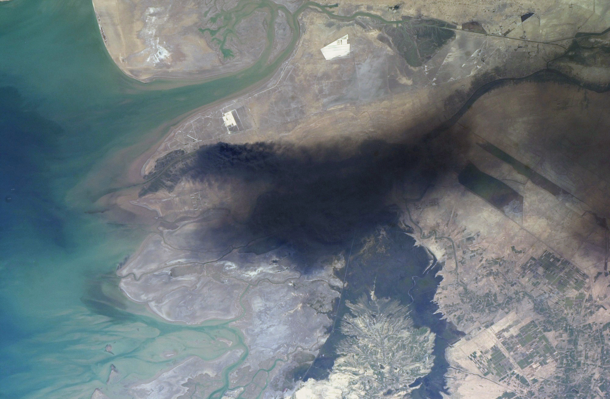
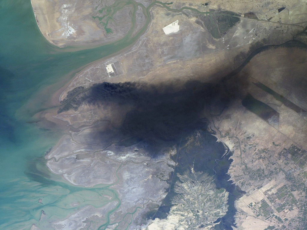
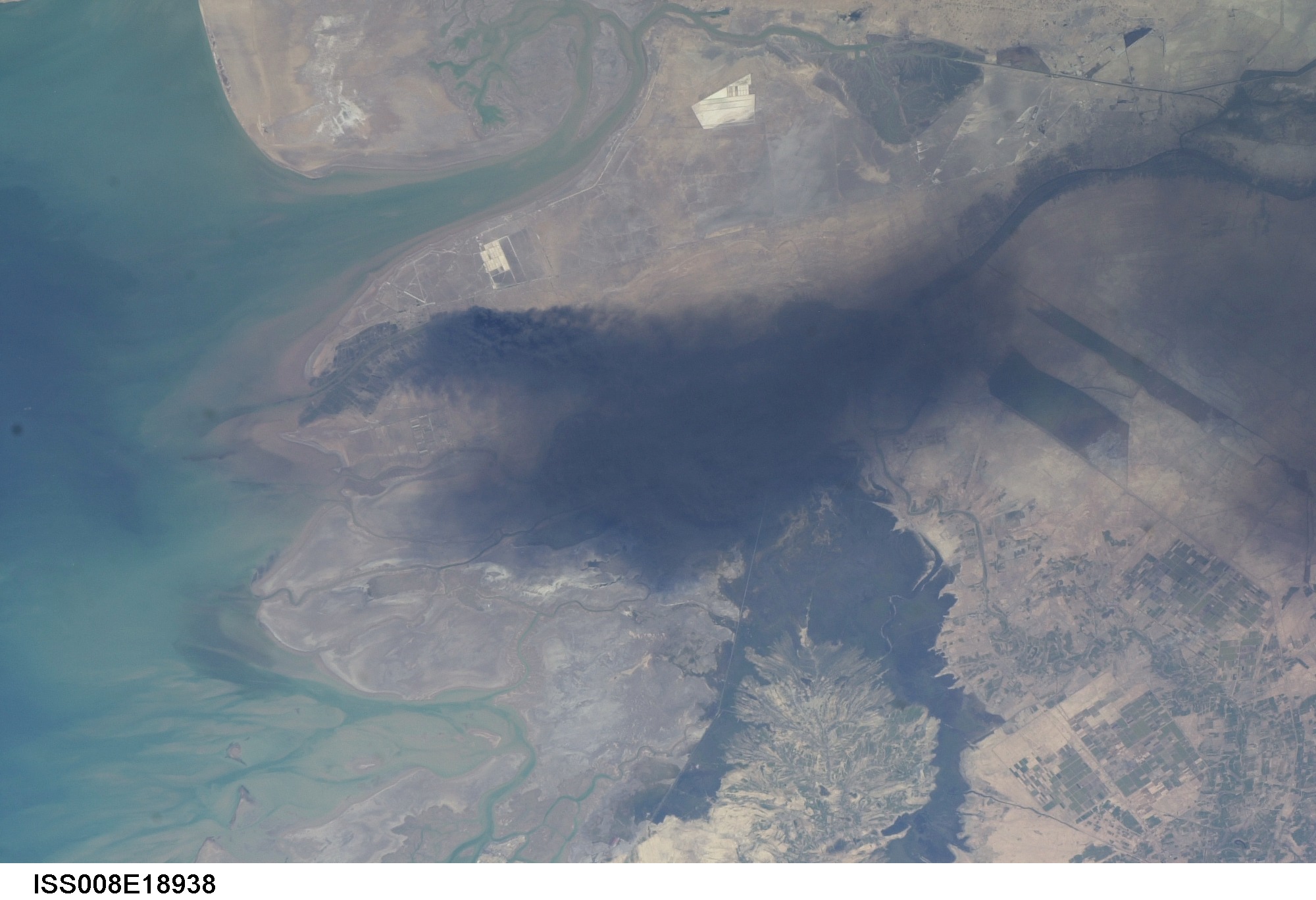
Image Caption: ISS008-E-18938 (24 March 2004) --- This photo of a large black smoke plume over southeastern Iraq was taken by an Expedition 8 crewmember on the International Space Station. The oil that is burning spilled from a ruptured pipeline on March 23, 2004. This photo was taken the next afternoon and shows details of land use near the fire. The delta of the Shatt al Arab has numerous channels, estuaries, and tidal flats. Near the top of the photo (southwest) are two large white salt evaporator operations while to the lower right are wetlands and irrigated agricultural fields. Iraq's only oil terminal on the Persian Gulf is near the left edge of the plume.
