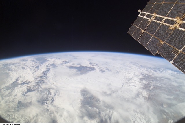
ISS008-E-16903
| NASA Photo ID | ISS008-E-16903 |
| Focal Length | 20mm |
| Date taken | 2004.02.20 |
| Time taken | 06:17:47 GMT |

Cloud masks available for this image:
Spacecraft nadir point: 42.5° N, 96.0° E
Photo center point: 46.0° N, 86.0° E
Photo center point by machine learning:
Photo center point: 46.0° N, 86.0° E
Photo center point by machine learning:
Nadir to Photo Center: West
Spacecraft Altitude: 194 nautical miles (359km)
Country or Geographic Name: | CHINA |
Features: | DZUNGARIAN BN., BOROHORO MTS., ATMOSPHERIC LIMB |
| Features Found Using Machine Learning: | PAN- |
Cloud Cover Percentage: | 100 (76-100)% |
Sun Elevation Angle: | 36° |
Sun Azimuth: | 189° |
Camera: | Kodak DCS760c Electronic Still Camera |
Focal Length: | 20mm |
Camera Tilt: | High Oblique |
Format: | 3060E: 3060 x 2036 pixel CCD, RGBG array |
Film Exposure: | |
| Additional Information | |
| Width | Height | Annotated | Cropped | Purpose | Links |
|---|---|---|---|---|---|
| 3032 pixels | 2064 pixels | No | No | Download Image | |
| 639 pixels | 435 pixels | No | No | Download Image |
Download Packaged File
Download a Google Earth KML for this Image
View photo footprint information
Download a GeoTIFF for this photo
Image Caption: CATALOGED BY TEXAS STATE UNIVERSITY
