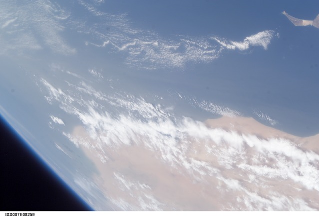
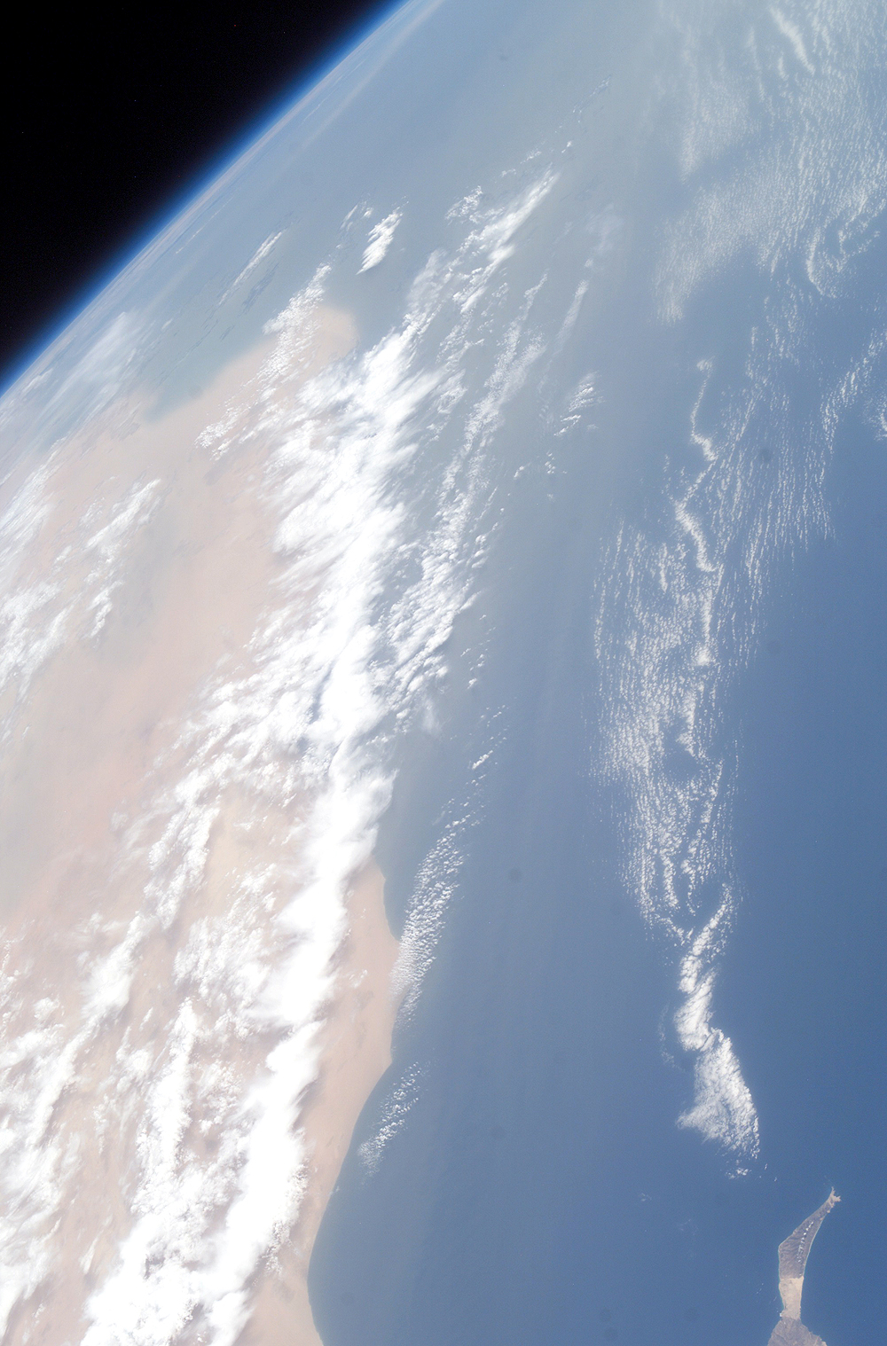
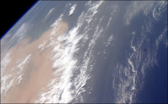
ISS007-E-8259
| NASA Photo ID | ISS007-E-8259 |
| Focal Length | 50mm |
| Date taken | 2003.06.25 |
| Time taken | 15:17:04 GMT |
Resolutions offered for this image:
1000 x 1518 pixels 1998 x 3032 pixels 540 x 334 pixels 3032 x 2064 pixels 639 x 435 pixels
1000 x 1518 pixels 1998 x 3032 pixels 540 x 334 pixels 3032 x 2064 pixels 639 x 435 pixels


Cloud masks available for this image:
Spacecraft nadir point: 30.7° N, 12.7° W
Photo center point: 27.0° N, 14.0° W
Photo center point by machine learning:
Photo center point: 27.0° N, 14.0° W
Photo center point by machine learning:
Nadir to Photo Center: South
Spacecraft Altitude: 210 nautical miles (389km)
Country or Geographic Name: | WESTERN SAHARA |
Features: | PAN-DUST, COAST, FUERTEVENTURA |
| Features Found Using Machine Learning: | PAN- |
Cloud Cover Percentage: | 25 (11-25)% |
Sun Elevation Angle: | 57° |
Sun Azimuth: | 266° |
Camera: | Kodak DCS760c Electronic Still Camera |
Focal Length: | 50mm |
Camera Tilt: | 48 degrees |
Format: | 3060E: 3060 x 2036 pixel CCD, RGBG array |
Film Exposure: | |
| Additional Information | |
| Width | Height | Annotated | Cropped | Purpose | Links |
|---|---|---|---|---|---|
| 1000 pixels | 1518 pixels | No | Yes | NASA's Earth Observatory web site | Download Image |
| 1998 pixels | 3032 pixels | No | Yes | NASA's Earth Observatory web site | Download Image |
| 540 pixels | 334 pixels | Yes | NASA's Earth Observatory web site | Download Image | |
| 3032 pixels | 2064 pixels | No | No | Download Image | |
| 639 pixels | 435 pixels | No | No | Download Image |
Download Packaged File
Download a Google Earth KML for this Image
View photo footprint information
Download a GeoTIFF for this photo
Image Caption: ISS007-E-08259 (25 June 2003) --- This view was taken by an Expedition 7 crewmember onboard the International Space Station (ISS) while in orbit over the Atlantic Ocean. Dust blowing from the Sahara Desert obscures the country of Western Sahara. Fuerteventura, one of the Canary Islands, is at upper right.
