ISS007-E-7388
| NASA Photo ID | ISS007-E-7388 |
| Focal Length | 180mm |
| Date taken | 2003.06.14 |
| Time taken | 12:35:20 GMT |
Resolutions offered for this image:
540 x 355 pixels 999 x 657 pixels 540 x 405 pixels 1000 x 660 pixels 3032 x 2064 pixels 6144 x 4068 pixels 639 x 435 pixels
540 x 355 pixels 999 x 657 pixels 540 x 405 pixels 1000 x 660 pixels 3032 x 2064 pixels 6144 x 4068 pixels 639 x 435 pixels

Cloud masks available for this image:
Spacecraft nadir point: 13.5° S, 68.5° W
Photo center point: 16.0° S, 72.5° W
Photo center point by machine learning:
Photo center point: 16.0° S, 72.5° W
Photo center point by machine learning:
Nadir to Photo Center: Southwest
Spacecraft Altitude: 211 nautical miles (391km)
Country or Geographic Name: | PERU |
Features: | COLCA RIVER, OCONA RIVER, AGR. |
| Features Found Using Machine Learning: | |
Cloud Cover Percentage: | 10 (1-10)% |
Sun Elevation Angle: | 21° |
Sun Azimuth: | 58° |
Camera: | Kodak DCS760c Electronic Still Camera |
Focal Length: | 180mm |
Camera Tilt: | 53 degrees |
Format: | 3060E: 3060 x 2036 pixel CCD, RGBG array |
Film Exposure: | |
| Additional Information | |
| Width | Height | Annotated | Cropped | Purpose | Links |
|---|---|---|---|---|---|
| 540 pixels | 355 pixels | Photographic Highlights | Download Image | ||
| 999 pixels | 657 pixels | Photographic Highlights | Download Image | ||
| 540 pixels | 405 pixels | Yes | Yes | Earth From Space collection | Download Image |
| 1000 pixels | 660 pixels | No | Yes | NASA's Earth Observatory web site | Download Image |
| 3032 pixels | 2064 pixels | No | No | Download Image | |
| 6144 pixels | 4068 pixels | No | No | Presentation | Download Image |
| 639 pixels | 435 pixels | No | No | Download Image |
Download Packaged File
Download a Google Earth KML for this Image
View photo footprint information
Download a GeoTIFF for this photo
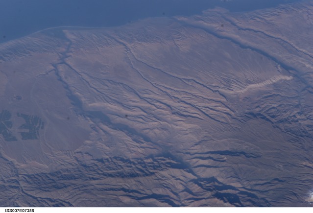
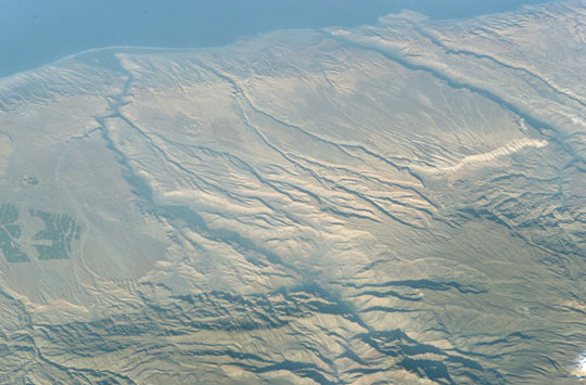
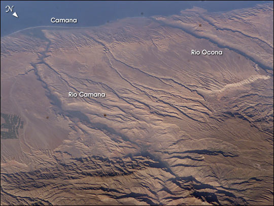
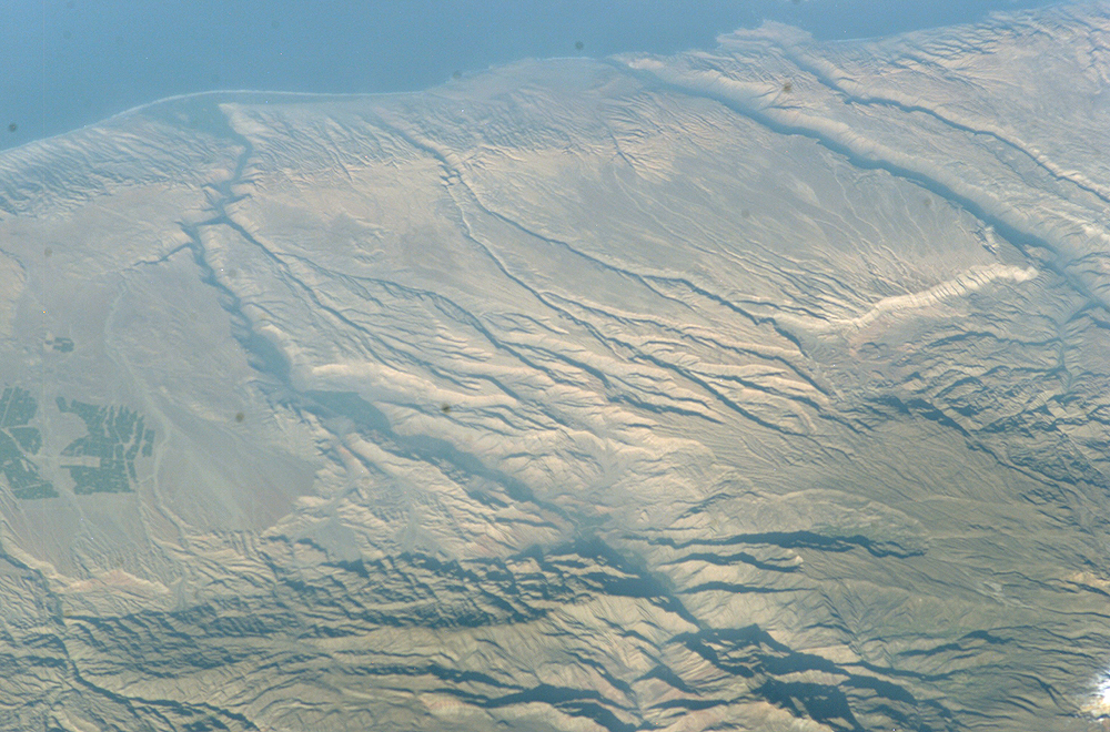
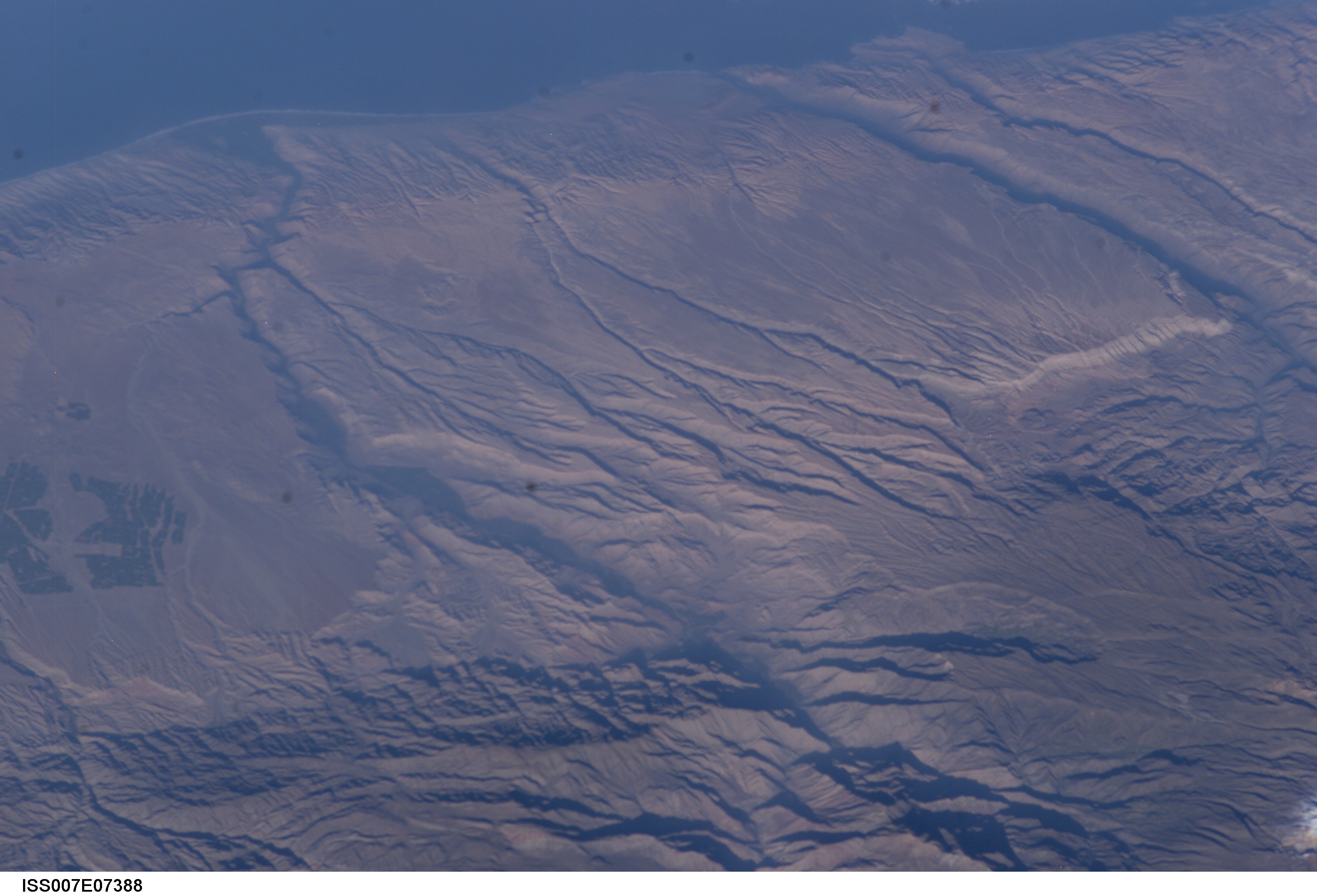
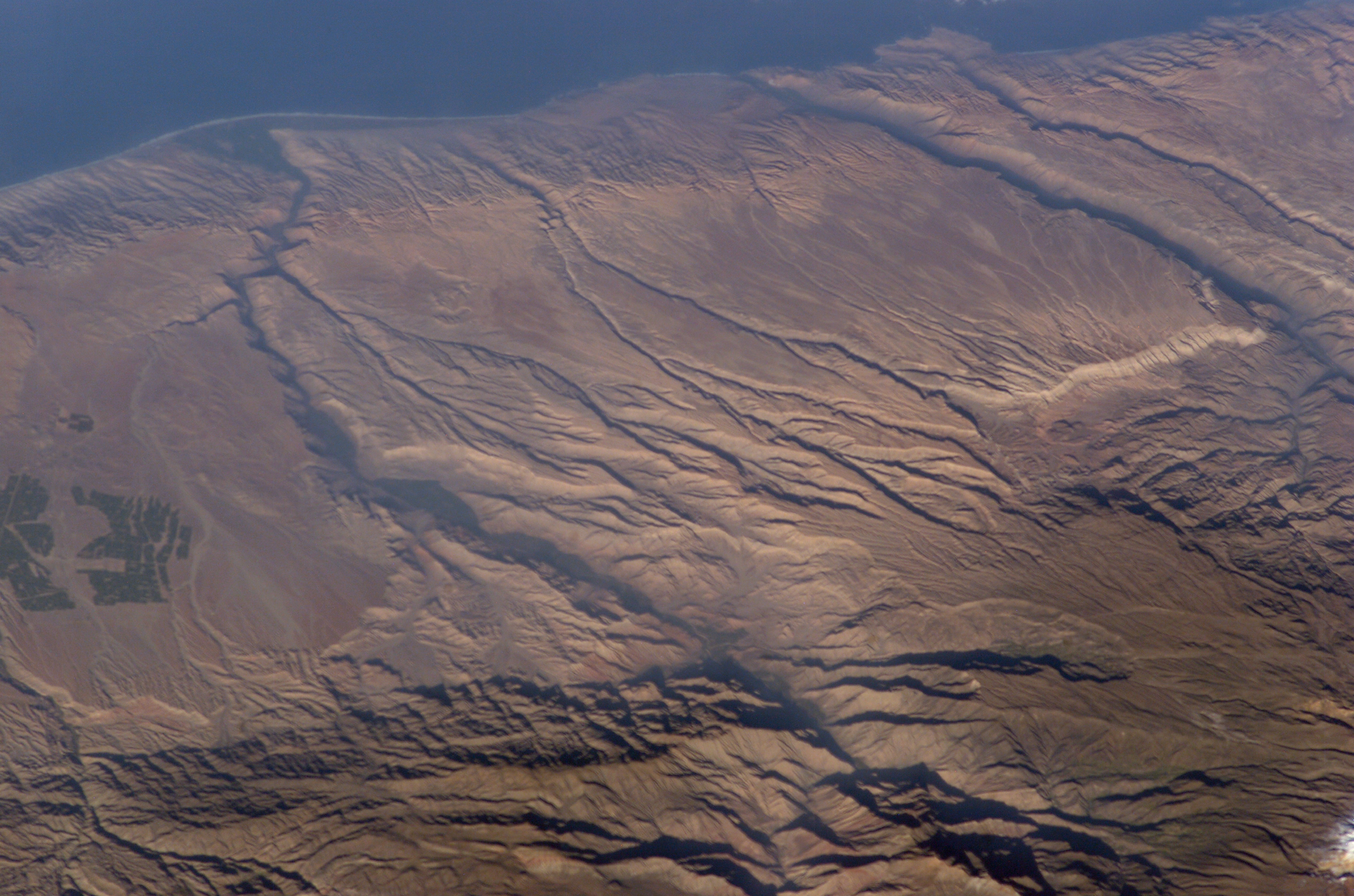
Image Caption: Some of the deepest canyons in the world cut west to the Pacific from the high crest of the Andes Mountains in Peru. This dramatic image taken from the International Space Station provides a birds-eye view down the canyons of the Rio Camana and the Rio Ocona. The low early morning sun highlights the extreme topography created by rapidly uplifting mountains and powerful water erosion by water dropping nearly 10,000 feet (more than 3000 m) in this view. At the edge of the image is the snowy flanks of Nevado Coropuna, the highest mountain in the Cordillera Occidental (6613 meters)
The coastal plane provides a small area for cultivating crops. The coastal region near the city of Camana suffered extensive damage from a tsunami in 2001 (//www.usc.edu/dept/tsunamis/peru01/web%20pages/peru01_camana.html).
The coastal plane provides a small area for cultivating crops. The coastal region near the city of Camana suffered extensive damage from a tsunami in 2001 (//www.usc.edu/dept/tsunamis/peru01/web%20pages/peru01_camana.html).
