ISS007-E-18087
| NASA Photo ID | ISS007-E-18087 |
| Focal Length | 800mm |
| Date taken | 2003.10.26 |
| Time taken | 19:54:24 GMT |
Cloud masks available for this image:
Spacecraft nadir point: 41.1° N, 120.1° W
Photo center point: 34.0° N, 117.5° W
Photo center point by machine learning:
Photo center point: 34.0° N, 117.5° W
Photo center point by machine learning:
Nadir to Photo Center: South
Spacecraft Altitude: 200 nautical miles (370km)
Country or Geographic Name: | USA-CALIFORNIA |
Features: | FIRE SMOKE, CAJON PASS, RESERVOIR |
| Features Found Using Machine Learning: | |
Cloud Cover Percentage: | 10 (1-10)% |
Sun Elevation Angle: | 36° |
Sun Azimuth: | 183° |
Camera: | Kodak DCS760c Electronic Still Camera |
Focal Length: | 800mm |
Camera Tilt: | High Oblique |
Format: | 3060E: 3060 x 2036 pixel CCD, RGBG array |
Film Exposure: | |
| Additional Information | |
| Width | Height | Annotated | Cropped | Purpose | Links |
|---|---|---|---|---|---|
| 3032 pixels | 2064 pixels | No | No | Earth From Space collection | Download Image |
| 3032 pixels | 2064 pixels | No | No | Download Image | |
| 639 pixels | 435 pixels | No | No | Download Image |
Download Packaged File
Download a Google Earth KML for this Image
View photo footprint information
Download a GeoTIFF for this photo
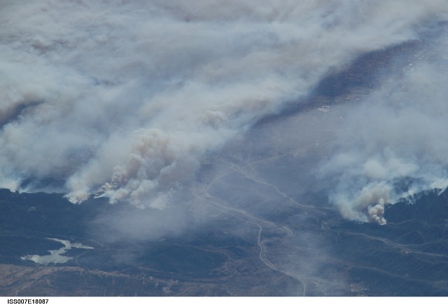
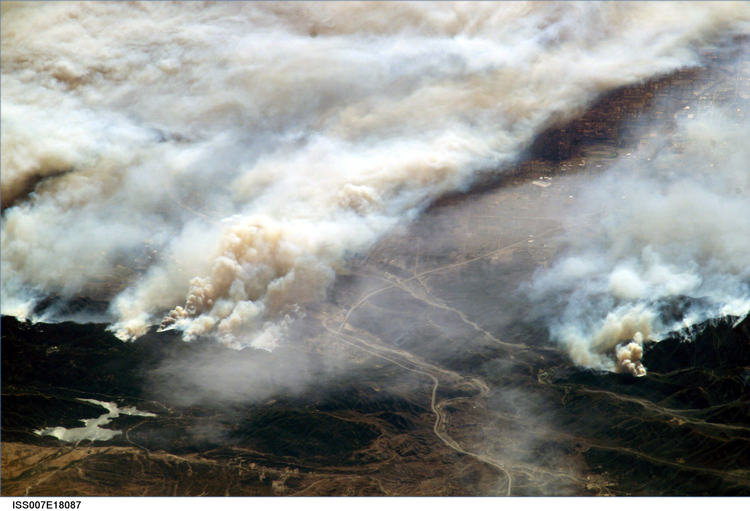
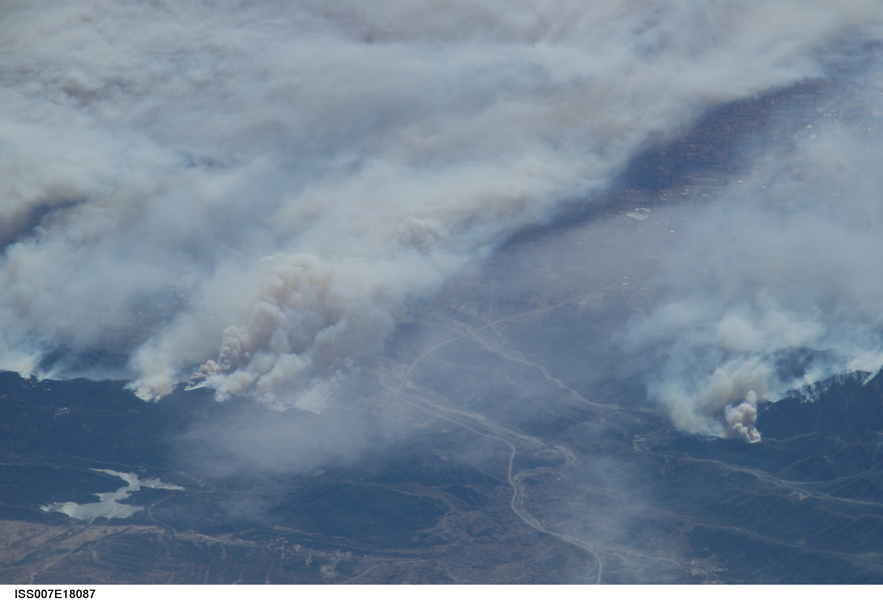
Image Caption: ISS007-E-18087 (26 October 2003) --- The fires in the San Bernardino Mountains, fueled by Santa Ana winds, burned out of control on the morning of Oct. 26, 2003, when this image and several others were taken from the International Space Station. This frame and image numbers 18086 and 18088 were taken at approximately 19:54 GMT, October 26, 2003 with a digital still camera equipped with a 400mm lens. Silverwood Lake is visible at the bottom of the image. Content was provided by JSC's Earth Observation Lab. The International Space Station Program supports the laboratory to help astronauts take pictures of Earth that will be of the greatest value to scientists and the public, and to make those images freely available on the Internet. Additional images taken by astronauts and cosmonauts can be viewed at the NASA/JSC Gateway to Astronaut Photography of Earth.
