ISS007-E-17557

| NASA Photo ID | ISS007-E-17557 |
| Focal Length | 35mm |
| Date taken | 2003.10.17 |
| Time taken | 22:30:29 GMT |
Resolutions offered for this image:
1024 x 665 pixels 540 x 351 pixels 3032 x 2064 pixels 6144 x 4068 pixels 639 x 435 pixels
1024 x 665 pixels 540 x 351 pixels 3032 x 2064 pixels 6144 x 4068 pixels 639 x 435 pixels

Cloud masks available for this image:
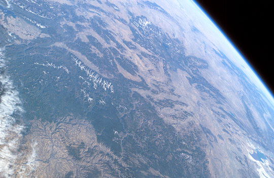
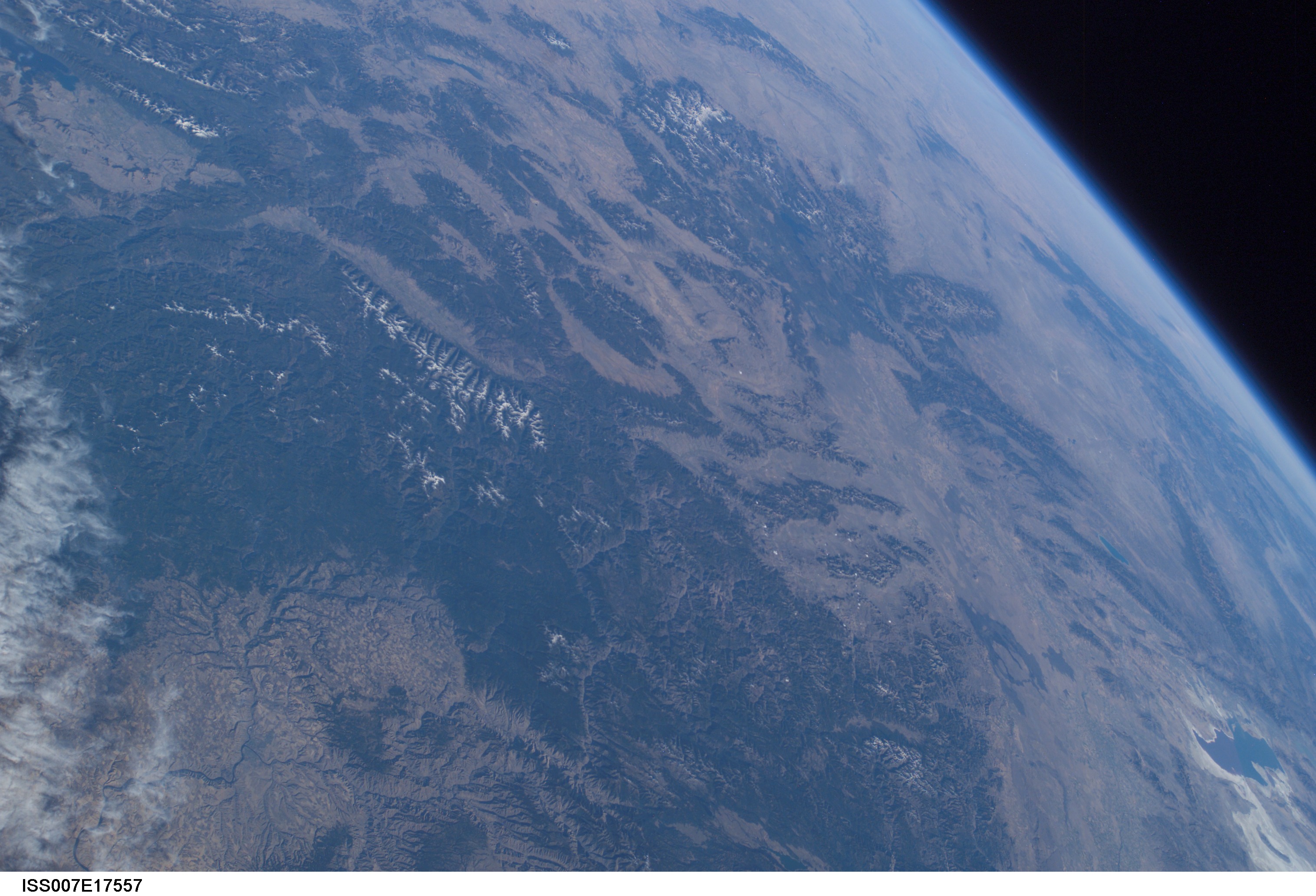
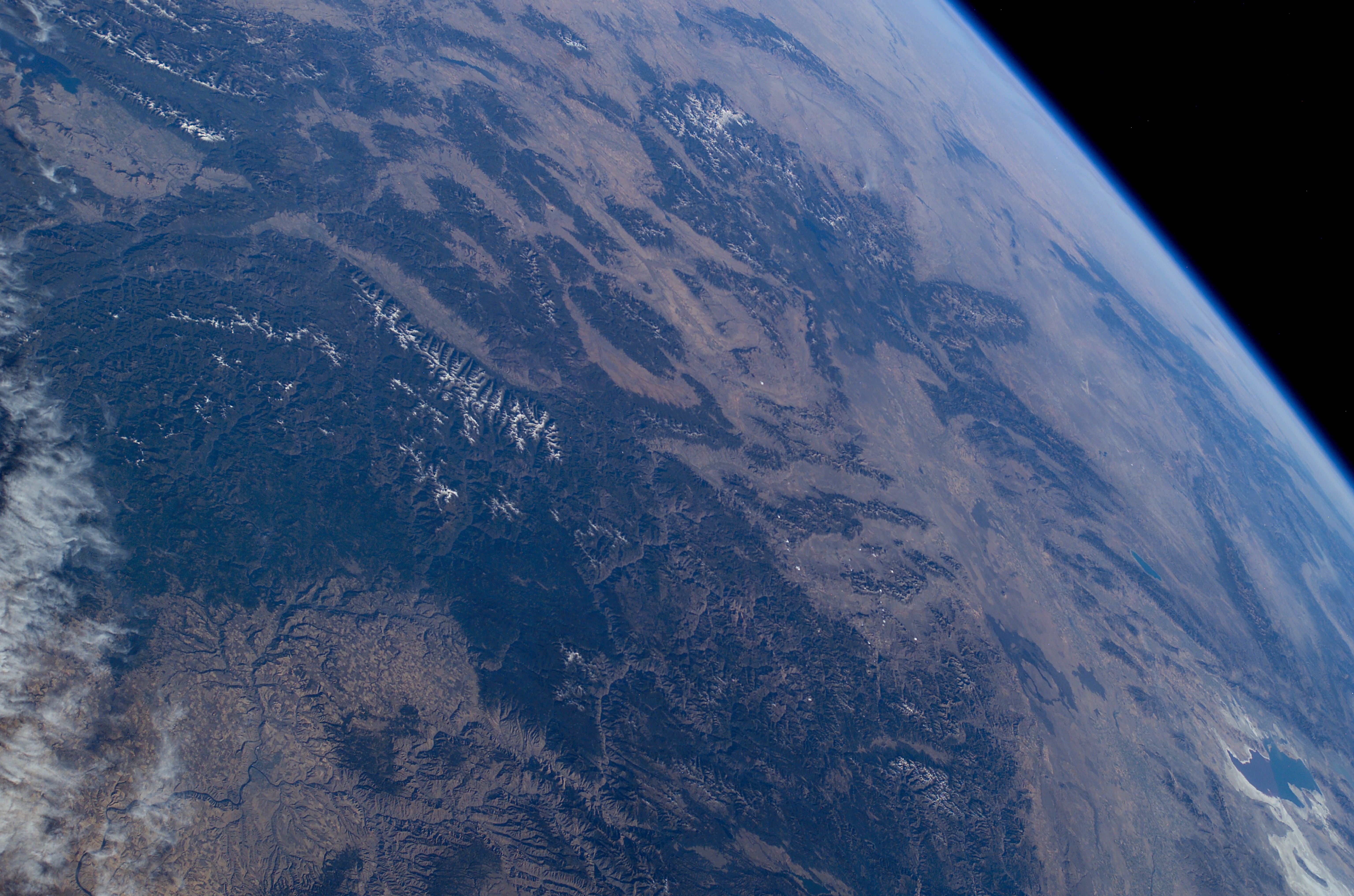
Spacecraft nadir point: 47.7° N, 121.9° W
Photo center point: 45.0° N, 113.0° W
Photo center point by machine learning:
Photo center point: 45.0° N, 113.0° W
Photo center point by machine learning:
Nadir to Photo Center: East
Spacecraft Altitude: 201 nautical miles (372km)
Country or Geographic Name: | USA-MONTANA |
Features: | PAN-SNAKE RIVER VALLEY, GREAT SALT LAKE |
| Features Found Using Machine Learning: | PAN- |
Cloud Cover Percentage: | 25 (11-25)% |
Sun Elevation Angle: | 23° |
Sun Azimuth: | 223° |
Camera: | Kodak DCS760c Electronic Still Camera |
Focal Length: | 35mm |
Camera Tilt: | High Oblique |
Format: | 3060E: 3060 x 2036 pixel CCD, RGBG array |
Film Exposure: | |
| Additional Information | |
| Width | Height | Annotated | Cropped | Purpose | Links |
|---|---|---|---|---|---|
| 1024 pixels | 665 pixels | Photographic Highlights | Download Image | ||
| 540 pixels | 351 pixels | Photographic Highlights | Download Image | ||
| 3032 pixels | 2064 pixels | No | No | Download Image | |
| 6144 pixels | 4068 pixels | No | No | Presentation | Download Image |
| 639 pixels | 435 pixels | No | No | Download Image |
Download Packaged File
Download a Google Earth KML for this Image
View photo footprint information
Download a GeoTIFF for this photo
Image Caption: ISS007-E-17557 (17 October 2003) --- This sweeping view of the Rocky Mountains and the western US was taken when the International Space Station (ISS) traveled over eastern Washington on October 17, 2003. The POV of the Station was looking southeast over the mountains of Idaho (foreground) and Wyoming (Yellowstone, the Tetons and the Wind River Range are just right and above the center of the image). Great Salt Lake is in the lower right of the image.
