ISS007-E-16807
| NASA Photo ID | ISS007-E-16807 |
| Focal Length | 800mm |
| Date taken | 2003.10.08 |
| Time taken | 21:41:38 GMT |
Resolutions offered for this image:
1000 x 760 pixels 2100 x 1596 pixels 540 x 334 pixels 3032 x 2064 pixels 639 x 435 pixels
1000 x 760 pixels 2100 x 1596 pixels 540 x 334 pixels 3032 x 2064 pixels 639 x 435 pixels
Cloud masks available for this image:
Spacecraft nadir point: 18.8° N, 159.8° W
Photo center point: 21.5° N, 158.0° W
Photo center point by machine learning:
Photo center point: 21.5° N, 158.0° W
Photo center point by machine learning:
Nadir to Photo Center: Northeast
Spacecraft Altitude: 203 nautical miles (376km)
Country or Geographic Name: | USA-HAWAII |
Features: | HONOLULU AIRPORT, OAHU |
| Features Found Using Machine Learning: | |
Cloud Cover Percentage: | 25 (11-25)% |
Sun Elevation Angle: | 63° |
Sun Azimuth: | 155° |
Camera: | Kodak DCS760c Electronic Still Camera |
Focal Length: | 800mm |
Camera Tilt: | 44 degrees |
Format: | 3060E: 3060 x 2036 pixel CCD, RGBG array |
Film Exposure: | |
| Additional Information | |
| Width | Height | Annotated | Cropped | Purpose | Links |
|---|---|---|---|---|---|
| 1000 pixels | 760 pixels | No | Yes | NASA's Earth Observatory web site | Download Image |
| 2100 pixels | 1596 pixels | No | Yes | NASA's Earth Observatory web site | Download Image |
| 540 pixels | 334 pixels | Yes | NASA's Earth Observatory web site | Download Image | |
| 3032 pixels | 2064 pixels | No | No | Download Image | |
| 639 pixels | 435 pixels | No | No | Download Image |
Download Packaged File
Download a Google Earth KML for this Image
View photo footprint information
Download a GeoTIFF for this photo
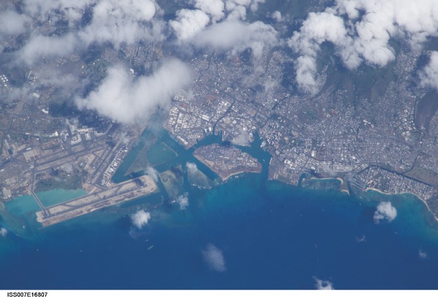
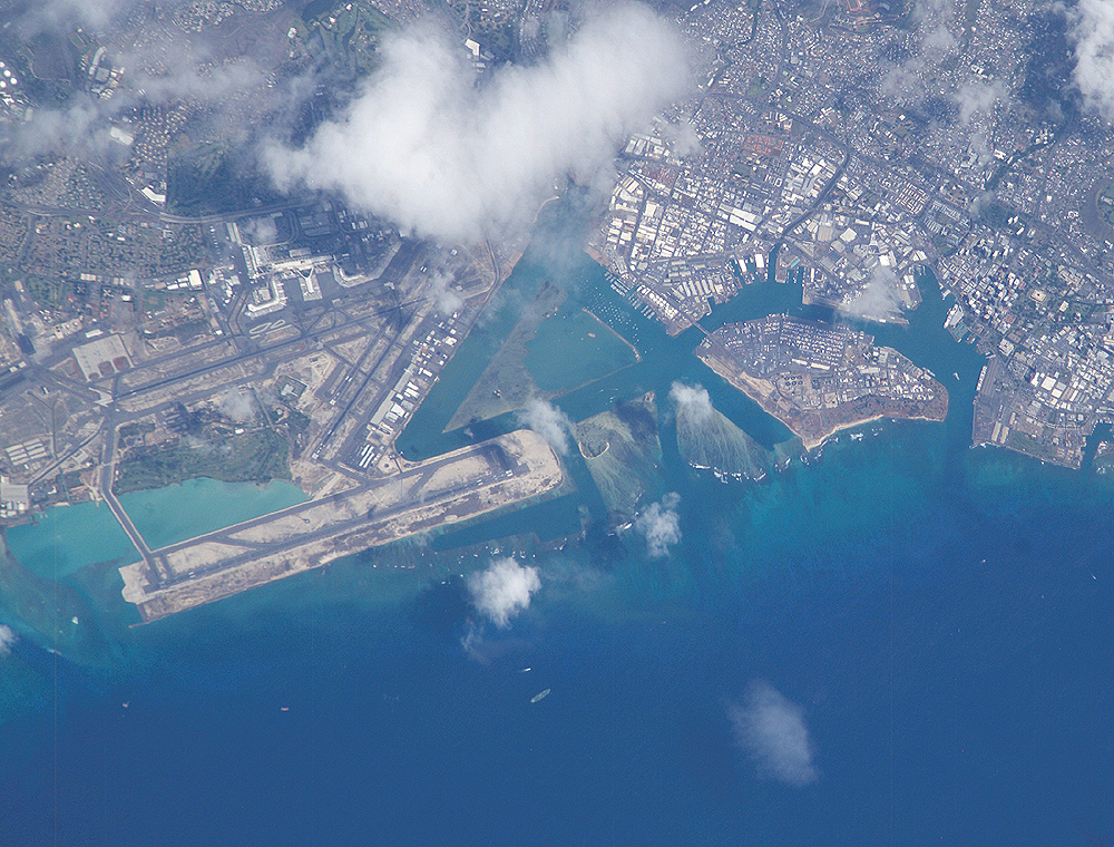
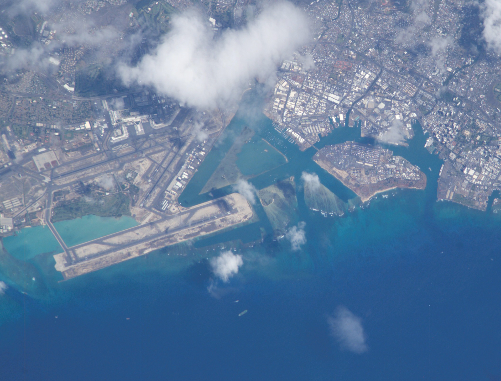
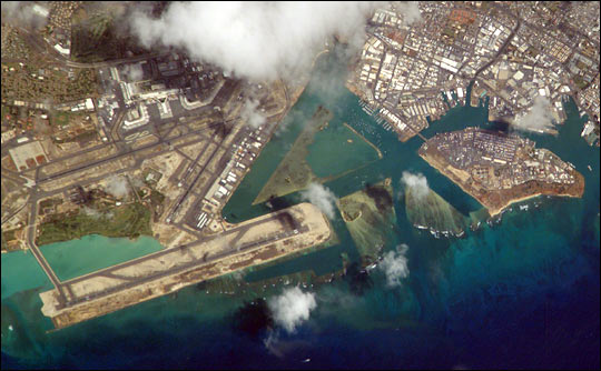
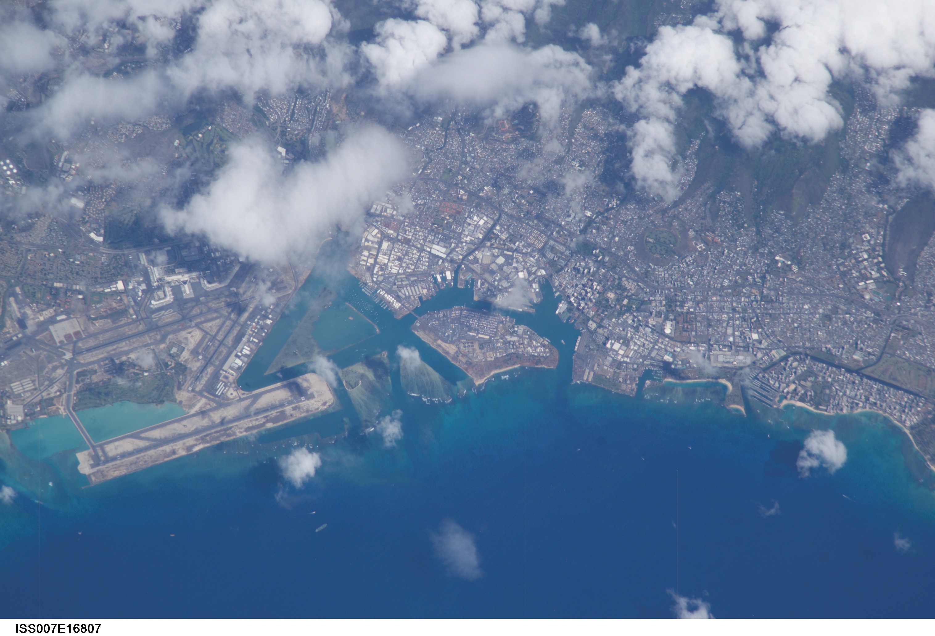
Image Caption: ISS007-E-16807 (8 October 2003) --- The Honolulu International Airport runway juts into the water on the left side of this image of Oahu, taken by an Expedition 7 crewmember onboard the International Space Station (ISS). In the center is Ke'ehi Lagoon and on the right is Sand Island.
