ISS007-E-13327
| NASA Photo ID | ISS007-E-13327 |
| Focal Length | 400mm |
| Date taken | 2003.08.24 |
| Time taken | 09:18:07 GMT |
Resolutions offered for this image:
540 x 448 pixels 925 x 768 pixels 540 x 405 pixels 1000 x 828 pixels 3032 x 2064 pixels 6144 x 4068 pixels 639 x 435 pixels
540 x 448 pixels 925 x 768 pixels 540 x 405 pixels 1000 x 828 pixels 3032 x 2064 pixels 6144 x 4068 pixels 639 x 435 pixels


Cloud masks available for this image:
Spacecraft nadir point: 7.2° S, 110.9° E
Photo center point: 7.5° S, 110.5° E
Photo center point by machine learning:
Photo center point: 7.5° S, 110.5° E
Photo center point by machine learning:
Nadir to Photo Center: Southwest
Spacecraft Altitude: 205 nautical miles (380km)
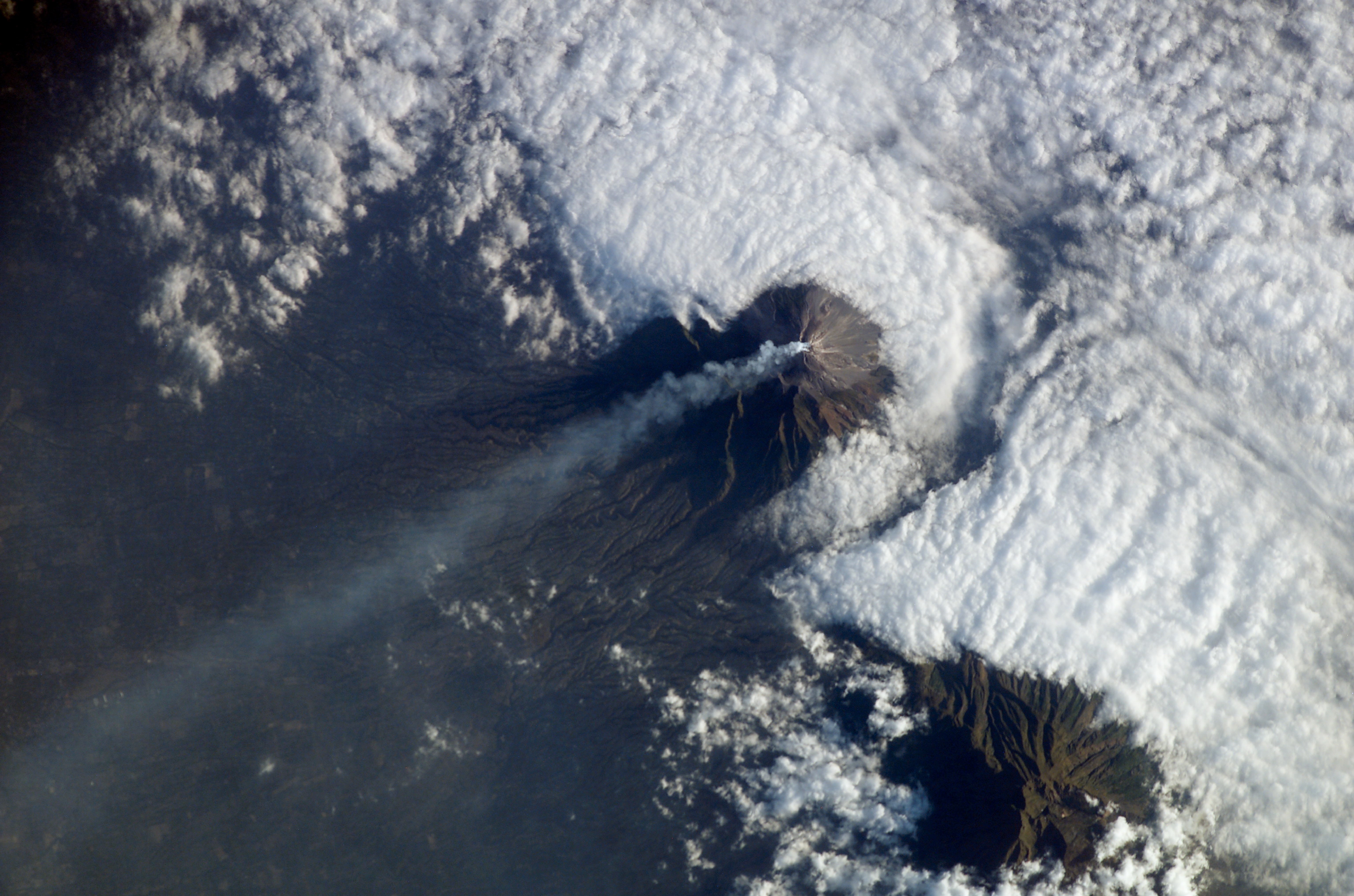
Country or Geographic Name: | INDONESIA-J |
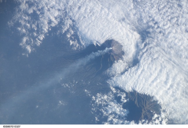
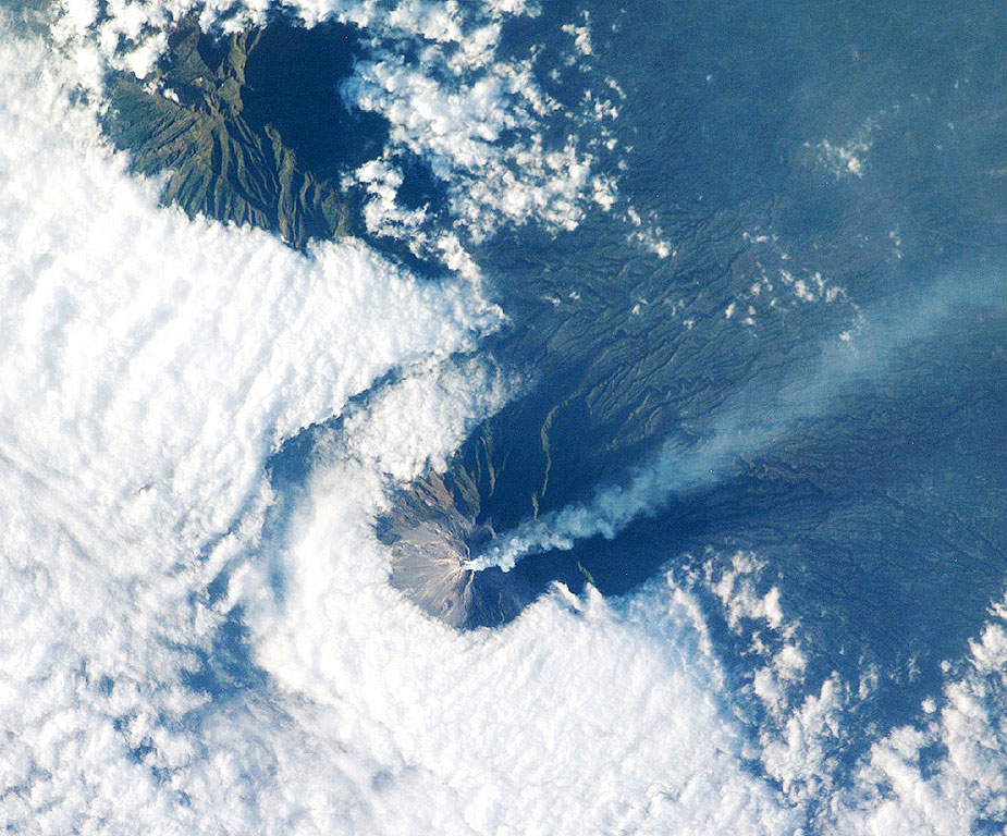
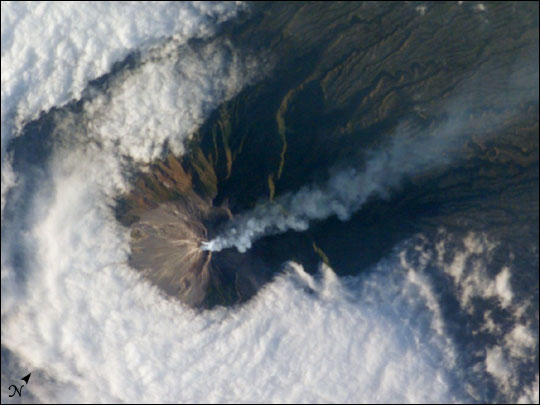
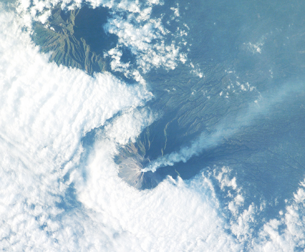
Features: | MOUNT MERAPI, PLUME, AGRICULTURE |
| Features Found Using Machine Learning: | |
Cloud Cover Percentage: | 50 (26-50)% |
Sun Elevation Angle: | 18° |
Sun Azimuth: | 284° |
Camera: | Kodak DCS760c Electronic Still Camera |
Focal Length: | 400mm |
Camera Tilt: | 8 degrees |
Format: | 3060E: 3060 x 2036 pixel CCD, RGBG array |
Film Exposure: | |
| Additional Information | |
| Width | Height | Annotated | Cropped | Purpose | Links |
|---|---|---|---|---|---|
| 540 pixels | 448 pixels | Photographic Highlights | Download Image | ||
| 925 pixels | 768 pixels | Photographic Highlights | Download Image | ||
| 540 pixels | 405 pixels | Yes | Yes | Earth From Space collection | Download Image |
| 1000 pixels | 828 pixels | No | Yes | NASA's Earth Observatory web site | Download Image |
| 3032 pixels | 2064 pixels | No | No | Download Image | |
| 6144 pixels | 4068 pixels | No | No | Presentation | Download Image |
| 639 pixels | 435 pixels | No | No | Download Image |
Download Packaged File
Download a Google Earth KML for this Image
View photo footprint information
Download a GeoTIFF for this photo
Image Caption: Merapi Volcano, Java: At 2,911 meters, the summit of Merapi Volcano and its vigorous steam plume rises above a bank of stratus clouds on its southern flank on August 24, 2003. One of Indonesia's most active volcanoes, it has been almost continuously active for nearly ten years, including periodic pyroclastic flows (hot ash and rock debris) and avalanches. The volcano is located less than 25 miles north of the city of Yogykarta in central Java. More than 50,000 people live adjacent the treacherous southwestern slope, where volcanic material often sloughs from the unstable summit. Note the deep ravines on the eastern slopes providing rich soils and moisture to the agriculture below.
