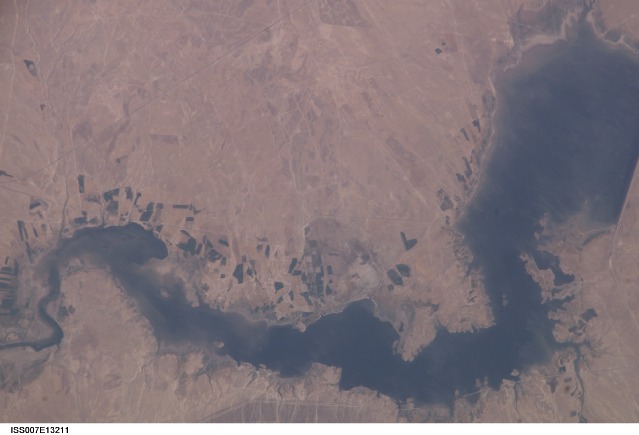
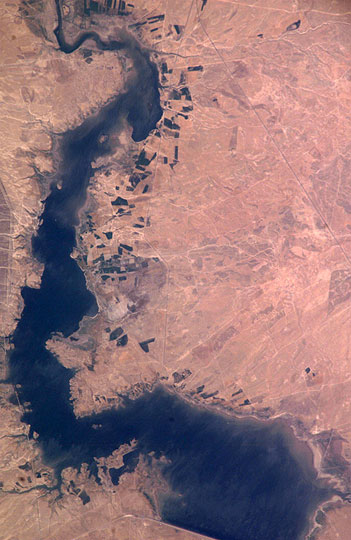
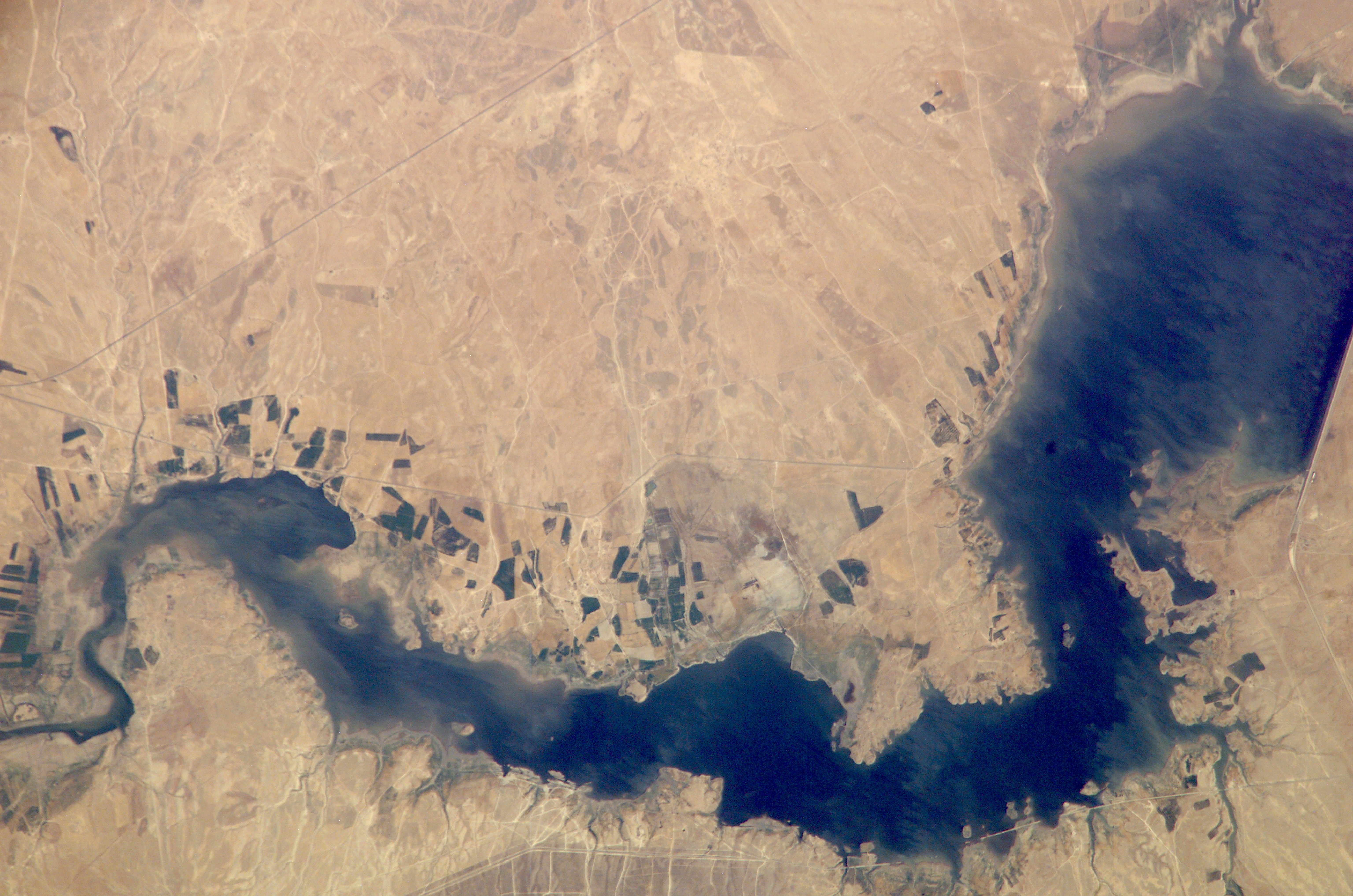
ISS007-E-13211
| NASA Photo ID | ISS007-E-13211 |
| Focal Length | 800mm |
| Date taken | 2003.08.23 |
| Time taken | 11:33:10 GMT |
Resolutions offered for this image:
351 x 540 pixels 499 x 768 pixels 3032 x 2064 pixels 6144 x 4068 pixels 639 x 435 pixels
351 x 540 pixels 499 x 768 pixels 3032 x 2064 pixels 6144 x 4068 pixels 639 x 435 pixels


Cloud masks available for this image:
Spacecraft nadir point: 36.2° N, 41.7° E
Photo center point: 36.0° N, 41.0° E
Photo center point by machine learning:
Photo center point: 36.0° N, 41.0° E
Photo center point by machine learning:
Nadir to Photo Center: West
Spacecraft Altitude: 202 nautical miles (374km)
Country or Geographic Name: | SYRIA |
Features: | KHABUR RIVER, RESERVOIR, AGR., ROADS |
| Features Found Using Machine Learning: | |
Cloud Cover Percentage: | 10 (1-10)% |
Sun Elevation Angle: | 51° |
Sun Azimuth: | 240° |
Camera: | Kodak DCS760c Electronic Still Camera |
Focal Length: | 800mm |
Camera Tilt: | 12 degrees |
Format: | 3060E: 3060 x 2036 pixel CCD, RGBG array |
Film Exposure: | |
| Additional Information | |
| Width | Height | Annotated | Cropped | Purpose | Links |
|---|---|---|---|---|---|
| 351 pixels | 540 pixels | Photographic Highlights | Download Image | ||
| 499 pixels | 768 pixels | Photographic Highlights | Download Image | ||
| 3032 pixels | 2064 pixels | No | No | Download Image | |
| 6144 pixels | 4068 pixels | No | No | Presentation | Download Image |
| 639 pixels | 435 pixels | No | No | Download Image |
Download Packaged File
Download a Google Earth KML for this Image
View photo footprint information
Download a GeoTIFF for this photo
Image Caption: none
