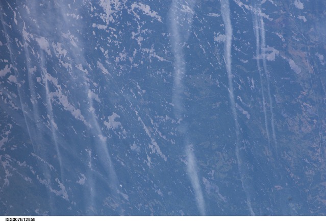
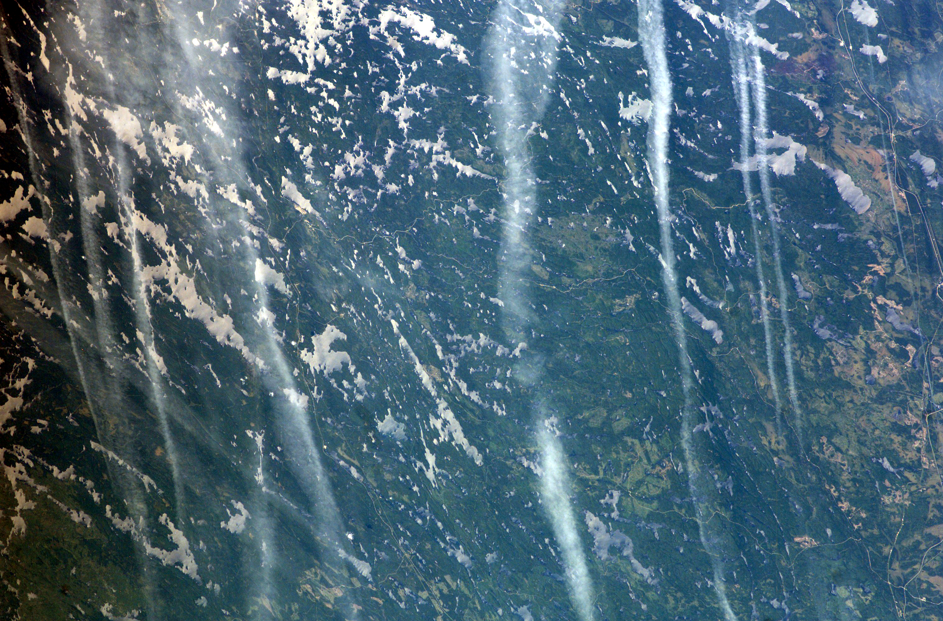
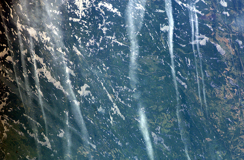
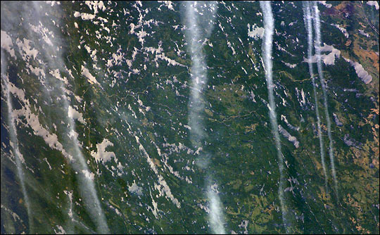
ISS007-E-12858
| NASA Photo ID | ISS007-E-12858 |
| Focal Length | 180mm |
| Date taken | 2003.08.17 |
| Time taken | 18:39:04 GMT |
Resolutions offered for this image:
3032 x 1998 pixels 1000 x 659 pixels 540 x 334 pixels 3032 x 2064 pixels 639 x 435 pixels
3032 x 1998 pixels 1000 x 659 pixels 540 x 334 pixels 3032 x 2064 pixels 639 x 435 pixels
Cloud masks available for this image:
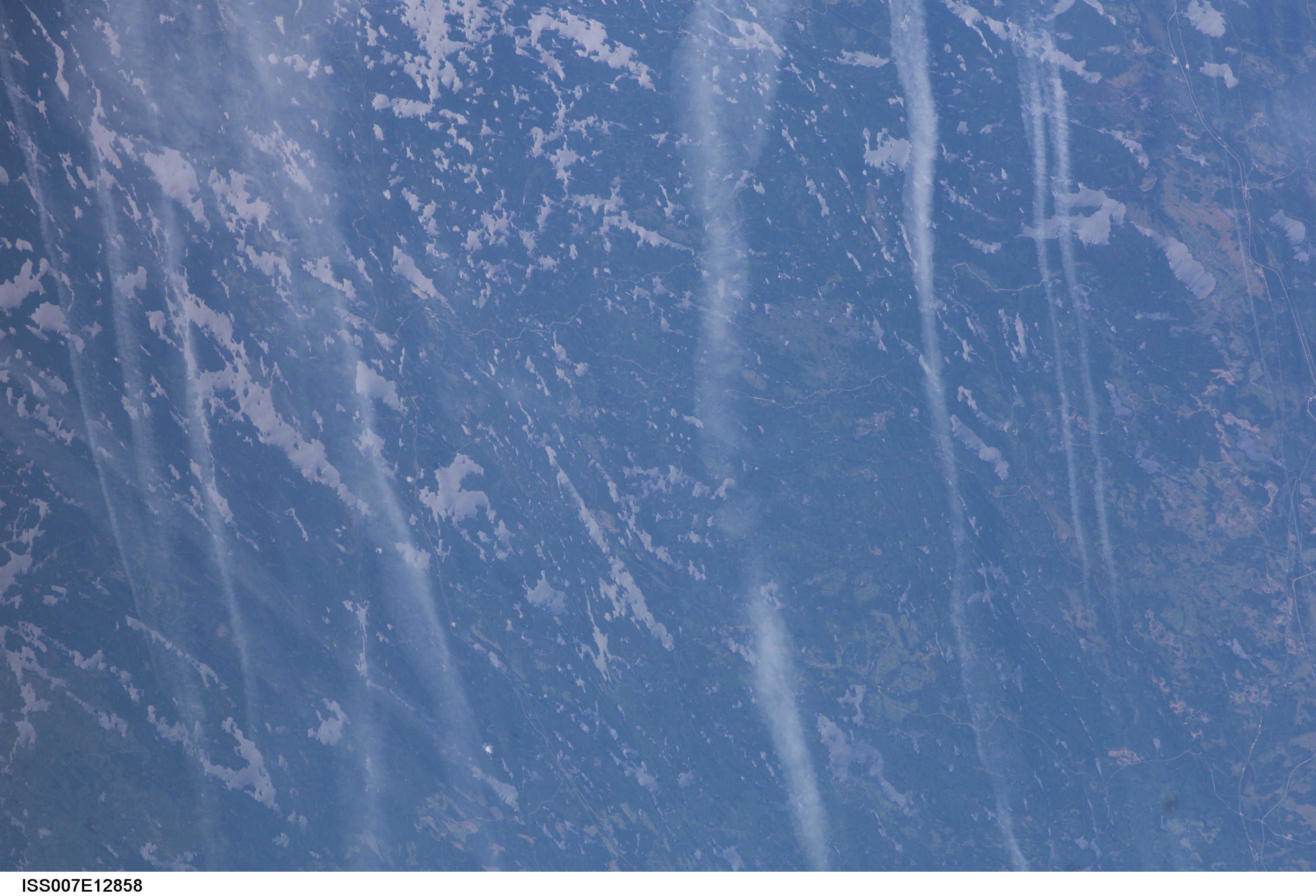
Spacecraft nadir point: 51.6° N, 91.5° W
Photo center point: 49.0° N, 91.5° W
Photo center point by machine learning:
Photo center point: 49.0° N, 91.5° W
Photo center point by machine learning:
Nadir to Photo Center: South
Spacecraft Altitude: 201 nautical miles (372km)
Country or Geographic Name: | CANADA-O |
Features: | CONTRAILS, PICKEREL LAKE, FOREST |
| Features Found Using Machine Learning: | |
Cloud Cover Percentage: | 25 (11-25)% |
Sun Elevation Angle: | 51° |
Sun Azimuth: | 191° |
Camera: | Kodak DCS760c Electronic Still Camera |
Focal Length: | 180mm |
Camera Tilt: | 38 degrees |
Format: | 3060E: 3060 x 2036 pixel CCD, RGBG array |
Film Exposure: | |
| Additional Information | |
| Width | Height | Annotated | Cropped | Purpose | Links |
|---|---|---|---|---|---|
| 3032 pixels | 1998 pixels | Earth From Space collection | Download Image | ||
| 1000 pixels | 659 pixels | No | Yes | NASA's Earth Observatory web site | Download Image |
| 540 pixels | 334 pixels | Yes | NASA's Earth Observatory web site | Download Image | |
| 3032 pixels | 2064 pixels | No | No | Download Image | |
| 639 pixels | 435 pixels | No | No | Download Image |
Download Packaged File
Download a Google Earth KML for this Image
View photo footprint information
Download a GeoTIFF for this photo
Image Caption: ISS007-E-12858 (17 August 2003) --- This view was taken by an Expedition 7 crewmember onboard the International Space Station (ISS). Sunlight reflects off of the lakes of Quetico Provincial Park, Ontario. The area lies between Lake Superior and Lake of the Woods, just north of the USA-Canadian border. The long vertical clouds in the image are condensation trails produced in the wake of jet airplanes.
