ISS007-E-10230

| NASA Photo ID | ISS007-E-10230 |
| Focal Length | 50mm |
| Date taken | 2003.07.13 |
| Time taken | 13:49:06 GMT |
Cloud masks available for this image:
Spacecraft nadir point: 15.0° N, 83.0° W
Photo center point: 18.5° N, 82.0° W
Photo center point by machine learning:
Photo center point: 18.5° N, 82.0° W
Photo center point by machine learning:
Nadir to Photo Center: North
Spacecraft Altitude: 211 nautical miles (391km)
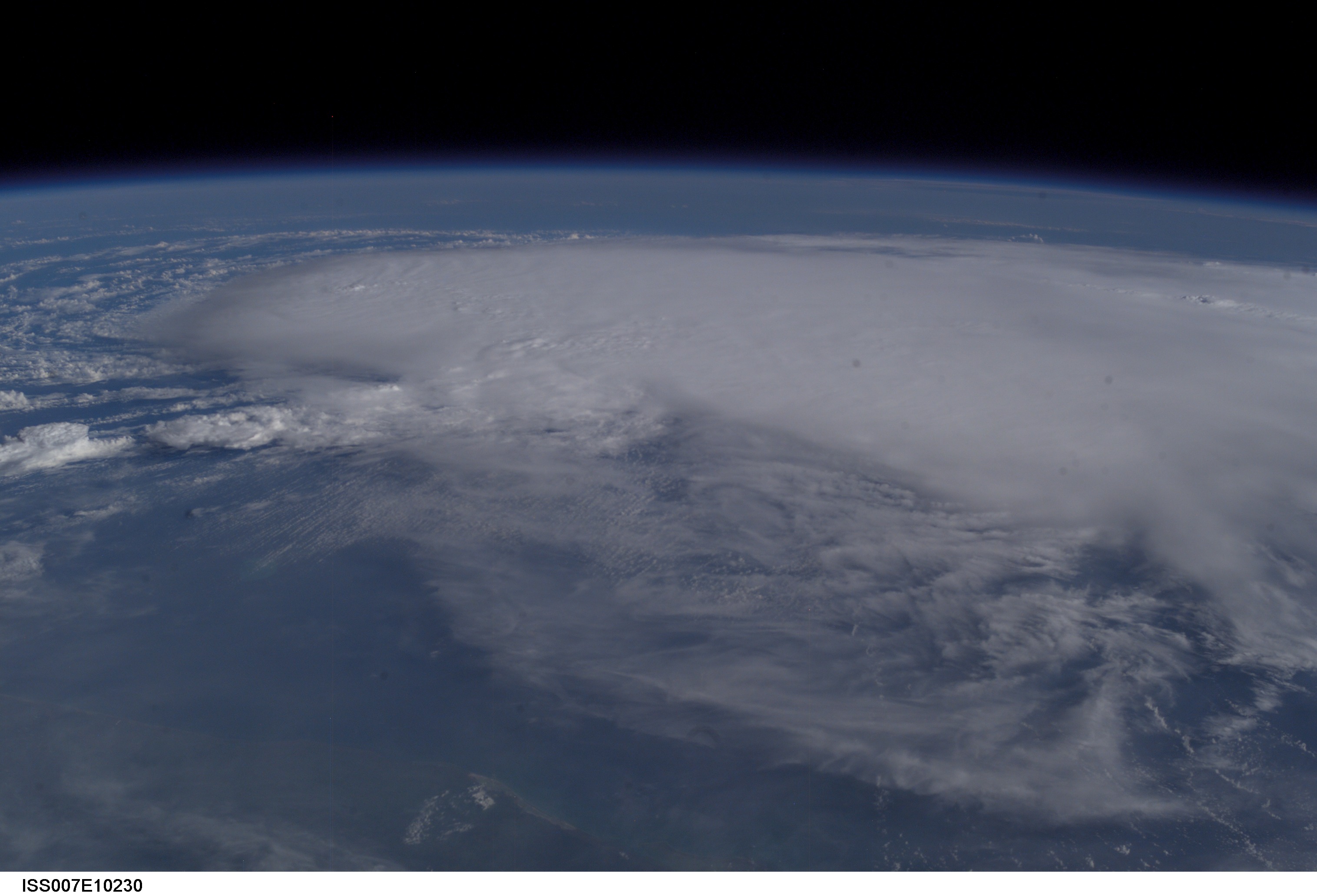
Country or Geographic Name: | CARIBBEAN SEA |
Features: | PAN-TROPICAL STORM CLAUDETTE |
| Features Found Using Machine Learning: | PAN- |
Cloud Cover Percentage: | 75 (51-75)% |
Sun Elevation Angle: | 36° |
Sun Azimuth: | 74° |
Camera: | Kodak DCS760c Electronic Still Camera |
Focal Length: | 50mm |
Camera Tilt: | 46 degrees |
Format: | 3060E: 3060 x 2036 pixel CCD, RGBG array |
Film Exposure: | |
| Additional Information | |
| Width | Height | Annotated | Cropped | Purpose | Links |
|---|---|---|---|---|---|
| 3032 pixels | 2064 pixels | No | No | Download Image | |
| 639 pixels | 435 pixels | No | No | Download Image |
Download Packaged File
Download a Google Earth KML for this Image
View photo footprint information
Download a GeoTIFF for this photo
Image Caption: ISS007-E-10230 (13 July 2003) --- This picture of tropical storm Claudette in the Gulf of Mexico was taken with a digital still camera by one of the Expedition 7 crew members aboard the Earth-orbiting International Space Station at an altitude of 238 statute miles. The exact location of the storm at the time the photo was taken was not immediately available.
