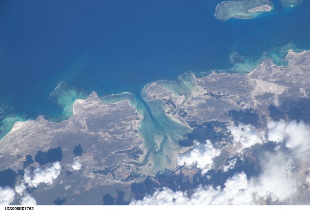
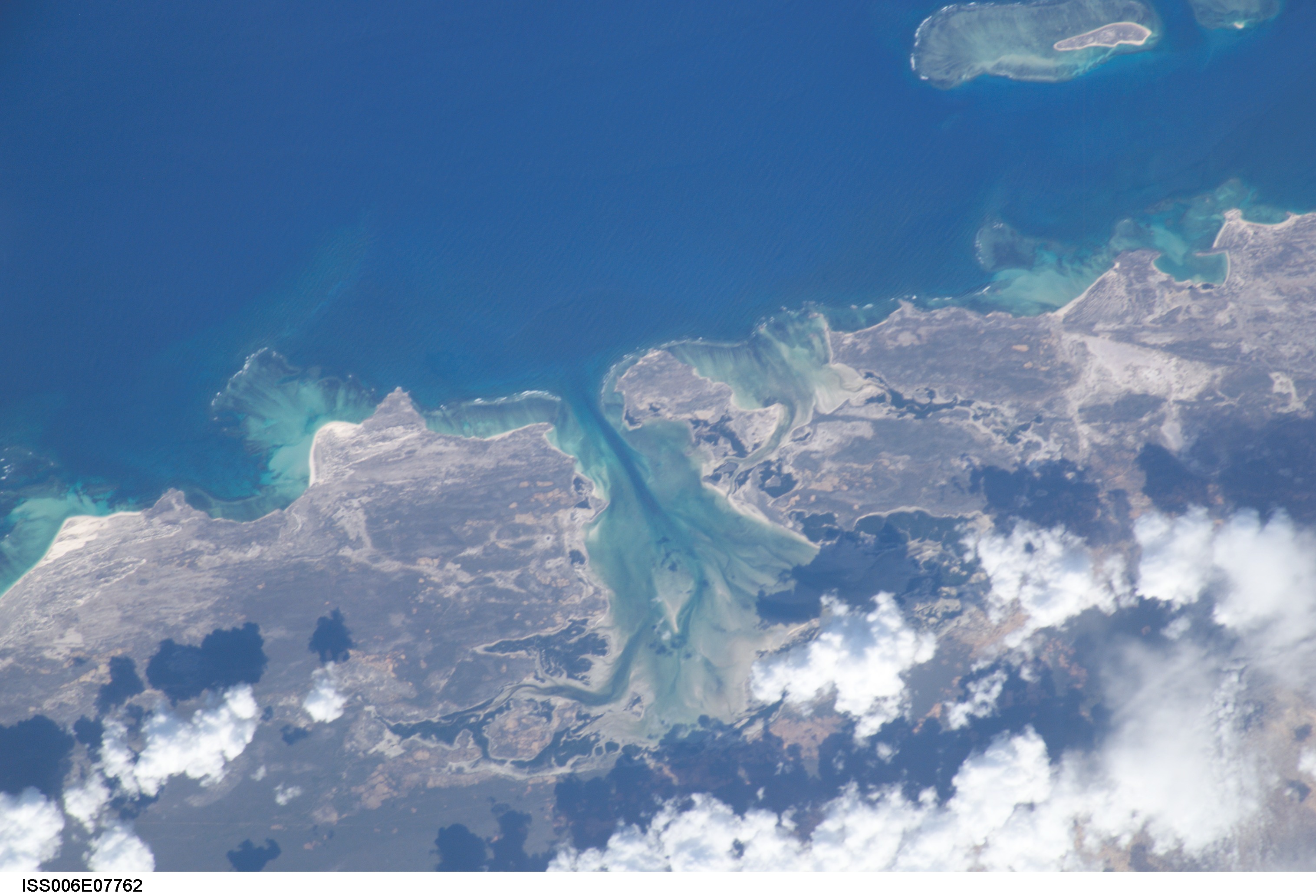
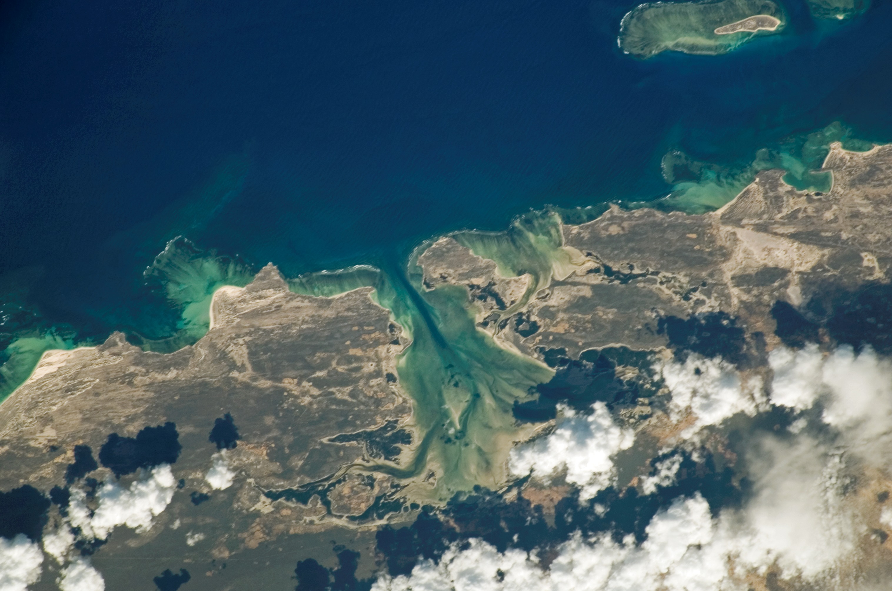
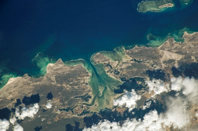
ISS006-E-7762
| NASA Photo ID | ISS006-E-7762 |
| Focal Length | 400mm |
| Date taken | 2002.12.13 |
| Time taken | 06:07:02 GMT |
Resolutions offered for this image:
3032 x 2064 pixels 3032 x 2008 pixels 3032 x 2008 pixels 639 x 435 pixels 639 x 423 pixels
3032 x 2064 pixels 3032 x 2008 pixels 3032 x 2008 pixels 639 x 435 pixels 639 x 423 pixels

Cloud masks available for this image:
Spacecraft nadir point: 21.7° S, 42.3° E
Photo center point: 22.0° S, 43.5° E
Photo center point by machine learning:
Photo center point: 22.0° S, 43.5° E
Photo center point by machine learning:
Nadir to Photo Center: East
Spacecraft Altitude: 215 nautical miles (398km)
Country or Geographic Name: | MADAGASCAR |
Features: | COAST, ASSASSINS BAY |
| Features Found Using Machine Learning: | |
Cloud Cover Percentage: | 25 (11-25)% |
Sun Elevation Angle: | 49° |
Sun Azimuth: | 101° |
Camera: | Kodak DCS760c Electronic Still Camera |
Focal Length: | 400mm |
Camera Tilt: | 19 degrees |
Format: | 3060E: 3060 x 2036 pixel CCD, RGBG array |
Film Exposure: | |
| Additional Information | |
| Width | Height | Annotated | Cropped | Purpose | Links |
|---|---|---|---|---|---|
| 3032 pixels | 2064 pixels | No | No | Download Image | |
| 3032 pixels | 2008 pixels | No | No | Download Image | |
| 3032 pixels | 2008 pixels | No | No | Download Image | |
| 639 pixels | 435 pixels | No | No | Download Image | |
| 639 pixels | 423 pixels | No | No | Download Image |
Download Packaged File
Download a Google Earth KML for this Image
View photo footprint information
Download a GeoTIFF for this photo
Image Caption: none
