ISS006-E-52006
| NASA Photo ID | ISS006-E-52006 |
| Focal Length | 800mm |
| Date taken | 2003.03.13 |
| Time taken | 19:13:26 GMT |
Resolutions offered for this image:
1000 x 656 pixels 1024 x 672 pixels 540 x 405 pixels 2000 x 1312 pixels 2000 x 1312 pixels 639 x 419 pixels
1000 x 656 pixels 1024 x 672 pixels 540 x 405 pixels 2000 x 1312 pixels 2000 x 1312 pixels 639 x 419 pixels


Cloud masks available for this image:
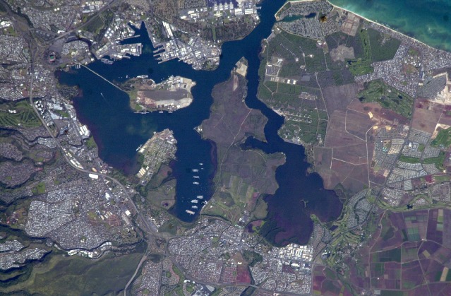
Spacecraft nadir point: 20.2° N, 156.8° W
Photo center point: 21.5° N, 158.0° W
Photo center point by machine learning:
Photo center point: 21.5° N, 158.0° W
Photo center point by machine learning:
Nadir to Photo Center: Northwest
Spacecraft Altitude: 213 nautical miles (394km)
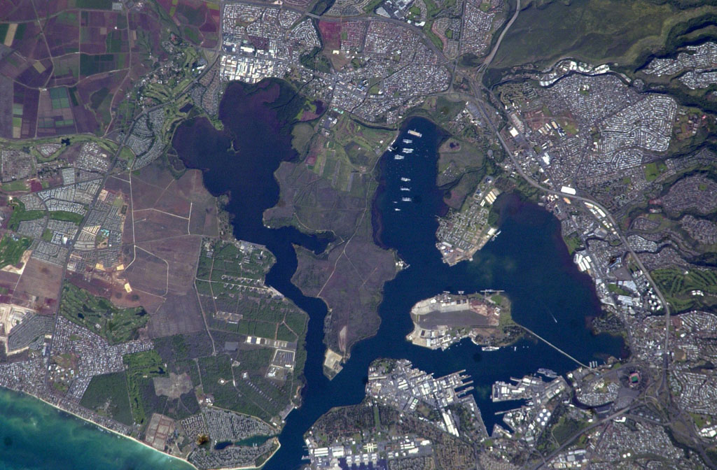
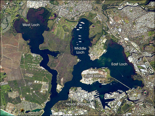
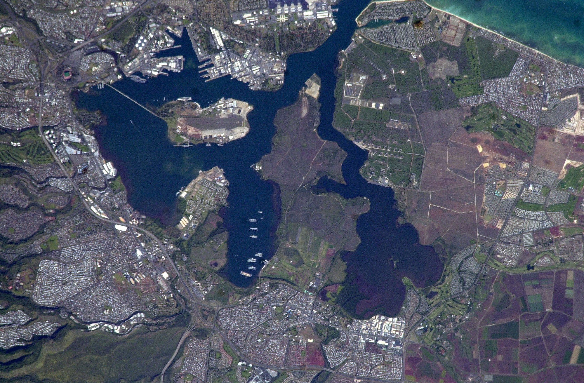
Country or Geographic Name: | USA-HAWAII |
Features: | PEARL HARBOR, OAHU |
| Features Found Using Machine Learning: | |
Cloud Cover Percentage: | 10 (1-10)% |
Sun Elevation Angle: | 35° |
Sun Azimuth: | 109° |
Camera: | Nikon D1 Electronic Still Camera |
Focal Length: | 800mm |
Camera Tilt: | 26 degrees |
Format: | 2000E: 2000 x 1312 pixel CCD, RGBG imager color filter |
Film Exposure: | |
| Additional Information | |
| Width | Height | Annotated | Cropped | Purpose | Links |
|---|---|---|---|---|---|
| 1000 pixels | 656 pixels | No | Yes | Download Image | |
| 1024 pixels | 672 pixels | No | Yes | Download Image | |
| 540 pixels | 405 pixels | Yes | Yes | NASA's Earth Observatory web site | Download Image |
| 2000 pixels | 1312 pixels | No | No | Download Image | |
| 2000 pixels | 1312 pixels | No | No | Original file from camera | Download Image |
| 639 pixels | 419 pixels | No | No | Download Image |
Download Packaged File
Download a Google Earth KML for this Image
View photo footprint information
Download a GeoTIFF for this photo
Image Caption: none
