ISS006-E-30535

| NASA Photo ID | ISS006-E-30535 |
| Focal Length | 180mm |
| Date taken | 2003.02.19 |
| Time taken | 09:58:03 GMT |
Cloud masks available for this image:
Spacecraft nadir point: 48.2° N, 15.0° E
Photo center point: 47.0° N, 12.5° E
Photo center point by machine learning:
Photo center point: 47.0° N, 12.5° E
Photo center point by machine learning:
Nadir to Photo Center: West
Spacecraft Altitude: 212 nautical miles (393km)
Country or Geographic Name: | AUSTRIA |
Features: | ALPS MOUNTAIN RANGE |
| Features Found Using Machine Learning: | |
Cloud Cover Percentage: | 10 (1-10)% |
Sun Elevation Angle: | 28° |
Sun Azimuth: | 159° |
Camera: | Kodak DCS760c Electronic Still Camera |
Focal Length: | 180mm |
Camera Tilt: | 38 degrees |
Format: | 3060E: 3060 x 2036 pixel CCD, RGBG array |
Film Exposure: | |
| Additional Information | |
| Width | Height | Annotated | Cropped | Purpose | Links |
|---|---|---|---|---|---|
| 3032 pixels | 2064 pixels | No | No | Download Image | |
| 639 pixels | 435 pixels | No | No | Download Image |
Download Packaged File
Download a Google Earth KML for this Image
View photo footprint information
Download a GeoTIFF for this photo
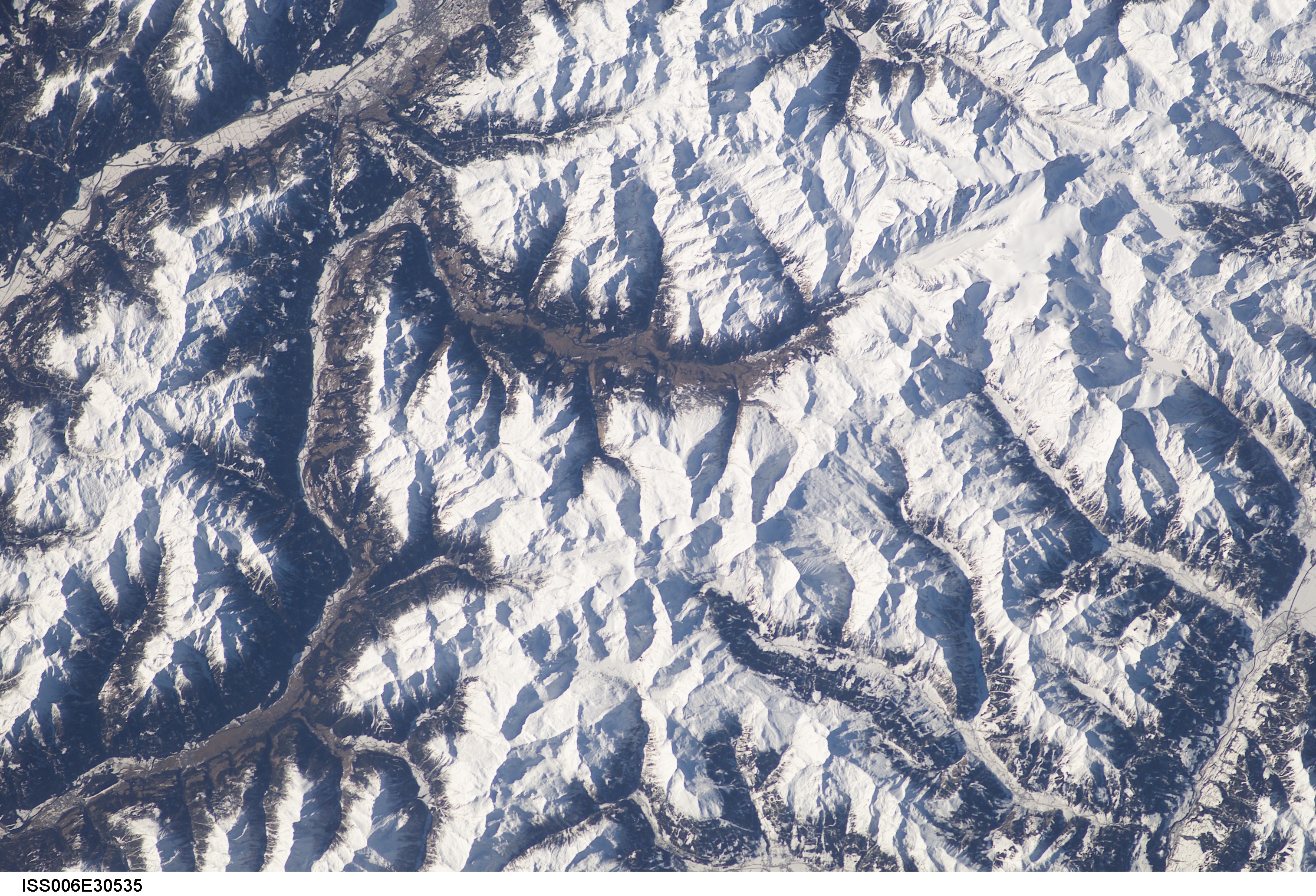
Image Caption: Lienz is shown on the top edge and the eastern part of the "Hohe Tauern" chain, with the "Grossglockner", Austria's highest mountain (3797 m) clearly visible. Also the deep valley of the Molltal from Lienz north to Heiligenblut ending in the white fingerlike "Pasterzenkees", Austria's largest glacier pointing to the Grossglockner. The famous Grossglockner-passroad, the highest in the eastern Alps (2575 m) is not visible because it closes from november till may. But the dams of the Kaprun and Stubach-valleys, as well as their snow-covered lakes are (upper half right). (submitted by Paul De Krock)
