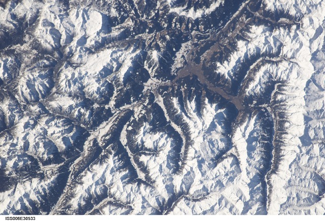
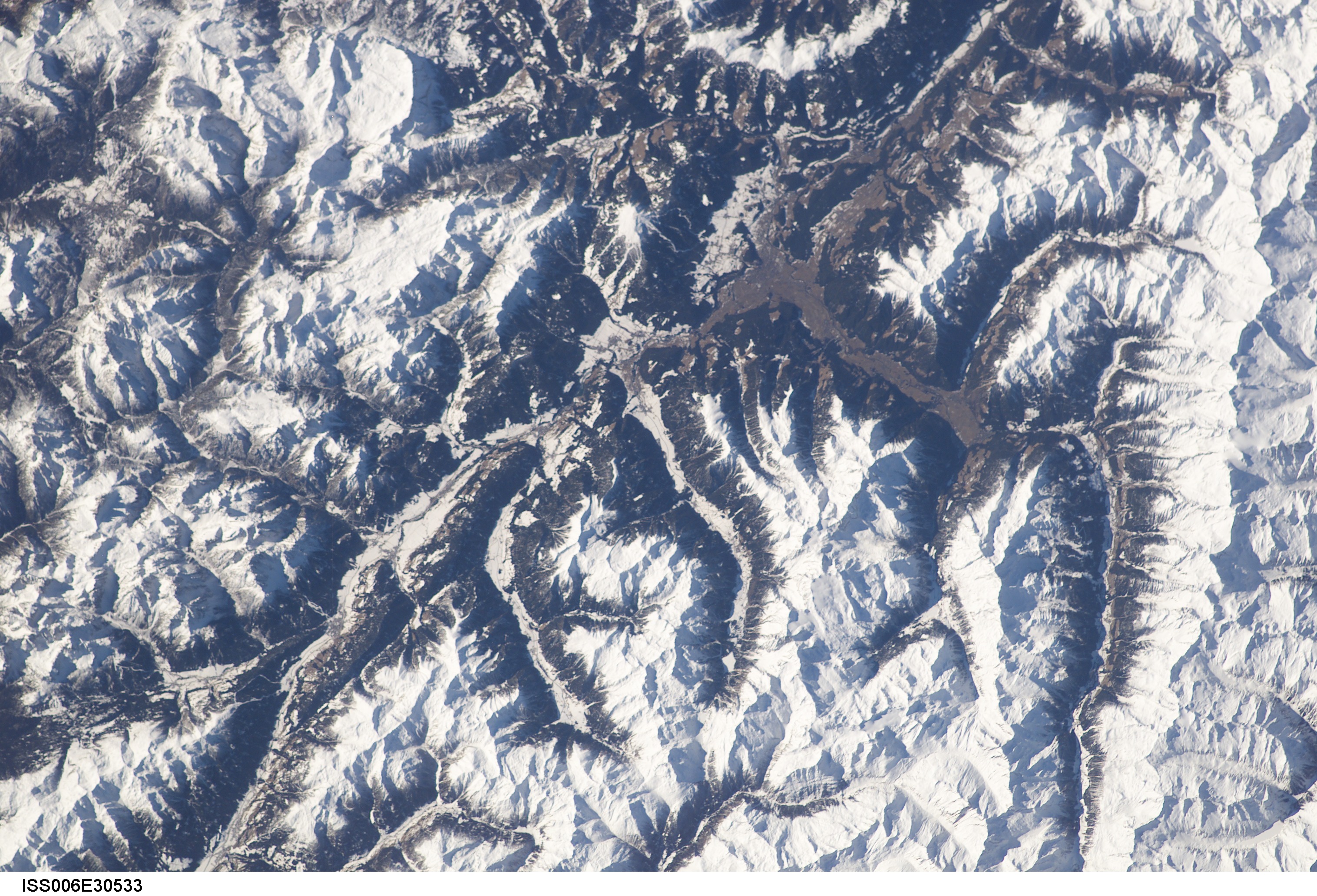
ISS006-E-30533
| NASA Photo ID | ISS006-E-30533 |
| Focal Length | 180mm |
| Date taken | 2003.02.19 |
| Time taken | 09:58:00 GMT |
Cloud masks available for this image:
Spacecraft nadir point: 48.1° N, 14.8° E
Photo center point: 47.0° N, 12.0° E
Photo center point by machine learning:
Photo center point: 47.0° N, 12.0° E
Photo center point by machine learning:
Nadir to Photo Center: West
Spacecraft Altitude: 212 nautical miles (393km)
Country or Geographic Name: | ITALY |
Features: | ALPS MOUNTAIN RANGE |
| Features Found Using Machine Learning: | |
Cloud Cover Percentage: | 10 (1-10)% |
Sun Elevation Angle: | 28° |
Sun Azimuth: | 159° |
Camera: | Kodak DCS760c Electronic Still Camera |
Focal Length: | 180mm |
Camera Tilt: | 40 degrees |
Format: | 3060E: 3060 x 2036 pixel CCD, RGBG array |
Film Exposure: | |
| Additional Information | |
| Width | Height | Annotated | Cropped | Purpose | Links |
|---|---|---|---|---|---|
| 3032 pixels | 2064 pixels | No | No | Download Image | |
| 639 pixels | 435 pixels | No | No | Download Image |
Download Packaged File
Download a Google Earth KML for this Image
View photo footprint information
Download a GeoTIFF for this photo
Image Caption: This image shows the main chain of the Zillertaler Alpen (right edge) on the border between the Austrian and Italian part of Tirol and the Pustertal around the town of Bruneck-Brunico. In the top left is the famous limestone Dolomiti/Dolomiten-massif with Cortina d'Ampezzo in its center. (submitted by Paul De Krock)
