ISS006-E-23743
| NASA Photo ID | ISS006-E-23743 |
| Focal Length | 85mm |
| Date taken | 2003.01.30 |
| Time taken | 20:39:38 GMT |
Resolutions offered for this image:
1024 x 768 pixels 540 x 405 pixels 540 x 396 pixels 1000 x 777 pixels 3032 x 2064 pixels 639 x 435 pixels
1024 x 768 pixels 540 x 405 pixels 540 x 396 pixels 1000 x 777 pixels 3032 x 2064 pixels 639 x 435 pixels


Cloud masks available for this image:
Spacecraft nadir point: 10.3° N, 81.3° W
Photo center point: 9.0° N, 79.5° W
Photo center point by machine learning:
Photo center point: 9.0° N, 79.5° W
Photo center point by machine learning:
Nadir to Photo Center: Southeast
Spacecraft Altitude: 209 nautical miles (387km)
Country or Geographic Name: | PANAMA |
Features: | PANAMA CANAL, PANAMA CITY |
| Features Found Using Machine Learning: | |
Cloud Cover Percentage: | 25 (11-25)% |
Sun Elevation Angle: | 37° |
Sun Azimuth: | 238° |
Camera: | Kodak DCS760c Electronic Still Camera |
Focal Length: | 85mm |
Camera Tilt: | 32 degrees |
Format: | 3060E: 3060 x 2036 pixel CCD, RGBG array |
Film Exposure: | |
| Additional Information | |
| Width | Height | Annotated | Cropped | Purpose | Links |
|---|---|---|---|---|---|
| 1024 pixels | 768 pixels | Photographic Highlights | Download Image | ||
| 540 pixels | 405 pixels | Photographic Highlights | Download Image | ||
| 540 pixels | 396 pixels | No | Yes | Earth From Space collection | Download Image |
| 1000 pixels | 777 pixels | No | Yes | NASA's Earth Observatory web site | Download Image |
| 3032 pixels | 2064 pixels | No | No | Download Image | |
| 639 pixels | 435 pixels | No | No | Download Image |
Download Packaged File
Download a Google Earth KML for this Image
View photo footprint information
Download a GeoTIFF for this photo
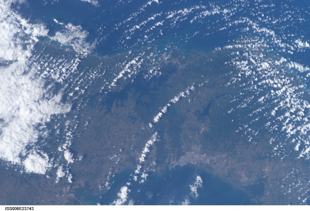
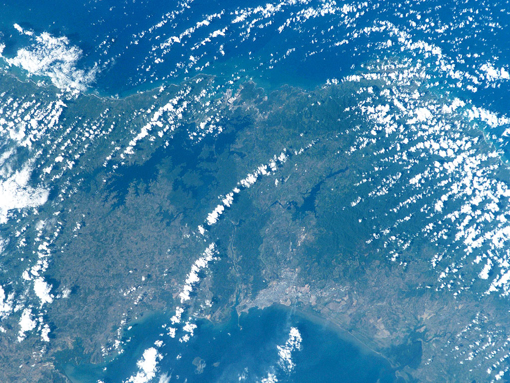
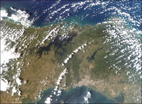
Image Caption: The Panama Canal is a 50-mile long engineering wonder connecting the Caribbean Sea and the Pacific Ocean. Completed by the United States in 1914, it runs southeastward from Colon, through the man-made Gatun Lake, to Panama City on the Pacific side of the Isthmus of Panama. The canal, a major artery of international shipping, uses a series of massive locks, manmade lakes, and water supplied by the copious tropical rainfall of the region to lift and lower transiting ships a height of 85 feet over the continental divide.
Thick rainforests border the canal, and the protected Canal Zone is easily delineated by the dark green band of forest, which contrast the lighter green cultivated areas of Panama. The ecologically sensitive Canal Zone supports diverse lowland rainforest that is crucial for water balance and erosion/siltation control around the canal. Scientists monitor the edges of the Canal Zone rainforest for degradation from development.
The crew of the International Space Station acquired this image on the afternoon of January 30, 2003, using an electronic still camera with 85 mm lens. Fair-weather cumulus clouds from the Caribbean can be seen pouring southward through the natural gap in this mountain chain of Central America.
