ISS005-E-5416
| NASA Photo ID | ISS005-E-5416 |
| Focal Length | 400mm |
| Date taken | 2002.06.18 |
| Time taken | 19:18:56 GMT |
Resolutions offered for this image:
540 x 364 pixels 1024 x 674 pixels 3032 x 2064 pixels 639 x 435 pixels
540 x 364 pixels 1024 x 674 pixels 3032 x 2064 pixels 639 x 435 pixels
Cloud masks available for this image:
Spacecraft nadir point: 42.1° N, 106.5° W
Photo center point: 39.5° N, 105.0° W
Photo center point by machine learning:
Photo center point: 39.5° N, 105.0° W
Photo center point by machine learning:
Nadir to Photo Center: Southeast
Spacecraft Altitude: 212 nautical miles (393km)
Country or Geographic Name: | USA-COLORADO |
Features: | HAYMAN FIRE NEAR DENVER |
| Features Found Using Machine Learning: | |
Cloud Cover Percentage: | 10 (1-10)% |
Sun Elevation Angle: | 71° |
Sun Azimuth: | 188° |
Camera: | Kodak DCS760c Electronic Still Camera |
Focal Length: | 400mm |
Camera Tilt: | 40 degrees |
Format: | 3060E: 3060 x 2036 pixel CCD, RGBG array |
Film Exposure: | |
| Additional Information | |
| Width | Height | Annotated | Cropped | Purpose | Links |
|---|---|---|---|---|---|
| 540 pixels | 364 pixels | Yes | Yes | Earth From Space collection | Download Image |
| 1024 pixels | 674 pixels | No | No | NASA's Earth Observatory web site | Download Image |
| 3032 pixels | 2064 pixels | No | No | Download Image | |
| 639 pixels | 435 pixels | No | No | Download Image |
Download Packaged File
Download a Google Earth KML for this Image
View photo footprint information
Download a GeoTIFF for this photo
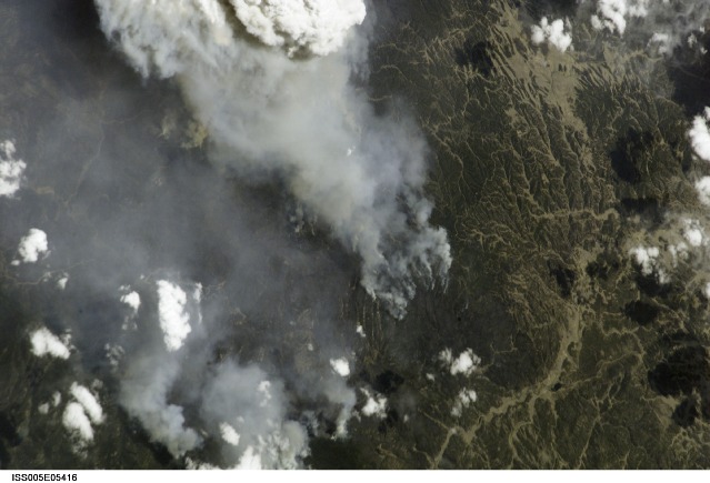
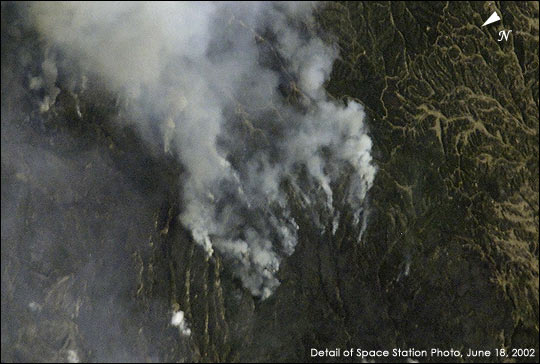
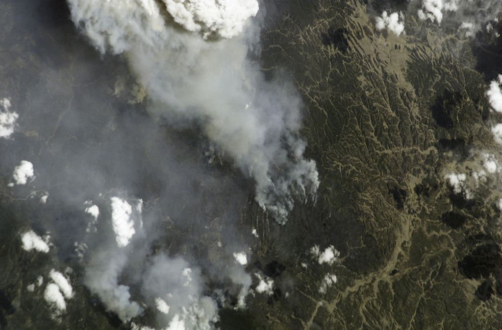
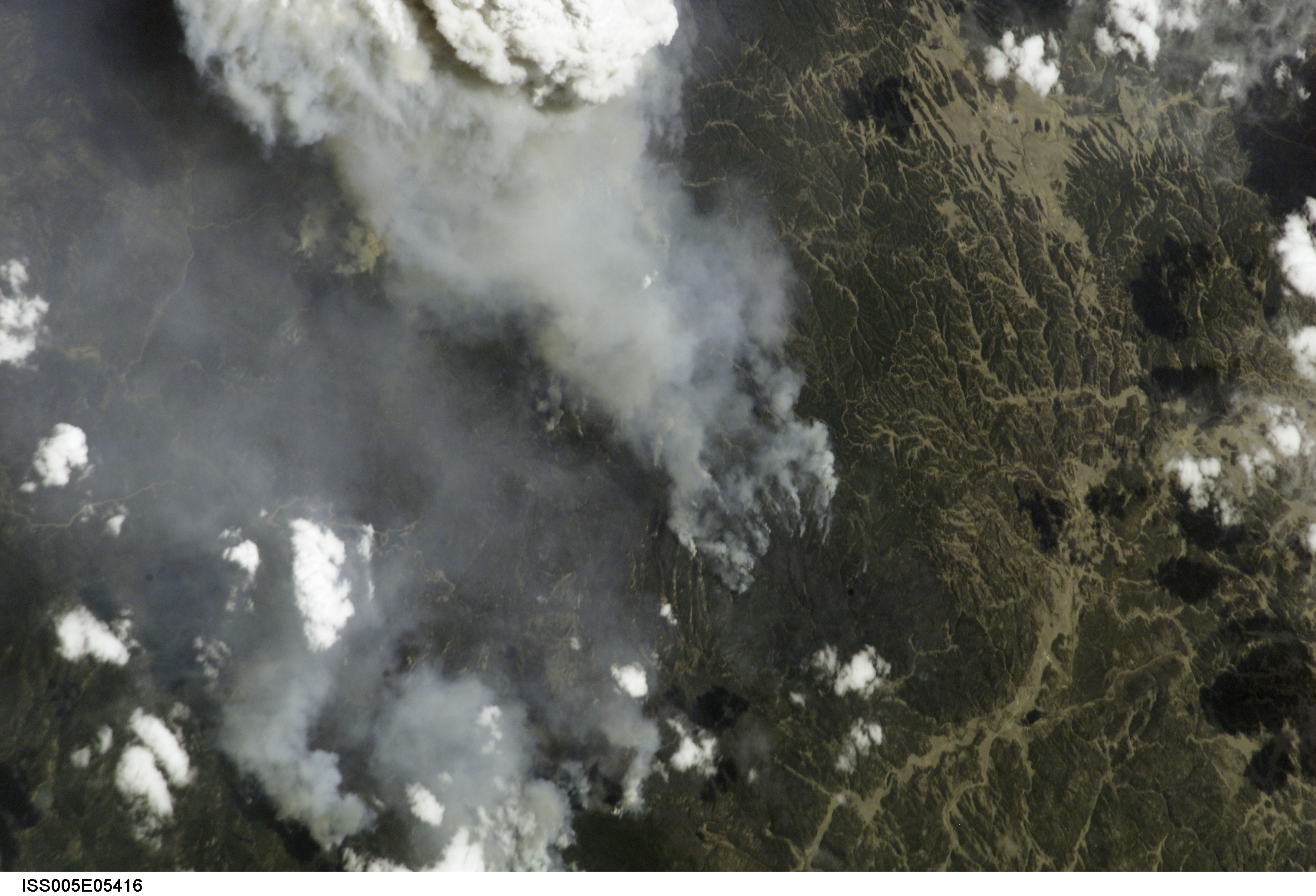
Image Caption: Hayman Fire and Others Scorch Western U.S.
This photograph taken by the new International Space Station crew on June 18, 2002, shows the eastern flank of the Hayman Fire burning in the foothills southwest of Denver. Astronauts use a variety of lenses and look angles as their orbits pass over wildfires to document the long-distance movements of smoke from the fires as well as details of the burning areas. In this detail view, you can see multiple smoke source points as the fire moves across the rough terrain.
This photograph taken by the new International Space Station crew on June 18, 2002, shows the eastern flank of the Hayman Fire burning in the foothills southwest of Denver. Astronauts use a variety of lenses and look angles as their orbits pass over wildfires to document the long-distance movements of smoke from the fires as well as details of the burning areas. In this detail view, you can see multiple smoke source points as the fire moves across the rough terrain.
