ISS005-E-13927

| NASA Photo ID | ISS005-E-13927 |
| Focal Length | 400mm |
| Date taken | 2002.09.12 |
| Time taken | 20:50:28 GMT |

Cloud masks available for this image:
Spacecraft nadir point: 26.6° N, 174.7° W
Photo center point: 28.0° N, 176.0° W
Photo center point by machine learning:
Photo center point: 28.0° N, 176.0° W
Photo center point by machine learning:
Nadir to Photo Center: Northwest
Spacecraft Altitude: 211 nautical miles (391km)
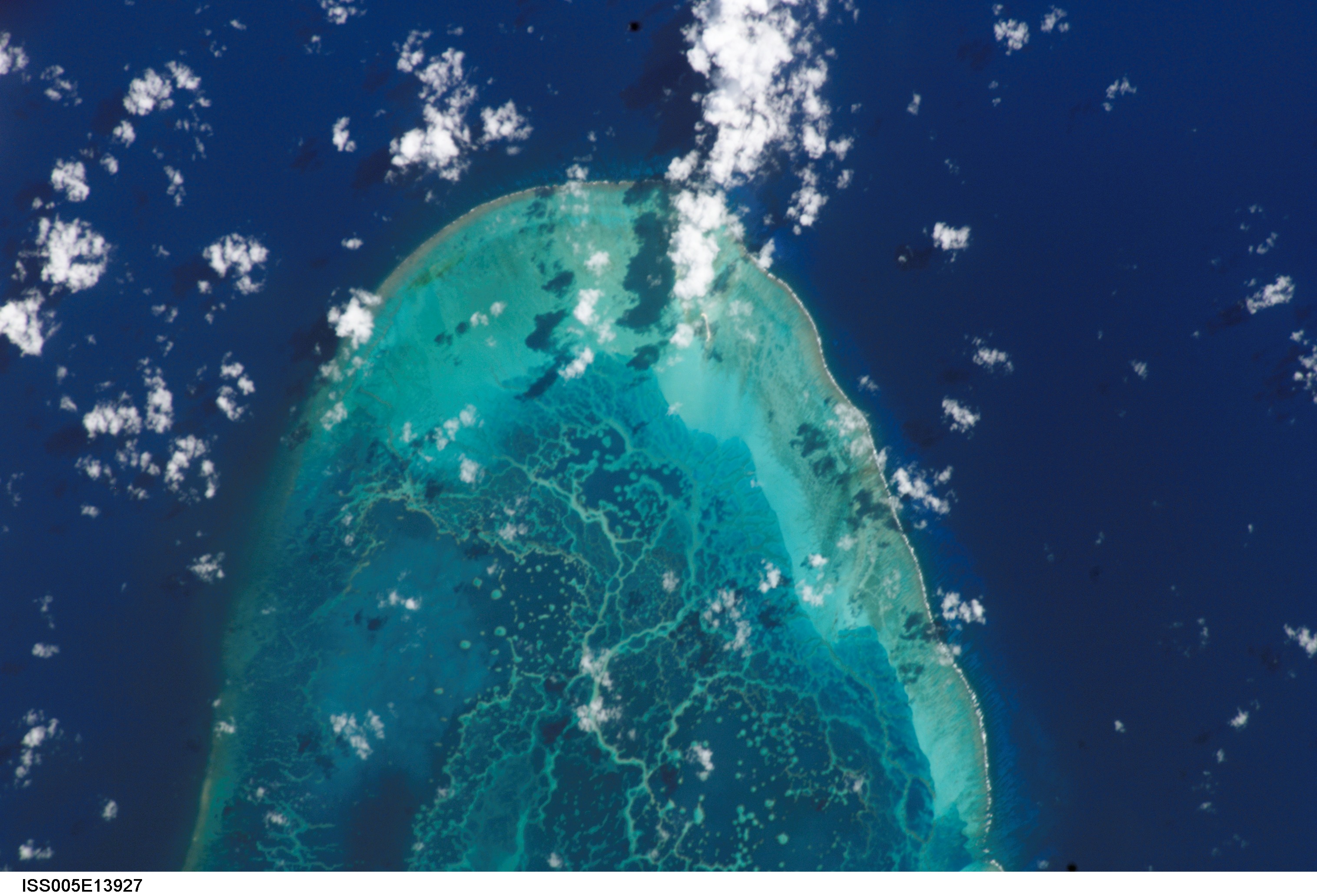
Country or Geographic Name: | USA-HAWAII |
Features: | PEARL AND HERMES REEF |
| Features Found Using Machine Learning: | |
Cloud Cover Percentage: | 10 (1-10)% |
Sun Elevation Angle: | 45° |
Sun Azimuth: | 113° |
Camera: | Kodak DCS760c Electronic Still Camera |
Focal Length: | 400mm |
Camera Tilt: | 28 degrees |
Format: | 3060E: 3060 x 2036 pixel CCD, RGBG array |
Film Exposure: | |
| Additional Information | |
| Width | Height | Annotated | Cropped | Purpose | Links |
|---|---|---|---|---|---|
| 3032 pixels | 2064 pixels | No | No | Download Image | |
| 2008 pixels | 3032 pixels | No | No | Reef RS | Download Image |
| 639 pixels | 435 pixels | No | No | Download Image |
Download Packaged File
Download a Google Earth KML for this Image
View photo footprint information
Download a GeoTIFF for this photo
Image Caption: none
