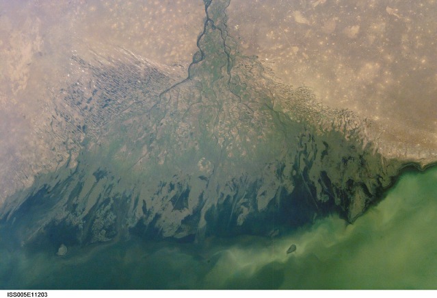
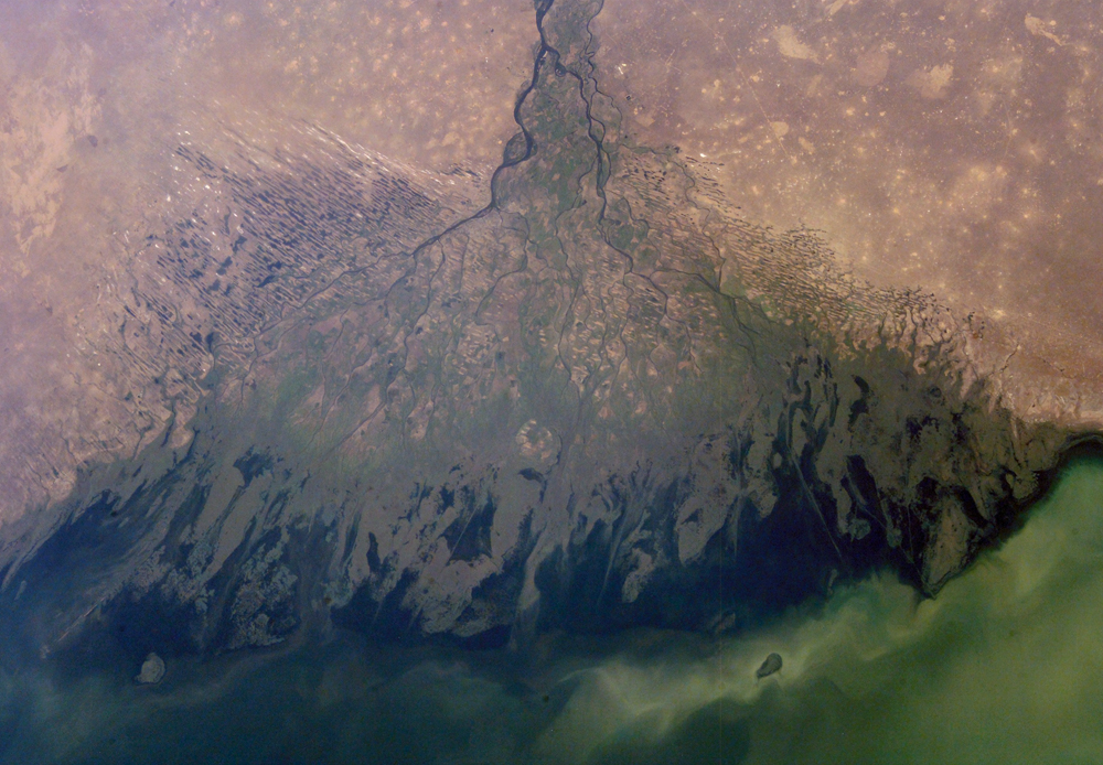
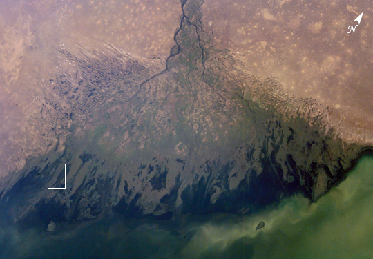
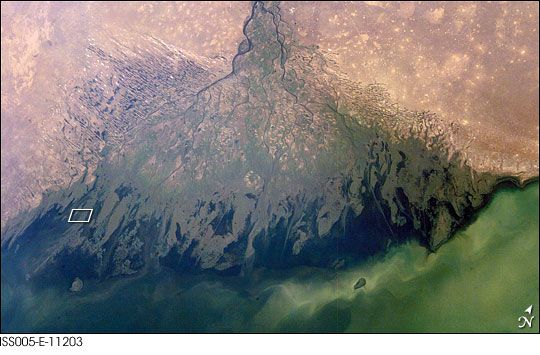
ISS005-E-11203
| NASA Photo ID | ISS005-E-11203 |
| Focal Length | 48mm |
| Date taken | 2002.08.25 |
| Time taken | 06:23:51 GMT |
Resolutions offered for this image:
1000 x 694 pixels 540 x 375 pixels 540 x 355 pixels 3032 x 2064 pixels 639 x 435 pixels
1000 x 694 pixels 540 x 375 pixels 540 x 355 pixels 3032 x 2064 pixels 639 x 435 pixels

Cloud masks available for this image:
Spacecraft nadir point: 46.2° N, 52.2° E
Photo center point: 46.0° N, 48.5° E
Photo center point by machine learning:
Photo center point: 46.0° N, 48.5° E
Photo center point by machine learning:
Nadir to Photo Center: West
Spacecraft Altitude: 211 nautical miles (391km)
Country or Geographic Name: | RUSSIAN FEDERATION |
Features: | VOLGA DELTA |
| Features Found Using Machine Learning: | |
Cloud Cover Percentage: | 10 (1-10)% |
Sun Elevation Angle: | 45° |
Sun Azimuth: | 132° |
Camera: | Kodak DCS760c Electronic Still Camera |
Focal Length: | 48mm |
Camera Tilt: | 47 degrees |
Format: | 3060E: 3060 x 2036 pixel CCD, RGBG array |
Film Exposure: | |
| Additional Information | |
| Width | Height | Annotated | Cropped | Purpose | Links |
|---|---|---|---|---|---|
| 1000 pixels | 694 pixels | No | Yes | Earth From Space collection | Download Image |
| 540 pixels | 375 pixels | Yes | Yes | Earth From Space collection | Download Image |
| 540 pixels | 355 pixels | Yes | Yes | NASA's Earth Observatory web site | Download Image |
| 3032 pixels | 2064 pixels | No | No | Download Image | |
| 639 pixels | 435 pixels | No | No | Download Image |
Download Packaged File
Download a Google Earth KML for this Image
View photo footprint information
Download a GeoTIFF for this photo
Image Caption: ISS005-E-11203 (25 Aug. 2002) --- The Volga Delta, Russia is featured in this image photographed by an Expedition Five crewmember on the International Space Station. The Volga River drains much of western Russia's industrial region and travels southward to empty into the Caspian Sea. According to scientists, over thousands of years, the river has built out a tremendous delta that forms the northwestern shoreline of the Caspian Sea. The Volga Delta is many things: the delta channels provide transportation access between the heartland of Russia and the oil-rich Caspian Sea. The Volga's extensive distributaries harbor habitat and rich fishing grounds for Russia's famous beluga sturgeon -- better known as the source of beluga caviar. The delta's wetlands, parts of which are designated as the Astrakhanskiy Biosphere Reserve, are important stopping points and breeding grounds for migrating water birds.
