ISS005-E-10097

| NASA Photo ID | ISS005-E-10097 |
| Focal Length | 800mm |
| Date taken | 2002.08.14 |
| Time taken | 05:46:47 GMT |
Resolutions offered for this image:
540 x 369 pixels 1000 x 684 pixels 2368 x 1620 pixels 3032 x 2064 pixels 3032 x 2008 pixels 639 x 435 pixels
540 x 369 pixels 1000 x 684 pixels 2368 x 1620 pixels 3032 x 2064 pixels 3032 x 2008 pixels 639 x 435 pixels


Cloud masks available for this image:
Spacecraft nadir point: 50.0° N, 177.4° W
Photo center point: 52.0° N, 177.0° W
Photo center point by machine learning:
Photo center point: 52.0° N, 177.0° W
Photo center point by machine learning:
Nadir to Photo Center: North
Spacecraft Altitude: 204 nautical miles (378km)
Country or Geographic Name: | USA-ALASKA |
Features: | KANAGA ISLAND, VOLCANO |
| Features Found Using Machine Learning: | |
Cloud Cover Percentage: | 10 (1-10)% |
Sun Elevation Angle: | 12° |
Sun Azimuth: | 278° |
Camera: | Kodak DCS760c Electronic Still Camera |
Focal Length: | 800mm |
Camera Tilt: | 31 degrees |
Format: | 3060E: 3060 x 2036 pixel CCD, RGBG array |
Film Exposure: | |
| Additional Information | |
| Width | Height | Annotated | Cropped | Purpose | Links |
|---|---|---|---|---|---|
| 540 pixels | 369 pixels | Yes | Yes | Earth From Space collection | Download Image |
| 1000 pixels | 684 pixels | No | Yes | NASA's Earth Observatory web site | Download Image |
| 2368 pixels | 1620 pixels | No | Yes | NASA's Earth Observatory web site | Download Image |
| 3032 pixels | 2064 pixels | No | No | Download Image | |
| 3032 pixels | 2008 pixels | No | No | Download Image | |
| 639 pixels | 435 pixels | No | No | Download Image |
Download Packaged File
Download a Google Earth KML for this Image
View photo footprint information
Download a GeoTIFF for this photo
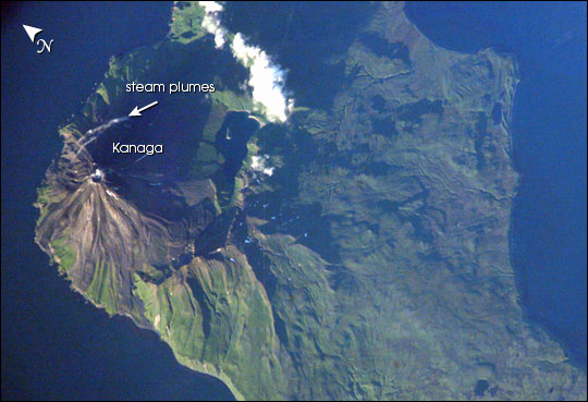
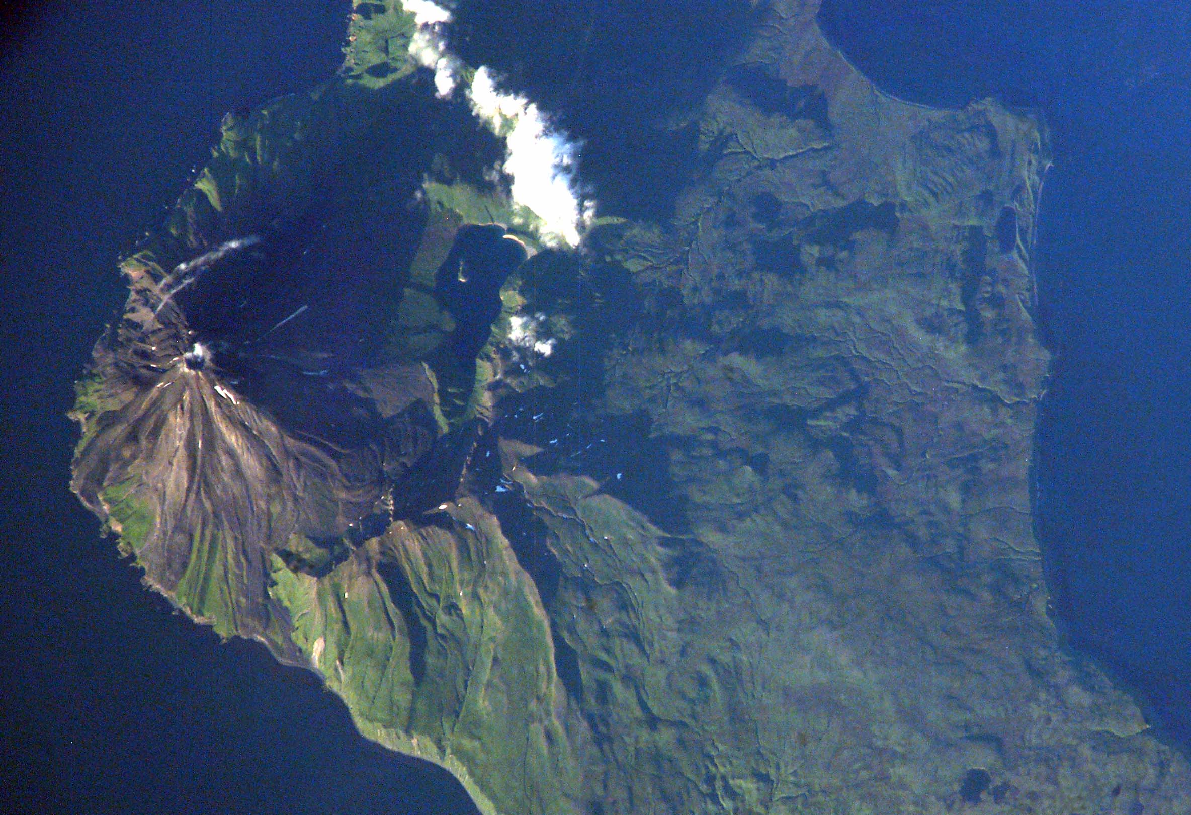
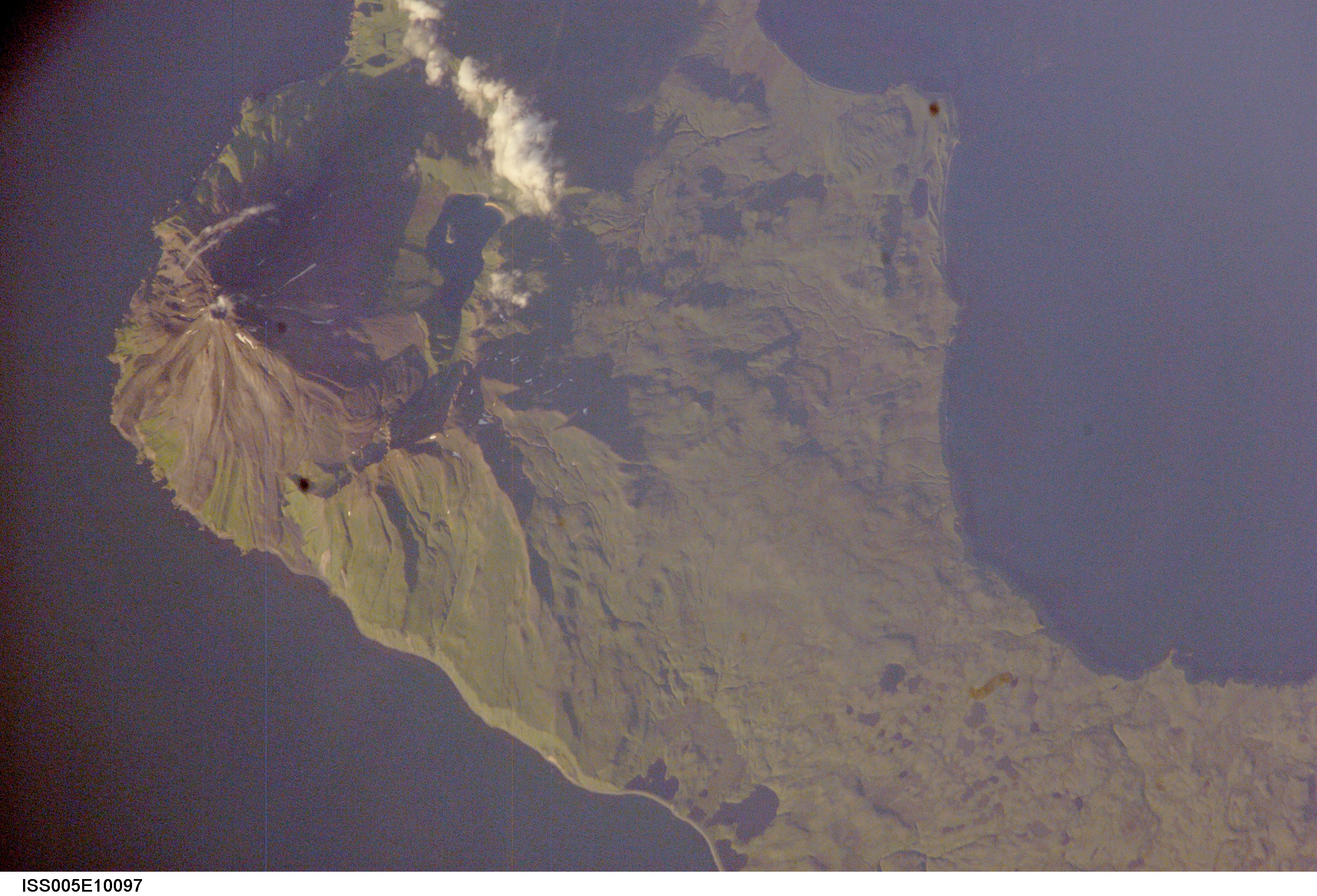
Image Caption: The symmetrical cone of Kanaga volcano stands out on the northern corner of Kanaga Island, located in the central part of Alaska's Aleutian archipelago. Kanaga last erupted in 1994 and is well known for its active fumaroles and hot springs (located, in this image, by fine steam plumes on the northeast flank of the volcano). A small lake to the southeast of the cone is situated on the floor of a larger more ancient volcanic caldera. The crew of the international space station acquired this image late in the day of August 13, 2002. Note how the late summer sun accentuates the terrain features like the volcanic flows that radiate down from the volcano's peak, and the steep cliffs along the western coastline.
