ISS004-E-8973

| NASA Photo ID | ISS004-E-8973 |
| Focal Length | 800mm |
| Date taken | 2002.03.20 |
| Time taken | 12:35:51 GMT |
Resolutions offered for this image:
540 x 1206 pixels 540 x 473 pixels 540 x 455 pixels 3032 x 2064 pixels 639 x 435 pixels
540 x 1206 pixels 540 x 473 pixels 540 x 455 pixels 3032 x 2064 pixels 639 x 435 pixels


Cloud masks available for this image:
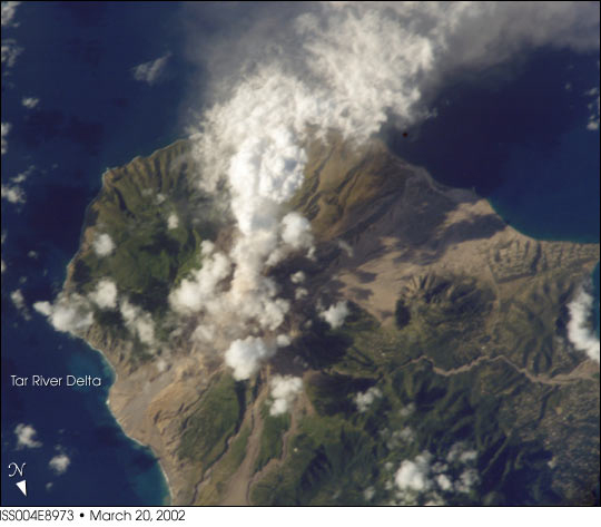
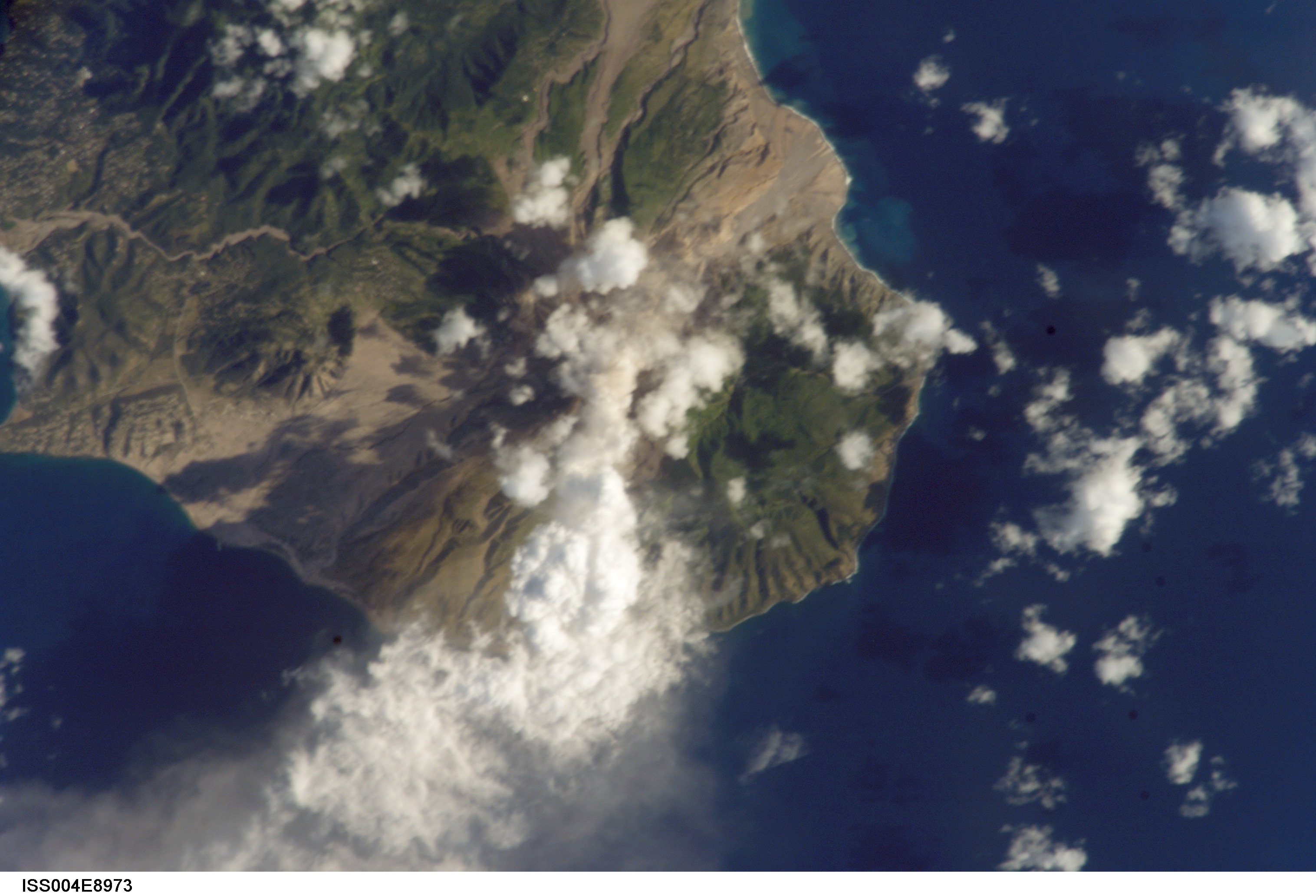
Spacecraft nadir point: 16.4° N, 61.8° W
Photo center point: 16.5° N, 62.0° W
Photo center point by machine learning:
Photo center point: 16.5° N, 62.0° W
Photo center point by machine learning:
Nadir to Photo Center: Northwest
Spacecraft Altitude: 213 nautical miles (394km)
Country or Geographic Name: | LESSER ANTILLES |
Features: | MONTSERRAT, VOLCANIC PLUME |
| Features Found Using Machine Learning: | |
Cloud Cover Percentage: | 25 (11-25)% |
Sun Elevation Angle: | 34° |
Sun Azimuth: | 101° |
Camera: | Kodak DCS760c Electronic Still Camera |
Focal Length: | 800mm |
Camera Tilt: | 4 degrees |
Format: | 3060E: 3060 x 2036 pixel CCD, RGBG array |
Film Exposure: | |
| Additional Information | |
| Width | Height | Annotated | Cropped | Purpose | Links |
|---|---|---|---|---|---|
| 540 pixels | 1206 pixels | Yes | Yes | NASA's Earth Observatory web site | Download Image |
| 540 pixels | 473 pixels | Yes | Yes | NASA's Earth Observatory web site | Download Image |
| 540 pixels | 455 pixels | Yes | Yes | NASA's Earth Observatory web site | Download Image |
| 3032 pixels | 2064 pixels | No | No | Download Image | |
| 639 pixels | 435 pixels | No | No | Download Image |
Download Packaged File
Download a Google Earth KML for this Image
View photo footprint information
Download a GeoTIFF for this photo
Image Caption: International Space Station crew members are regularly alerted to dynamic events on the Earth's surface. On request from scientists on the ground, the ISS crew observed and recorded activity from the summit of Soufriere Hills on March 20, 2002. These two images provide a context view of the island (bottom) and a detailed view of the summit plume (top). When the images were taken, the eastern side of the summit region experienced continued lava growth, and reports posted on the Smithsonian Institution's Weekly Volcanic Activity Report indicate that "large (50-70 m high), fast-growing, spines developed on the dome's summit. These spines periodically collapsed, producing pyroclastic flows down the volcano's east flank that sometimes reached the Tar River fan. Small ash clouds produced from these events reached roughly 1 km above the volcano and drifted westward over Plymouth and Richmond Hill. Ash predominately fell into the sea. Sulfur dioxide emission rates remained high. Theodolite measurements of the dome taken on March 20 yielded a dome height of 1,039 m."
