ISS004-E-6249

| NASA Photo ID | ISS004-E-6249 |
| Focal Length | 400mm |
| Date taken | 2002.01.16 |
| Time taken | 20:56:59 GMT |
Resolutions offered for this image:
1024 x 768 pixels 540 x 405 pixels 1748 x 1389 pixels 540 x 429 pixels 540 x 429 pixels 3032 x 2064 pixels 639 x 435 pixels 400 x 272 pixels
1024 x 768 pixels 540 x 405 pixels 1748 x 1389 pixels 540 x 429 pixels 540 x 429 pixels 3032 x 2064 pixels 639 x 435 pixels 400 x 272 pixels


Cloud masks available for this image:
Spacecraft nadir point: 1.4° N, 158.0° W
Photo center point: 2.0° N, 157.5° W
Photo center point by machine learning:
Photo center point: 2.0° N, 157.5° W
Photo center point by machine learning:
Nadir to Photo Center: Northeast
Spacecraft Altitude: 216 nautical miles (400km)
Country or Geographic Name: | KIRIBATI |
Features: | KIRITIMATI (CHRISTMAS ISLAND) |
| Features Found Using Machine Learning: | |
Cloud Cover Percentage: | 10 (1-10)% |
Sun Elevation Angle: | 56° |
Sun Azimuth: | 132° |
Camera: | Kodak DCS760c Electronic Still Camera |
Focal Length: | 400mm |
Camera Tilt: | 12 degrees |
Format: | 3060E: 3060 x 2036 pixel CCD, RGBG array |
Film Exposure: | |
| Additional Information | |
| Width | Height | Annotated | Cropped | Purpose | Links |
|---|---|---|---|---|---|
| 1024 pixels | 768 pixels | Photographic Highlights | Download Image | ||
| 540 pixels | 405 pixels | Photographic Highlights | Download Image | ||
| 1748 pixels | 1389 pixels | No | No | NASA's Earth Observatory web site | Download Image |
| 540 pixels | 429 pixels | Yes | Yes | NASA's Earth Observatory web site | Download Image |
| 540 pixels | 429 pixels | Yes | No | NASA's Earth Observatory web site | Download Image |
| 3032 pixels | 2064 pixels | No | No | Download Image | |
| 639 pixels | 435 pixels | No | No | Download Image | |
| 400 pixels | 272 pixels | No | No | Photographic Highlights | Download Image |
Download Packaged File
Download a Google Earth KML for this Image
View photo footprint information
Download a GeoTIFF for this photo
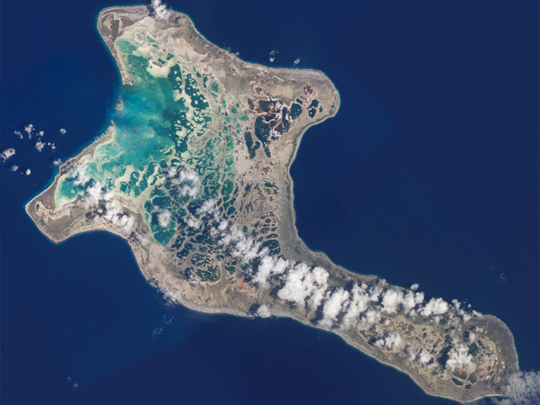
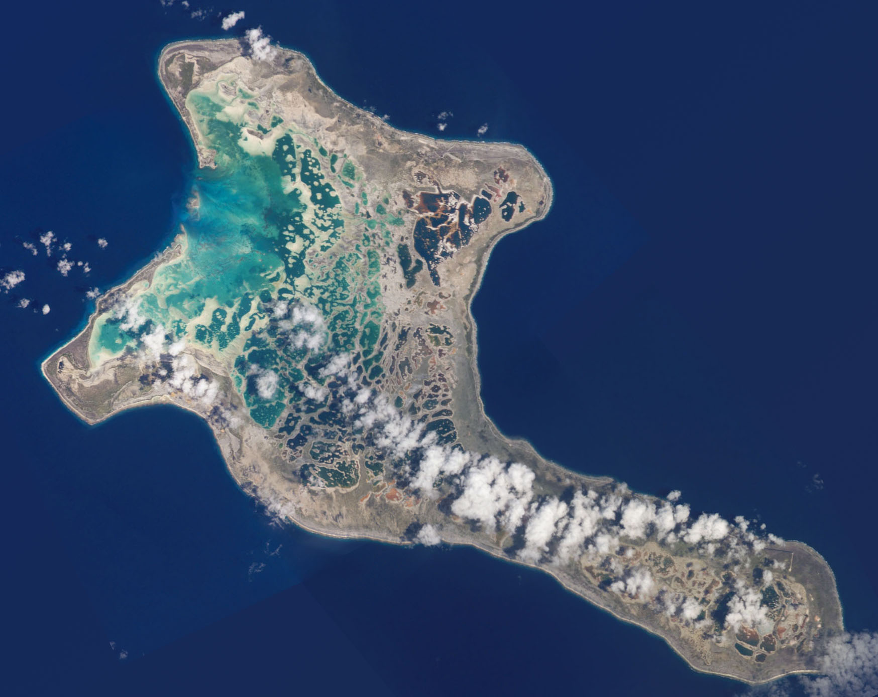
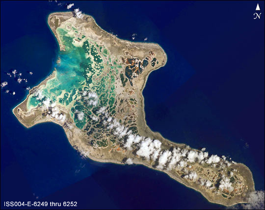
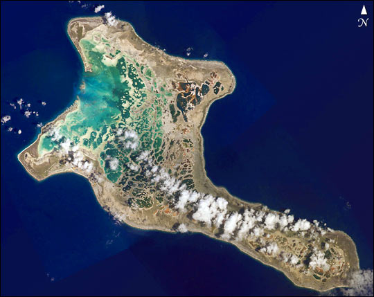
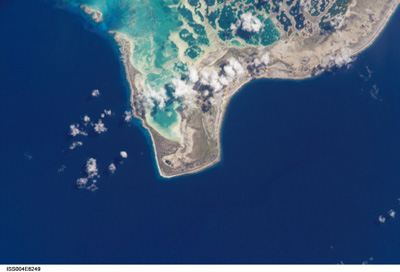
Image Caption: Pronounced "Ki-ris-mas," Kiritimati Island has a large infilled lagoon that
gives it the largest land area (125 square miles, 321 square km) of any atoll
in the world. Captain Cook named the atoll Christmas Island when he arrived on
Christmas Eve in 1777. Used for nuclear testing in the 1950s and 1960s, the
island is now valued for its marine and wildlife resources. It is particularly
important as a seabird nesting site--with an estimated 6 million birds using or
breeding on the island, including several million Sooty Terns. Rainfall on
Kiritimati is linked to El Nino patterns, with long droughts experienced
between the wetter El Nino years.
