ISS004-E-13304

| NASA Photo ID | ISS004-E-13304 |
| Focal Length | 800mm |
| Date taken | 2002.06.07 |
| Time taken | 23:18:06 GMT |
Resolutions offered for this image:
1000 x 681 pixels 638 x 421 pixels 3032 x 2064 pixels 639 x 435 pixels
1000 x 681 pixels 638 x 421 pixels 3032 x 2064 pixels 639 x 435 pixels

Cloud masks available for this image:
Spacecraft nadir point: 29.9° N, 119.6° W
Photo center point: 35.0° N, 119.0° W
Photo center point by machine learning:
Photo center point: 35.0° N, 119.0° W
Photo center point by machine learning:
Nadir to Photo Center: North
Spacecraft Altitude: 207 nautical miles (383km)
Country or Geographic Name: | USA-CALIFORNIA |
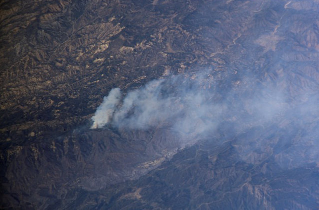
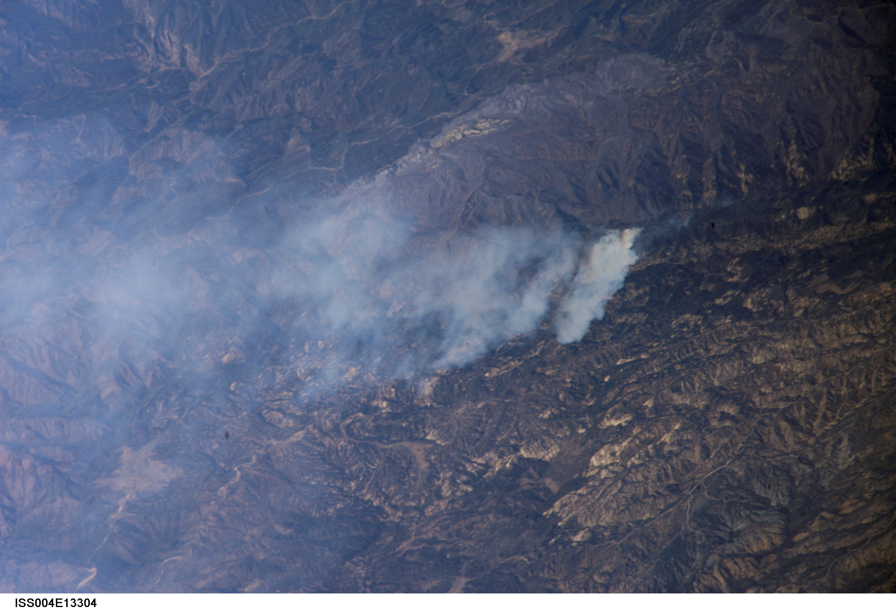
Features: | WOLF FIRE NORTH OF LOS ANGELES |
| Features Found Using Machine Learning: | |
Cloud Cover Percentage: | 10 (1-10)% |
Sun Elevation Angle: | 45° |
Sun Azimuth: | 274° |
Camera: | Kodak DCS760c Electronic Still Camera |
Focal Length: | 800mm |
Camera Tilt: | High Oblique |
Format: | 3060E: 3060 x 2036 pixel CCD, RGBG array |
Film Exposure: | |
| Additional Information | |
| Width | Height | Annotated | Cropped | Purpose | Links |
|---|---|---|---|---|---|
| 1000 pixels | 681 pixels | No | No | NASA's Earth Observatory web site | Download Image |
| 638 pixels | 421 pixels | No | No | NASA's Earth Observatory web site | Download Image |
| 3032 pixels | 2064 pixels | No | No | Download Image | |
| 639 pixels | 435 pixels | No | No | Download Image |
Download Packaged File
Download a Google Earth KML for this Image
View photo footprint information
Download a GeoTIFF for this photo
Image Caption: Using a handheld digital camera as part of the ongoing Crew Earth Observations research program aboard the International Space Station, station crew members took this photo June 7, 2002, of wildfires in the hills north and northwest of Los Angeles. Visible in the picture are details of a fire to the north of Los Angeles.
