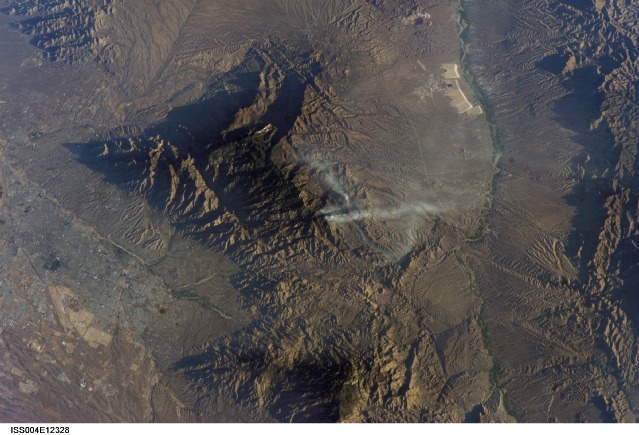
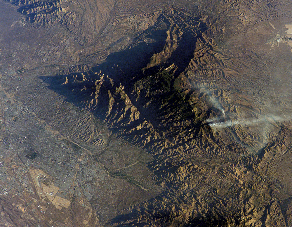
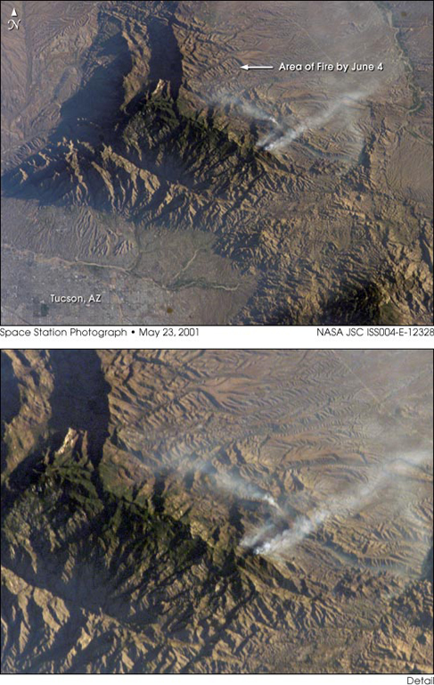
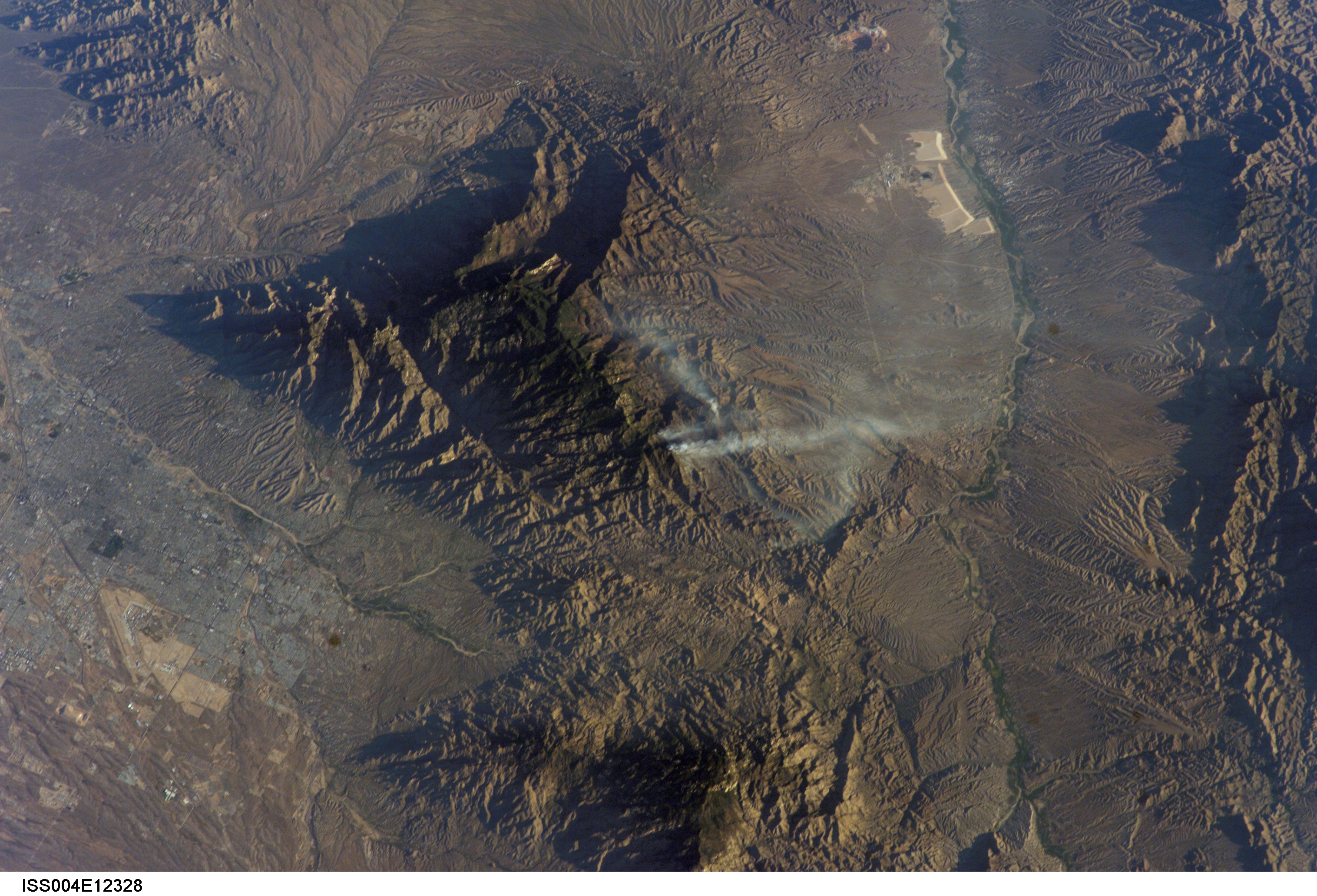
ISS004-E-12328
| NASA Photo ID | ISS004-E-12328 |
| Focal Length | 180mm |
| Date taken | 2002.05.23 |
| Time taken | 13:15:20 GMT |
Resolutions offered for this image:
540 x 851 pixels 1000 x 777 pixels 487 x 768 pixels 3032 x 2064 pixels 639 x 435 pixels
540 x 851 pixels 1000 x 777 pixels 487 x 768 pixels 3032 x 2064 pixels 639 x 435 pixels

Cloud masks available for this image:
Spacecraft nadir point: 29.4° N, 109.3° W
Photo center point: 32.5° N, 110.5° W
Photo center point by machine learning:
Photo center point: 32.5° N, 110.5° W
Photo center point by machine learning:
Nadir to Photo Center: North
Spacecraft Altitude: 206 nautical miles (382km)
Country or Geographic Name: | USA-ARIZONA |
Features: | BULLOCK FIRE NEAR TUCSON |
| Features Found Using Machine Learning: | |
Cloud Cover Percentage: | 10 (1-10)% |
Sun Elevation Angle: | 10° |
Sun Azimuth: | 72° |
Camera: | Kodak DCS760c Electronic Still Camera |
Focal Length: | 180mm |
Camera Tilt: | 44 degrees |
Format: | 3060E: 3060 x 2036 pixel CCD, RGBG array |
Film Exposure: | |
| Additional Information | |
| Width | Height | Annotated | Cropped | Purpose | Links |
|---|---|---|---|---|---|
| 540 pixels | 851 pixels | Yes | Yes | Earth From Space collection | Download Image |
| 1000 pixels | 777 pixels | No | Yes | NASA's Earth Observatory web site | Download Image |
| 487 pixels | 768 pixels | Yes | Yes | NASA's Earth Observatory web site | Download Image |
| 3032 pixels | 2064 pixels | No | No | Download Image | |
| 639 pixels | 435 pixels | No | No | Download Image |
Download Packaged File
Download a Google Earth KML for this Image
View photo footprint information
Download a GeoTIFF for this photo
Image Caption: This image of the Bullock Fire was taken by the crew of the International Space Station using a digital camera on May 23, 2002, two days after the fire began. By May 25, fighting the fire was listed as the top national priority. The mountainous region of the Coronado National Forest, northeast of Tucson, Arizona, is highlighted by the low sun angle when the photograph was taken. Around 30,560 acres were consumed by the blaze (which was 85% contained by June 3) but it is still considered dangerous.
