ISS004-E-10413

| NASA Photo ID | ISS004-E-10413 |
| Focal Length | 400mm |
| Date taken | 2002.04.24 |
| Time taken | 15:19:27 GMT |
Resolutions offered for this image:
2075 x 1500 pixels 1024 x 768 pixels 540 x 405 pixels 3032 x 2064 pixels 2008 x 3032 pixels 639 x 435 pixels
2075 x 1500 pixels 1024 x 768 pixels 540 x 405 pixels 3032 x 2064 pixels 2008 x 3032 pixels 639 x 435 pixels


Cloud masks available for this image:
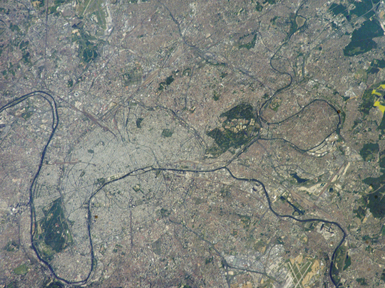
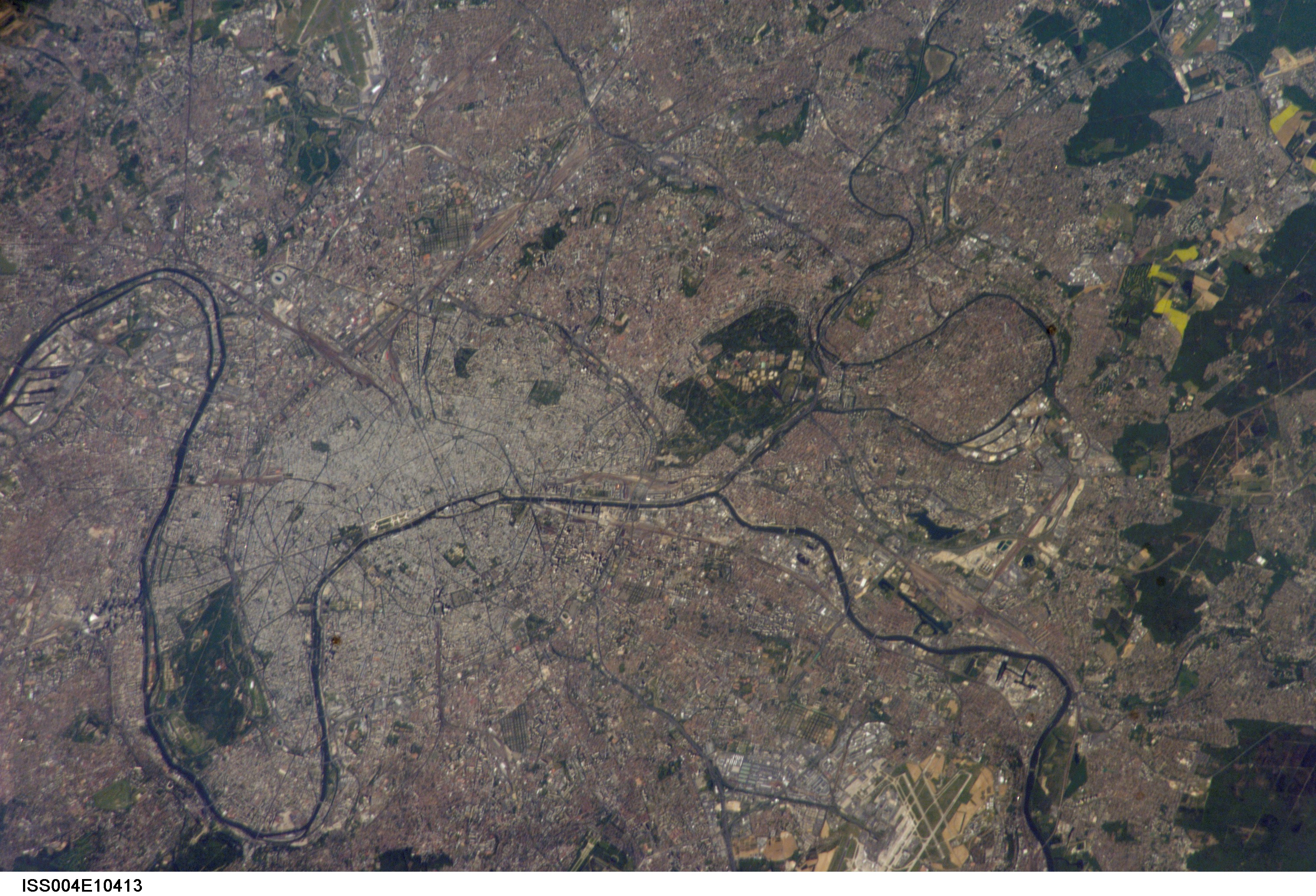
Spacecraft nadir point: 46.7° N, 3.0° E
Photo center point: 49.0° N, 2.5° E
Photo center point by machine learning:
Photo center point: 49.0° N, 2.5° E
Photo center point by machine learning:
Nadir to Photo Center: North
Spacecraft Altitude: 210 nautical miles (389km)
Country or Geographic Name: | FRANCE |
Features: | PARIS, SEINE RIVER |
| Features Found Using Machine Learning: | |
Cloud Cover Percentage: | 10 (1-10)% |
Sun Elevation Angle: | 34° |
Sun Azimuth: | 251° |
Camera: | Kodak DCS760c Electronic Still Camera |
Focal Length: | 400mm |
Camera Tilt: | 34 degrees |
Format: | 3060E: 3060 x 2036 pixel CCD, RGBG array |
Film Exposure: | |
| Additional Information | |
| Width | Height | Annotated | Cropped | Purpose | Links |
|---|---|---|---|---|---|
| 2075 pixels | 1500 pixels | Cities collection | Download Image | ||
| 1024 pixels | 768 pixels | Photographic Highlights | Download Image | ||
| 540 pixels | 405 pixels | Photographic Highlights | Download Image | ||
| 3032 pixels | 2064 pixels | No | No | Download Image | |
| 2008 pixels | 3032 pixels | No | No | Scientist Request | Download Image |
| 639 pixels | 435 pixels | No | No | Download Image |
Download Packaged File
Download a Google Earth KML for this Image
View photo footprint information
Download a GeoTIFF for this photo
Image Caption: none
