ISS003-E-5120
| NASA Photo ID | ISS003-E-5120 |
| Focal Length | 800mm |
| Date taken | 2001.08.15 |
| Time taken | 12:__:__ GMT |
Resolutions offered for this image:
1024 x 681 pixels 540 x 359 pixels 530 x 358 pixels 3060 x 2092 pixels 3060 x 2036 pixels 640 x 437 pixels 400 x 265 pixels
1024 x 681 pixels 540 x 359 pixels 530 x 358 pixels 3060 x 2092 pixels 3060 x 2036 pixels 640 x 437 pixels 400 x 265 pixels


Cloud masks available for this image:
Spacecraft nadir point:
Photo center point: 30.0° N, 31.0° E
Photo center point by machine learning:
Photo center point: 30.0° N, 31.0° E
Photo center point by machine learning:
Nadir to Photo Center:
Spacecraft Altitude: 205 nautical miles (380km)
Camera: | Kodak DCS460 Electronic Still Camera |
Focal Length: | 800mm |
Camera Tilt: | |
Format: | 3060E: 3060 x 2036 pixel CCD, RGBG array |
Film Exposure: | |
| Additional Information | |
| Width | Height | Annotated | Cropped | Purpose | Links |
|---|---|---|---|---|---|
| 1024 pixels | 681 pixels | Photographic Highlights | Download Image | ||
| 540 pixels | 359 pixels | Photographic Highlights | Download Image | ||
| 530 pixels | 358 pixels | Yes | Yes | Earth From Space collection | Download Image |
| 3060 pixels | 2092 pixels | No | No | Download Image | |
| 3060 pixels | 2036 pixels | No | No | Download Image | |
| 640 pixels | 437 pixels | No | No | Download Image | |
| 400 pixels | 265 pixels | No | No | Photographic Highlights | Download Image |
Download Packaged File
Download a Google Earth KML for this Image
View photo footprint information
Download a GeoTIFF for this photo
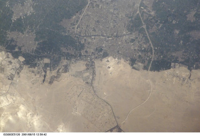
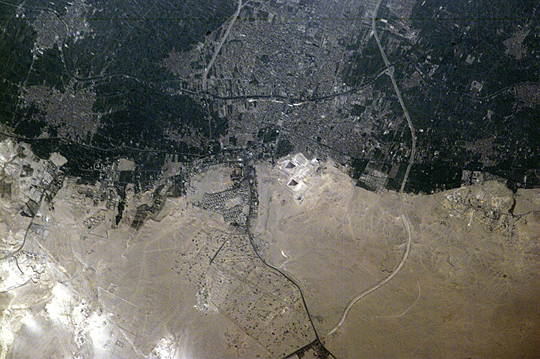
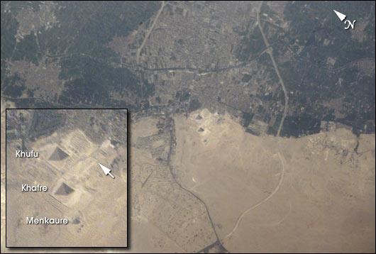
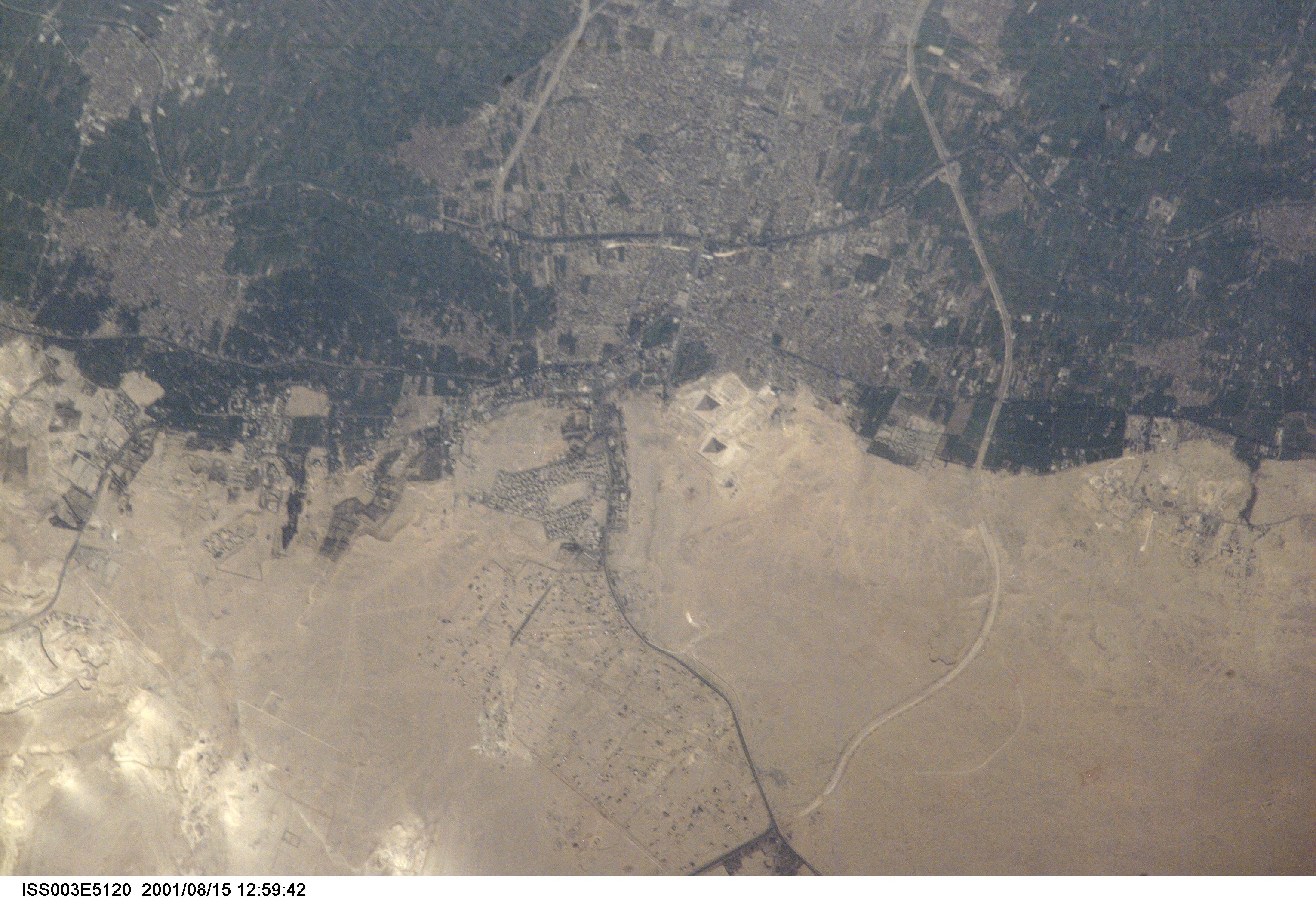
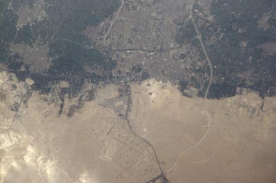
Image Caption: Space Station view of the Pyramids at Giza
One of the world's most famous archaeological sites has been photographed in amazing detail by the astronauts onboard Space Station Alpha. This image, taken 15 August, 2001, represents the greatest detail of the Giza plateau captured from a human-occupied spacecraft (approximate 7 m resolution). Afternoon sun casts shadows that help the eye make out the large pyramids of Khufu, Khafre and Menkaure. Sets of three smaller queens' pyramids can be seen to the east of the Pyramid of Khufu and south of the Pyramid of Menkaure. The light-colored causeway stretching from the Mortuary Temple at the Pyramid of Khafre to the Valley Temple near the Sphinx (arrow) can also be seen. Because it is not tall enough to cast a deep shadow, the Sphinx itself cannot readily be distinguished.
Although some commercial satellites, such as IKONOS, have imaged the Pyramids at Giza in greater detail (1 m resolution), this image highlights the potential of the International Space Station as a remote sensing platform. A commercial digital camera without space modifications was used to obtain this picture. Similarly, a variety of remote sensing instruments developed for use on aircraft can potentially be used from the Space Station.
