ISS002-E-6638
| NASA Photo ID | ISS002-E-6638 |
| Focal Length | 800mm |
| Date taken | 2001.05.08 |
| Time taken | 11:20:44 GMT |
Resolutions offered for this image:
1024 x 681 pixels 540 x 359 pixels 400 x 554 pixels 3057 x 2033 pixels 540 x 748 pixels 3060 x 2092 pixels 640 x 437 pixels
1024 x 681 pixels 540 x 359 pixels 400 x 554 pixels 3057 x 2033 pixels 540 x 748 pixels 3060 x 2092 pixels 640 x 437 pixels


Cloud masks available for this image:
Spacecraft nadir point: 50.5° N, 0.7° W
Photo center point: 51.5° N, 0.0° E
Photo center point by machine learning:
Photo center point: 51.5° N, 0.0° E
Photo center point by machine learning:
Nadir to Photo Center: Northeast
Spacecraft Altitude: 205 nautical miles (380km)
Country or Geographic Name: | UK-ENGLAND |
Features: | GREENWICH, THAMES RIVER |
| Features Found Using Machine Learning: | LONDON |
Cloud Cover Percentage: | 10 (1-10)% |
Sun Elevation Angle: | 56° |
Sun Azimuth: | 163° |
Camera: | Kodak DCS460 Electronic Still Camera |
Focal Length: | 800mm |
Camera Tilt: | 20 degrees |
Format: | 3060E: 3060 x 2036 pixel CCD, RGBG array |
Film Exposure: | |
| Additional Information | |
| Width | Height | Annotated | Cropped | Purpose | Links |
|---|---|---|---|---|---|
| 1024 pixels | 681 pixels | Photographic Highlights | Download Image | ||
| 540 pixels | 359 pixels | Photographic Highlights | Download Image | ||
| 400 pixels | 554 pixels | Yes | Yes | Photographic Highlights | Download Image |
| 3057 pixels | 2033 pixels | No | No | Earth From Space collection | Download Image |
| 540 pixels | 748 pixels | Yes | Yes | Earth From Space collection | Download Image |
| 3060 pixels | 2092 pixels | No | No | Download Image | |
| 640 pixels | 437 pixels | No | No | Download Image |
Download Packaged File
Download a Google Earth KML for this Image
View photo footprint information
Download a GeoTIFF for this photo
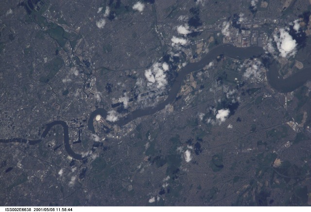
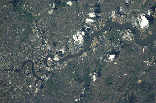
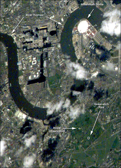
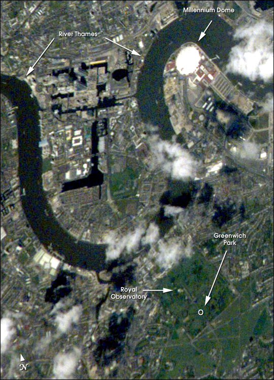
Image Caption: Greenwich is situated on the south shore of a sharp bend in the River Thames, just southeast of the City of London and is part of Greater London. Here is located the world famous Royal Observatory where the Prime Meridian, dividing East and West Longitude, was defined by international agreement in 1884. In this detailed portion of a larger area photographed by the crew of the International Space Station on May 8, 2000, the location of the Observatory itself is roughly the small, light area in the northern, wooded part of Greenwich Park. The River Thames with its port facilities and industrial sites winds its way, left to right, across the scene. The large, white, circular structure is the Millennium Dome. Over 1 km in diameter and 50 m high, it was built as an exhibition center to commemorate the new millennium, which chronologically began at the Prime Meridian.
