ISS002-E-6176
| NASA Photo ID | ISS002-E-6176 |
| Focal Length | 800mm |
| Date taken | 2001.05.07 |
| Time taken | 10:50:59 GMT |
Resolutions offered for this image:
540 x 359 pixels 3060 x 2092 pixels 640 x 437 pixels 400 x 266 pixels
540 x 359 pixels 3060 x 2092 pixels 640 x 437 pixels 400 x 266 pixels

Cloud masks available for this image:
Spacecraft nadir point: 38.3° N, 47.4° E
Photo center point: 40.5° N, 50.0° E
Photo center point by machine learning:
Photo center point: 40.5° N, 50.0° E
Photo center point by machine learning:
Nadir to Photo Center: Northeast
Spacecraft Altitude: 210 nautical miles (389km)
Camera: | Kodak DCS460 Electronic Still Camera |
Focal Length: | 800mm |
Camera Tilt: | 44 degrees |
Format: | 3060E: 3060 x 2036 pixel CCD, RGBG array |
Film Exposure: | |
| Additional Information | |
| Width | Height | Annotated | Cropped | Purpose | Links |
|---|---|---|---|---|---|
| 540 pixels | 359 pixels | Yes | Yes | Earth From Space collection | Download Image |
| 3060 pixels | 2092 pixels | No | No | Download Image | |
| 640 pixels | 437 pixels | No | No | Download Image | |
| 400 pixels | 266 pixels | Yes | No | Photographic Highlights | Download Image |
Download Packaged File
Download a Google Earth KML for this Image
View photo footprint information
Download a GeoTIFF for this photo
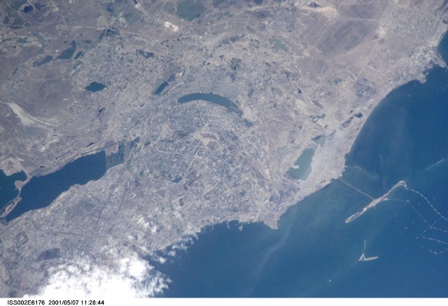
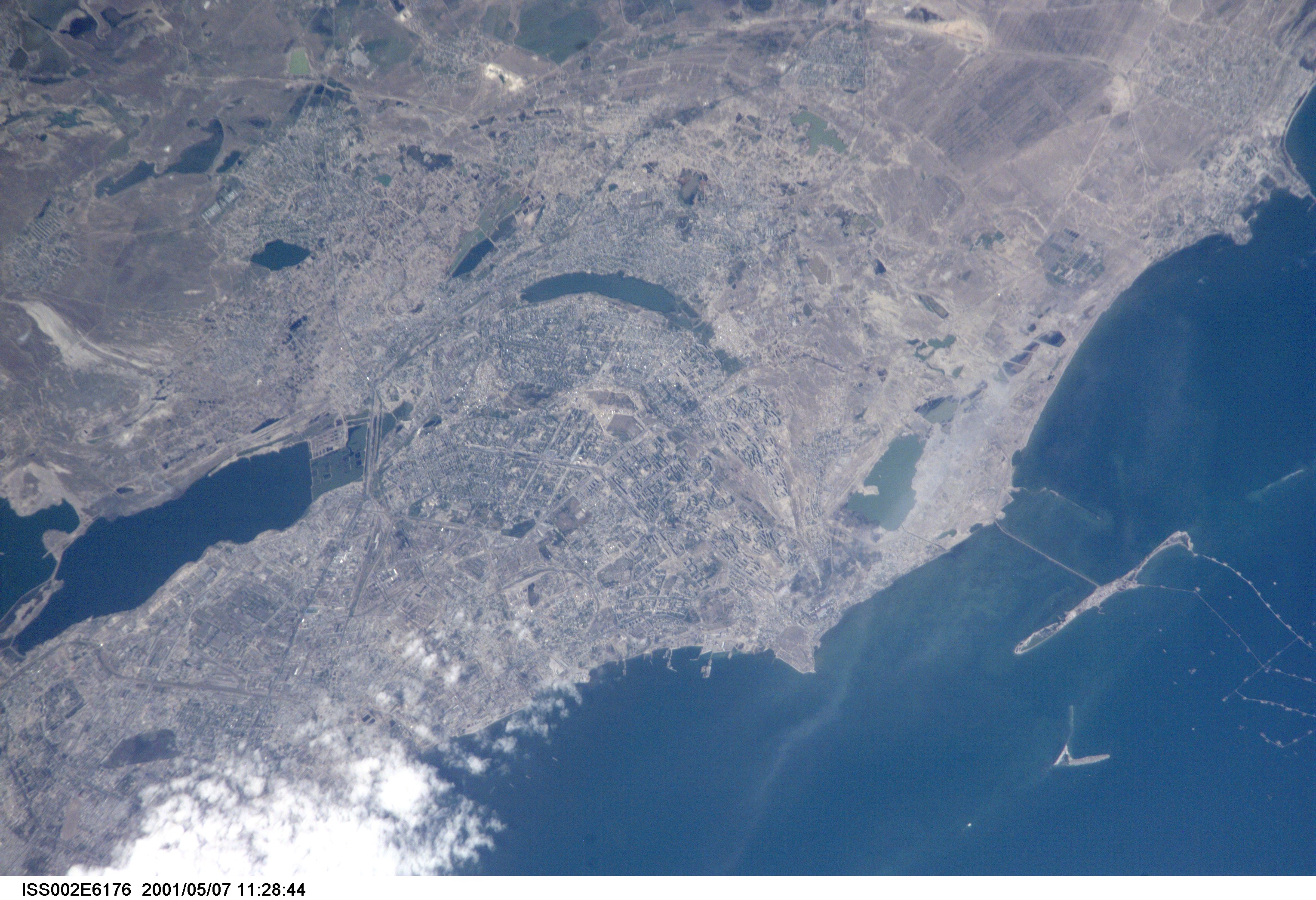
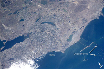
Image Caption: Baku is Azerbaijan's major city, and the oil capital of the Caspian region. This detailed view taken by the Expedition 2 crew on the International Space Station shows details of the city, including the extensive port facilities, and part of the large web of offshore oil platforms in the Caspian Sea. The oil platforms off Baku were built in the 1950s and 1960s, and were the first offshore oil-drilling efforts in the world. A larger offshore complex (not pictured here) called the Oily Rocks included multistory dormitories, stores, and other infrastructures to support the thousands of workers employed by the oil industry. Today, multinational oil exploration, sea-level rise (the Caspian sea has risen more than 2 meters in the past 20 years), offshore platform maintenance, and environmental degradation are all hot topics in Baku.
