ISS002-E-5661

| NASA Photo ID | ISS002-E-5661 |
| Focal Length | 800mm |
| Date taken | 2001.04.16 |
| Time taken | 22:29:30 GMT |
Cloud masks available for this image:
Spacecraft nadir point: 31.3° N, 116.5° W
Photo center point: 33.0° N, 117.0° W
Photo center point by machine learning:
Photo center point: 33.0° N, 117.0° W
Photo center point by machine learning:
Nadir to Photo Center: North
Spacecraft Altitude: 208 nautical miles (385km)
Camera: | Kodak DCS460 Electronic Still Camera |
Focal Length: | 800mm |
Camera Tilt: | 27 degrees |
Format: | 3060E: 3060 x 2036 pixel CCD, RGBG array |
Film Exposure: | |
| Additional Information | |
| Width | Height | Annotated | Cropped | Purpose | Links |
|---|---|---|---|---|---|
| 2092 pixels | 3060 pixels | No | No | Download Image | |
| 437 pixels | 640 pixels | No | No | Download Image |
Download Packaged File
Download a Google Earth KML for this Image
View photo footprint information
Download a GeoTIFF for this photo
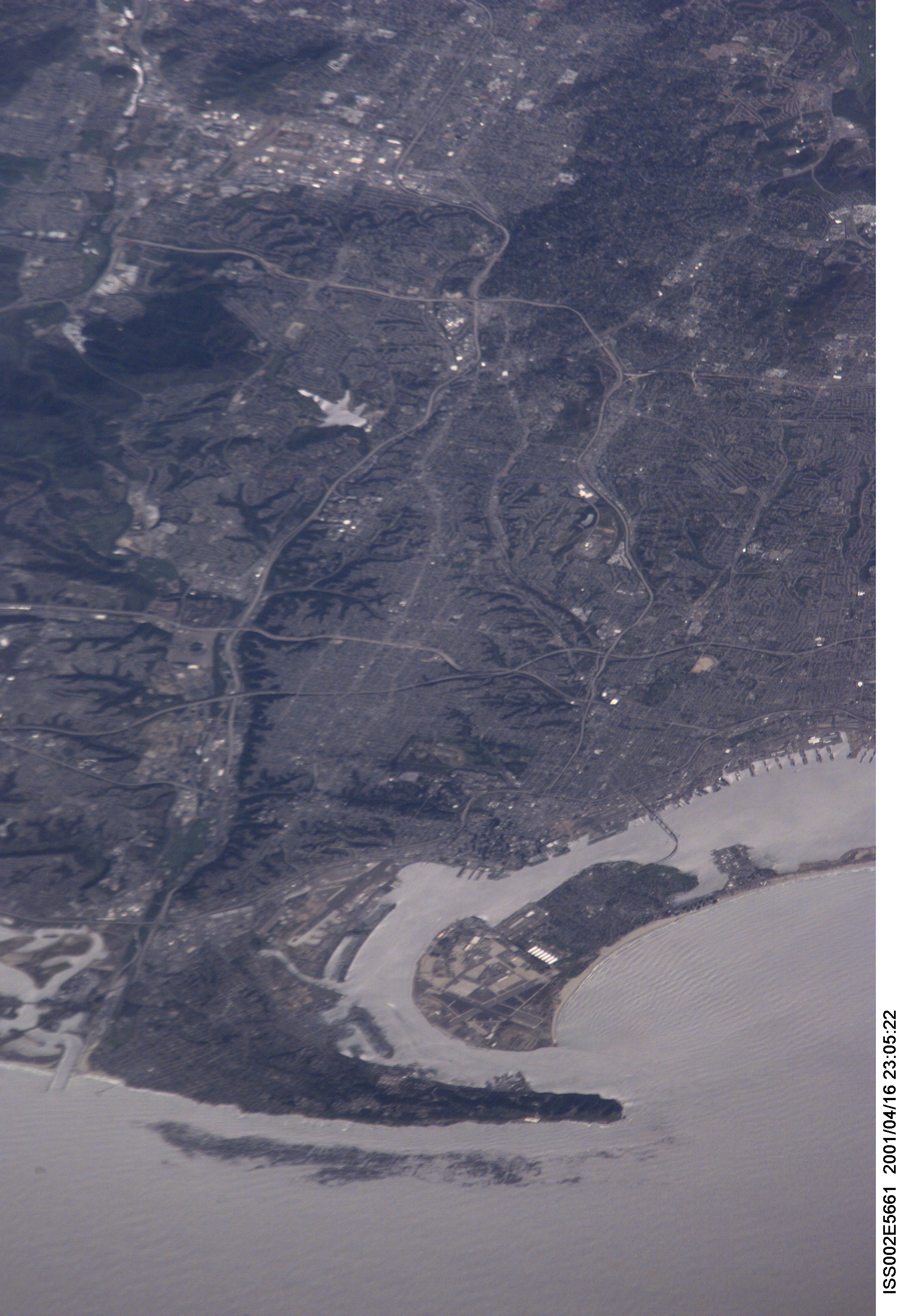
Image Caption: ISS002-E-5661 (16 April 2001) --- As the International Space Station (ISS) recently passed over the Pacific Ocean, one of the Expedition Two crew members, using an 800mm lens on a digital still camera, photographed this high oblique image of the coastal metropolitan area of San Diego, California. The angle of the view allows one to see quite a distance inland.
