ISS002-E-5654
| NASA Photo ID | ISS002-E-5654 |
| Focal Length | 800mm |
| Date taken | 2001.04.16 |
| Time taken | 16:04:30 GMT |
Resolutions offered for this image:
1024 x 700 pixels 540 x 369 pixels 3060 x 2027 pixels 540 x 358 pixels 3060 x 2027 pixels 1024 x 768 pixels 540 x 405 pixels 2092 x 3060 pixels 400 x 265 pixels 437 x 640 pixels
1024 x 700 pixels 540 x 369 pixels 3060 x 2027 pixels 540 x 358 pixels 3060 x 2027 pixels 1024 x 768 pixels 540 x 405 pixels 2092 x 3060 pixels 400 x 265 pixels 437 x 640 pixels


Cloud masks available for this image:
Spacecraft nadir point: 17.4° S, 61.5° W
Photo center point: 17.5° S, 60.5° W
Photo center point by machine learning:
Photo center point: 17.5° S, 60.5° W
Photo center point by machine learning:
Nadir to Photo Center: East
Spacecraft Altitude: 206 nautical miles (382km)
Country or Geographic Name: | BOLIVIA |
Features: | TIERRAS BAJAS DEFORESTATION |
| Features Found Using Machine Learning: | |
Cloud Cover Percentage: | 10 (1-10)% |
Sun Elevation Angle: | 62° |
Sun Azimuth: | 1° |
Camera: | Kodak DCS460 Electronic Still Camera |
Focal Length: | 800mm |
Camera Tilt: | 16 degrees |
Format: | 3060E: 3060 x 2036 pixel CCD, RGBG array |
Film Exposure: | |
| Additional Information | |
| Width | Height | Annotated | Cropped | Purpose | Links |
|---|---|---|---|---|---|
| 1024 pixels | 700 pixels | Photographic Highlights | Download Image | ||
| 540 pixels | 369 pixels | Photographic Highlights | Download Image | ||
| 3060 pixels | 2027 pixels | No | No | Earth From Space collection | Download Image |
| 540 pixels | 358 pixels | Yes | No | Earth From Space collection | Download Image |
| 3060 pixels | 2027 pixels | No | No | NASA's Earth Observatory web site | Download Image |
| 1024 pixels | 768 pixels | Yes | Presentation | Download Image | |
| 540 pixels | 405 pixels | Scientist Request | Download Image | ||
| 2092 pixels | 3060 pixels | No | No | Download Image | |
| 400 pixels | 265 pixels | No | No | Photographic Highlights | Download Image |
| 437 pixels | 640 pixels | No | No | Download Image |
Download Packaged File
Download a Google Earth KML for this Image
View photo footprint information
Download a GeoTIFF for this photo
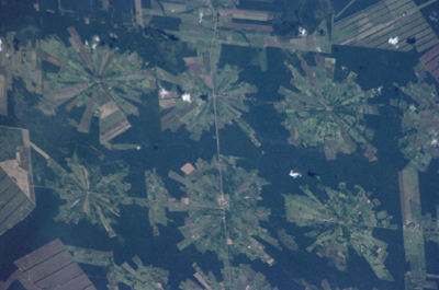
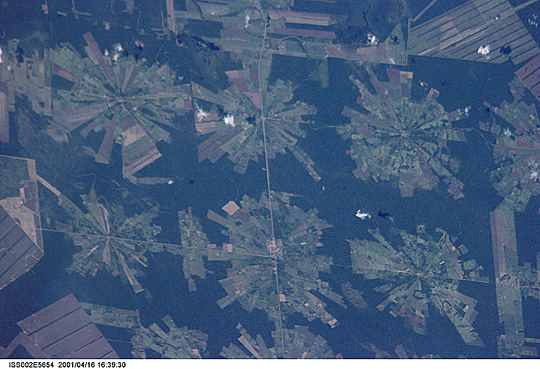
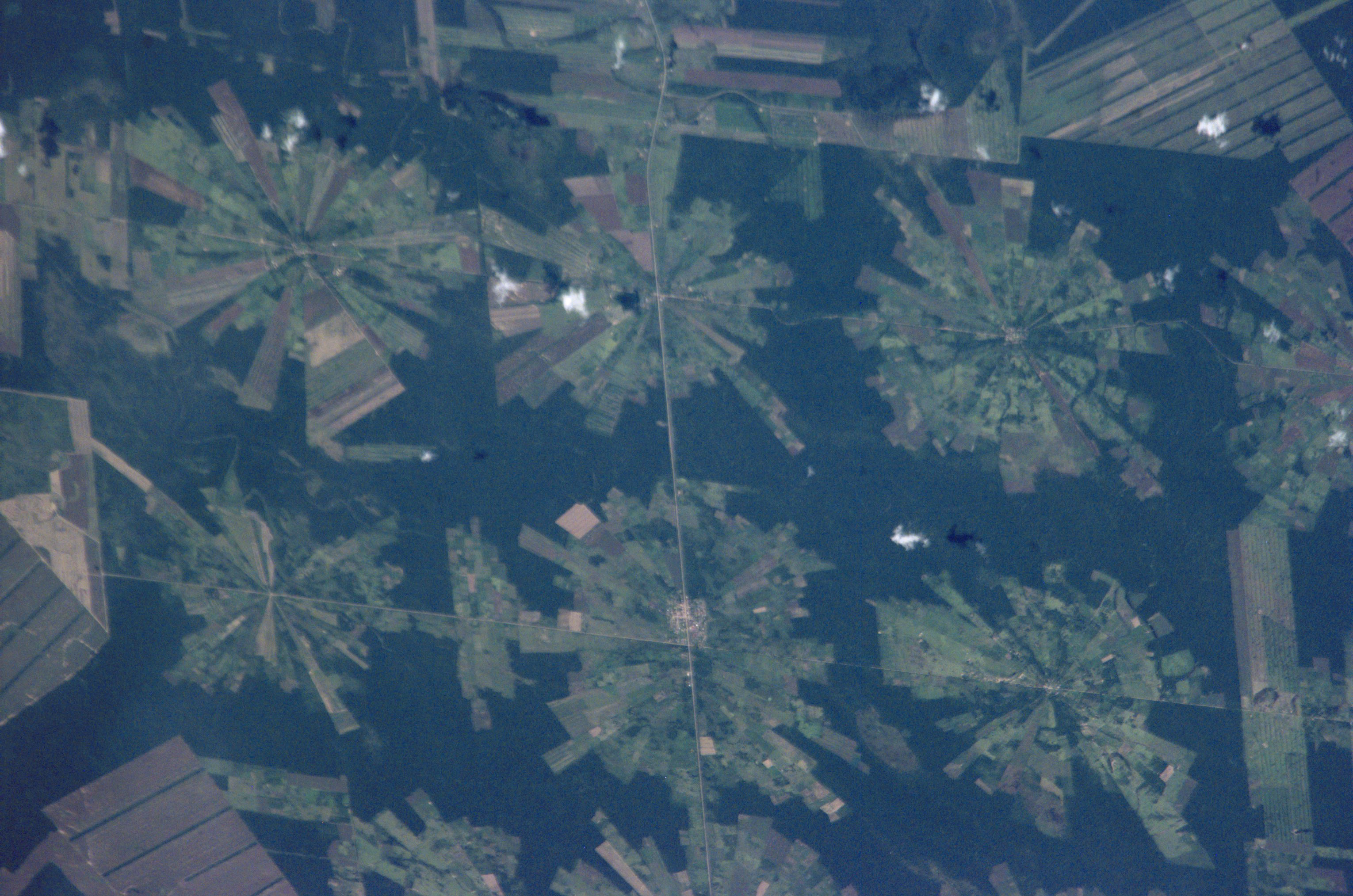
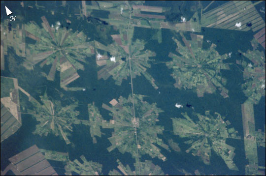
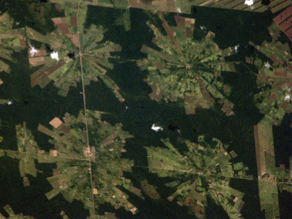
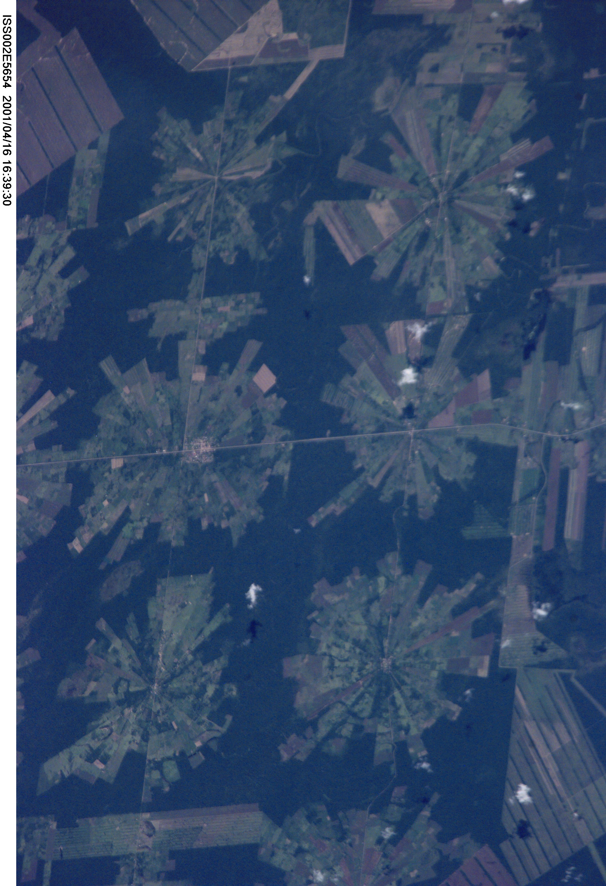
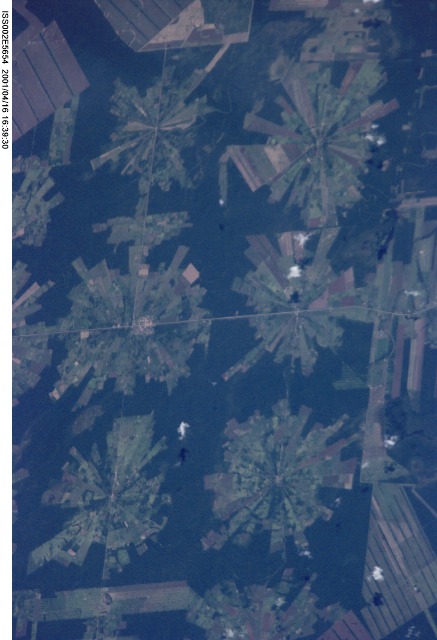
Image Caption: Tierras Bajas Deforestation, Bolivia
This digital photograph of deforestation associated with the Tierras Bajas project in eastern Bolivia was taken by astronauts from the International Space Station on April 16, 2001. The spatial resolution of the original digital photograph is about 6 meters per pixel.
The area east of Santa Cruz was originally dry tropical forest. As part of the Tierras Bajas project, people have been resettled from the Altiplano to cultivate soybeans. Each agricultural "pin wheel" pattern is centered on a small community. The communities are then spaced evenly across the landscape at 5-km intervals. Roadways can be seen connecting each town center.
