ISS002-E-5627
| NASA Photo ID | ISS002-E-5627 |
| Focal Length | 800mm |
| Date taken | 2001.04.23 |
| Time taken | 12:44:39 GMT |
Cloud masks available for this image:
Spacecraft nadir point: 37.5° N, 1.4° W
Photo center point: 36.0° N, 5.5° W
Photo center point by machine learning:
Photo center point: 36.0° N, 5.5° W
Photo center point by machine learning:
Nadir to Photo Center: West
Spacecraft Altitude: 205 nautical miles (380km)
Country or Geographic Name: | SPAIN |
Features: | GIBRALTAR TO MALAGA |
| Features Found Using Machine Learning: | |
Cloud Cover Percentage: | 10 (1-10)% |
Sun Elevation Angle: | 64° |
Sun Azimuth: | 203° |
Camera: | Kodak DCS460 Electronic Still Camera |
Focal Length: | 800mm |
Camera Tilt: | 52 degrees |
Format: | 3060E: 3060 x 2036 pixel CCD, RGBG array |
Film Exposure: | |
| Additional Information | |
| Width | Height | Annotated | Cropped | Purpose | Links |
|---|---|---|---|---|---|
| 3060 pixels | 2092 pixels | No | No | Download Image | |
| 640 pixels | 437 pixels | No | No | Download Image |
Download Packaged File
Download a Google Earth KML for this Image
View photo footprint information
Download a GeoTIFF for this photo
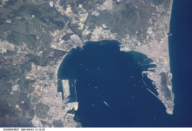
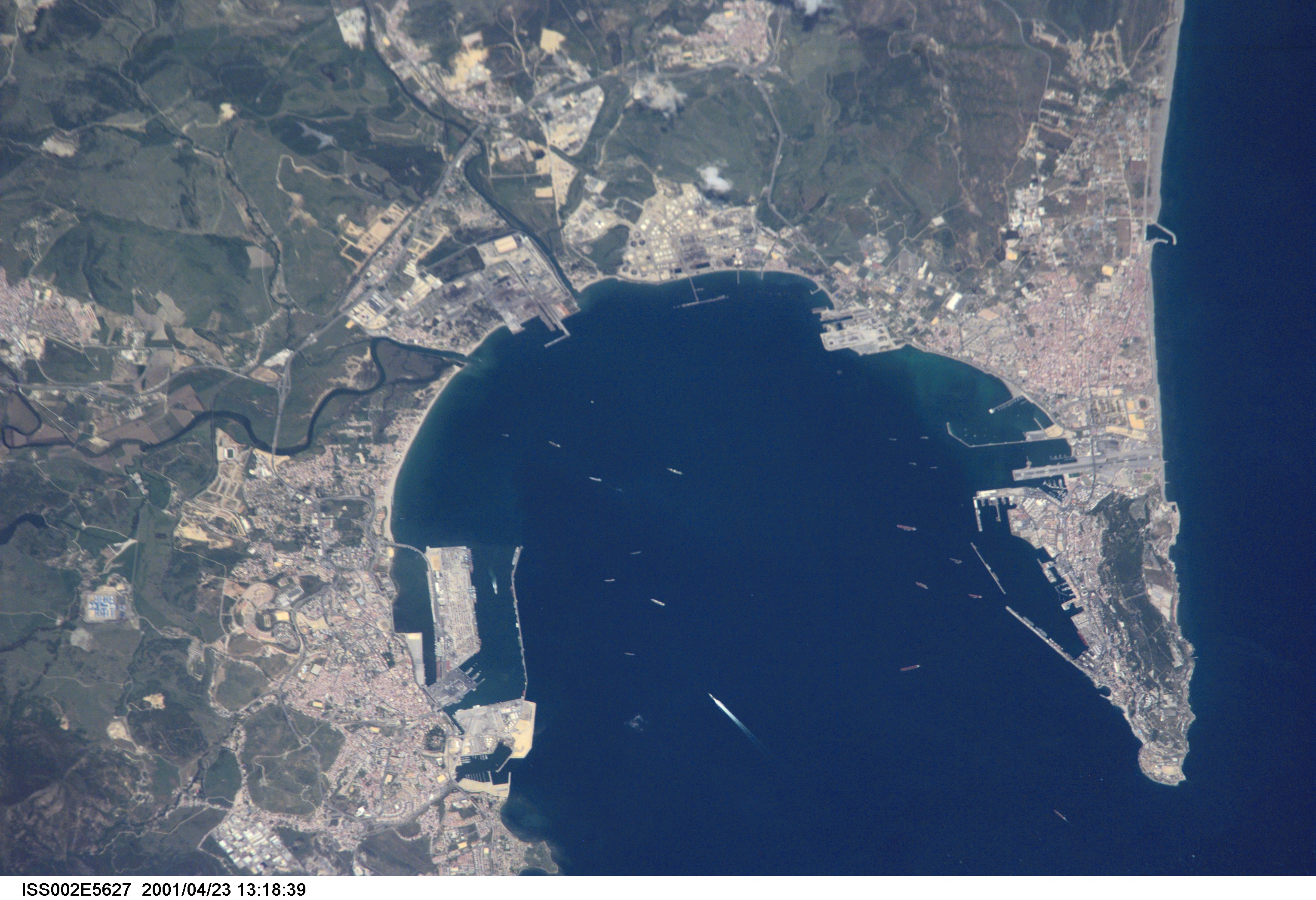
Image Caption: ISS002-E-5627 (23 April 2001) --- Algecira (left), the Bay of Gibraltar (Bahia de Algecira) and "The Rock of Gibraltar" (right) are featured in this detailed vertical view on the European side of the Strait of Gibraltar. Ship traffic in the Bay and Gibraltar Dock Yard can easily be seen. This digital still camera's image is part of a series of pictures centering on the Strait of Gibraltar area which was recorded by the ISS Expedition Two crew on April 23, 2001.
