ISS002-E-5457
| NASA Photo ID | ISS002-E-5457 |
| Focal Length | 105mm |
| Date taken | 2001.04.13 |
| Time taken | 16:04:12 GMT |
Cloud masks available for this image:
Spacecraft nadir point: 21.7° N, 10.8° W
Photo center point: 21.0° N, 11.5° W
Photo center point by machine learning:
Photo center point: 21.0° N, 11.5° W
Photo center point by machine learning:
Nadir to Photo Center: Southwest
Spacecraft Altitude: 209 nautical miles (387km)
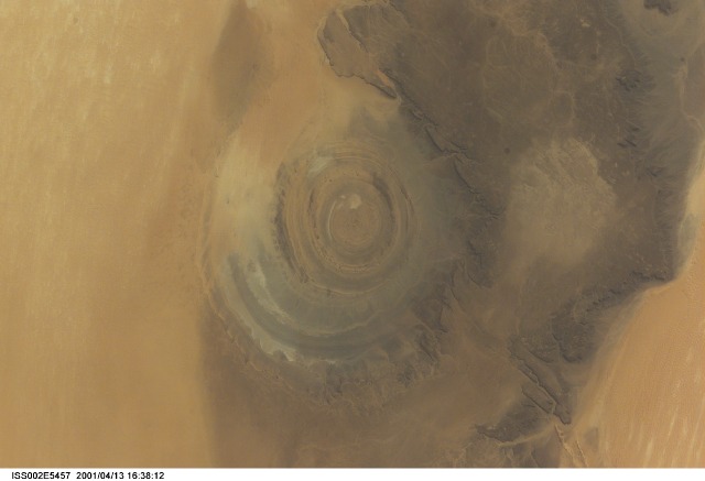
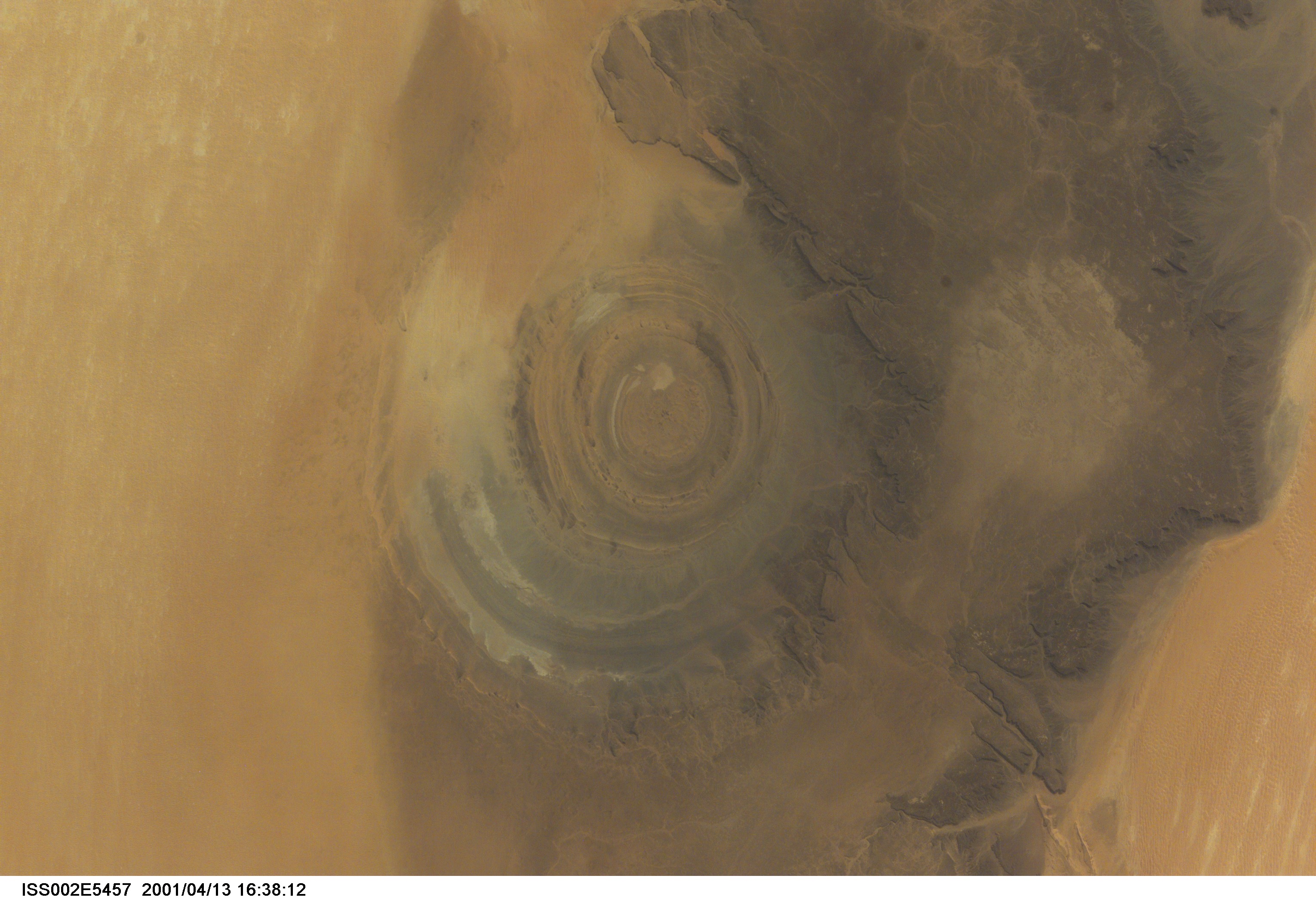
Country or Geographic Name: | MAURITANIA |
Features: | RICHAT STRUCTURE |
| Features Found Using Machine Learning: | |
Cloud Cover Percentage: | 0 (no clouds present) |
Sun Elevation Angle: | 40° |
Sun Azimuth: | 264° |
Camera: | Kodak DCS460 Electronic Still Camera |
Focal Length: | 105mm |
Camera Tilt: | 16 degrees |
Format: | 3060E: 3060 x 2036 pixel CCD, RGBG array |
Film Exposure: | |
| Additional Information | |
| Width | Height | Annotated | Cropped | Purpose | Links |
|---|---|---|---|---|---|
| 3060 pixels | 2092 pixels | No | No | Download Image | |
| 640 pixels | 437 pixels | No | No | Download Image |
Download Packaged File
Download a Google Earth KML for this Image
View photo footprint information
Download a GeoTIFF for this photo
Image Caption: ISS002-E-5457 (13 April 2001) --- The "bull's-eye" of the Richat Structure adds interest to the barren Gres de Chinguetti Plateau in central Mauritania in northwest Africa. It represents domally uplifted, layered (sedimentary) rocks that have been eroded by water and wind into the present shape. The 25-mile-wide structure is a 300-foot-deep landmark that has caught the eye of many an astronaut in Earth orbit. Image number ISS002-E-5693 shows the same feature six days later. The image was recorded with a digital still camera.
