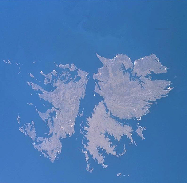
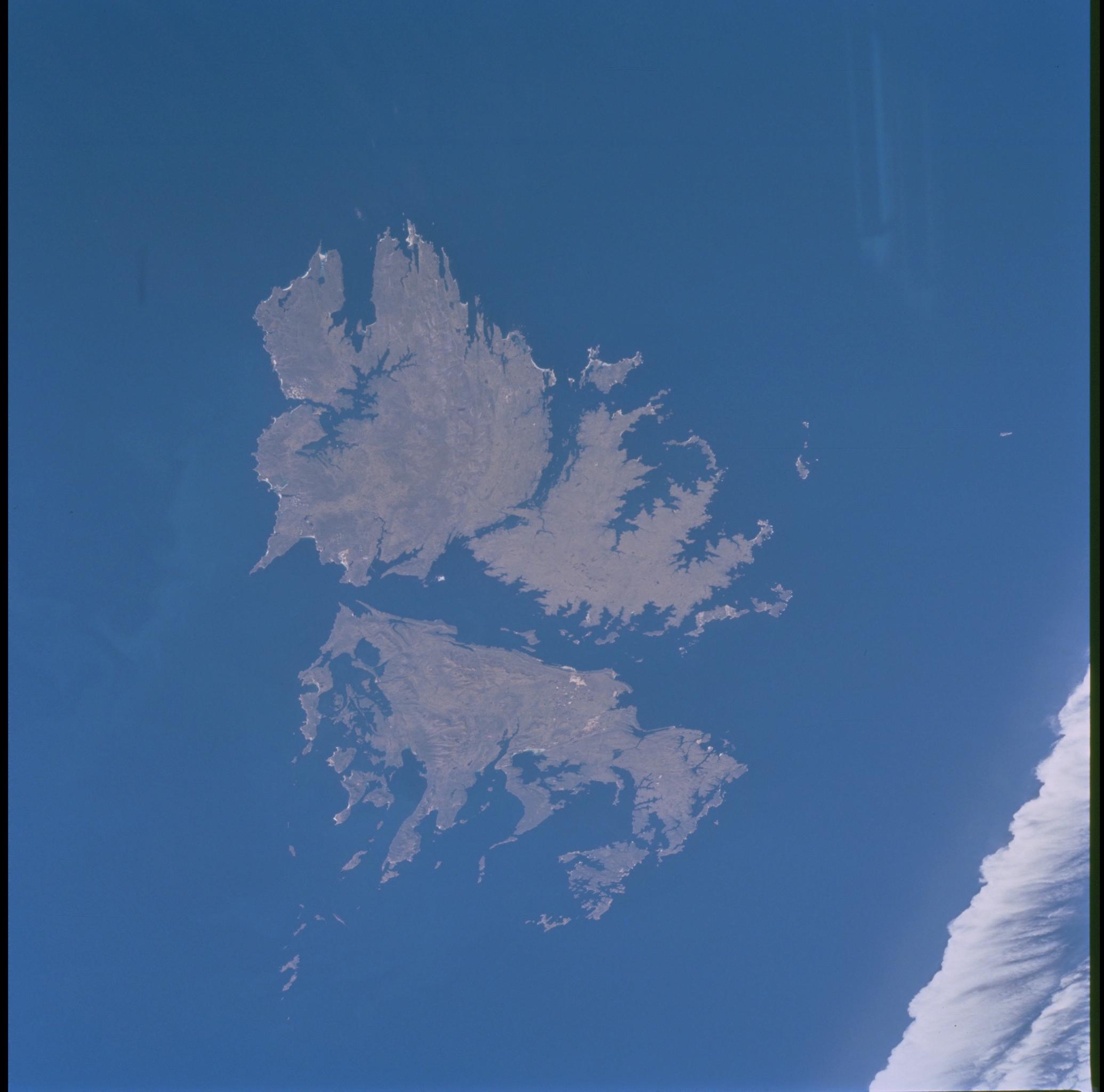
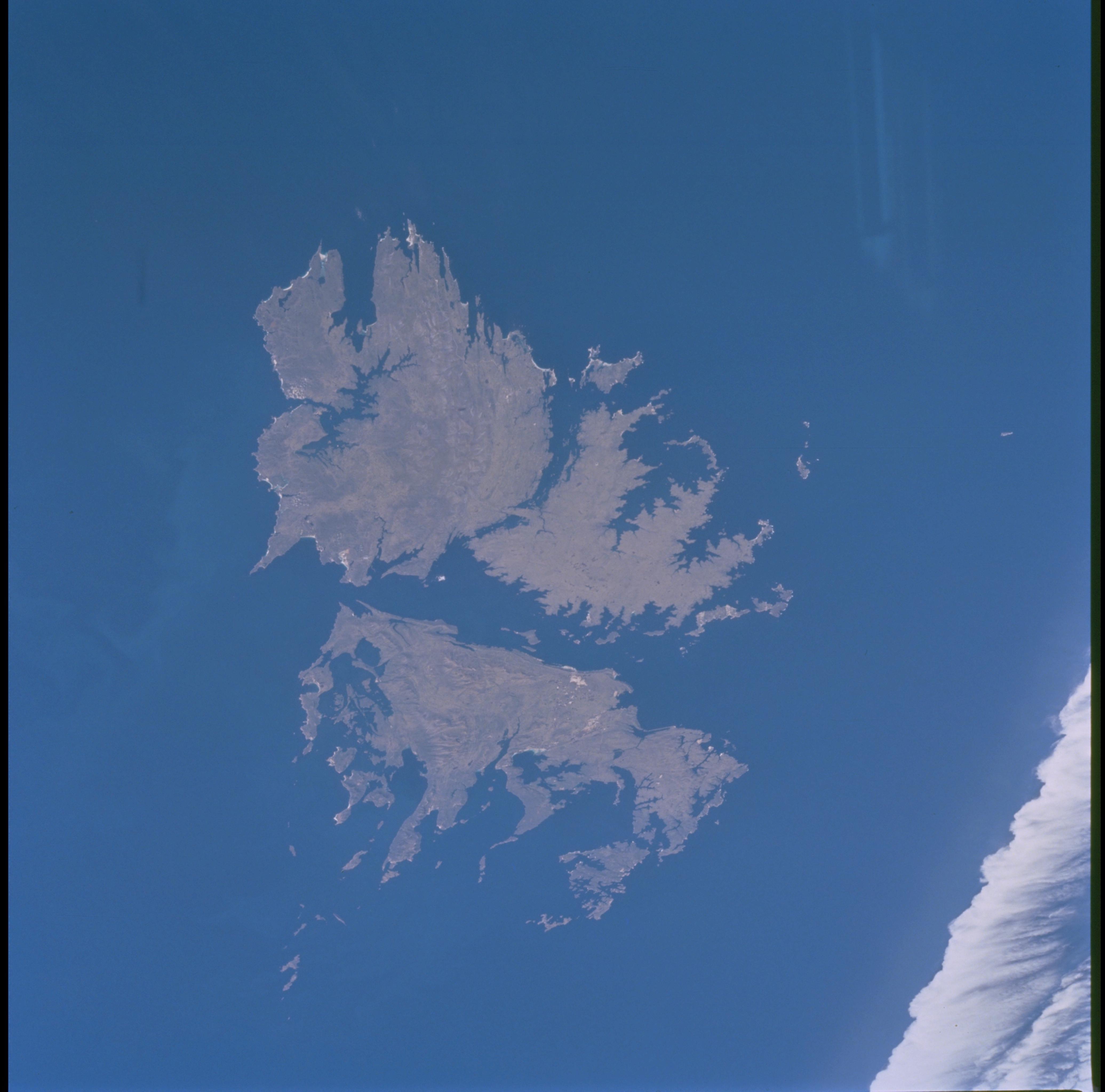
ISS002-700-27

| NASA Photo ID | ISS002-700-27 |
| Focal Length | 250mm |
| Date taken | 2001.03.30 |
| Time taken | 16:42:32 GMT |
Resolutions offered for this image:
540 x 530 pixels 782 x 768 pixels 1034 x 1024 pixels 2071 x 2048 pixels 4143 x 4096 pixels 517 x 512 pixels
540 x 530 pixels 782 x 768 pixels 1034 x 1024 pixels 2071 x 2048 pixels 4143 x 4096 pixels 517 x 512 pixels


Cloud masks available for this image:
Spacecraft nadir point: 51.0° S, 57.5° W
Photo center point: 51.5° S, 59.0° W
Photo center point by machine learning:
Photo center point: 51.5° S, 59.0° W
Photo center point by machine learning:
Nadir to Photo Center: West
Spacecraft Altitude: 208 nautical miles (385km)
Country or Geographic Name: | FALKLAND ISLANDS |
Features: | FALKLAND ISLANDS |
| Features Found Using Machine Learning: | |
Cloud Cover Percentage: | 10 (1-10)% |
Sun Elevation Angle: | 34° |
Sun Azimuth: | 345° |
Camera: | Hasselblad |
Focal Length: | 250mm |
Camera Tilt: | 25 degrees |
Format: | 5069: Kodak Elite 100S, E6 Reversal, Replaces Lumiere, Warmer in tone vs. Lumiere |
Film Exposure: | |
| Additional Information | |
| Width | Height | Annotated | Cropped | Purpose | Links |
|---|---|---|---|---|---|
| 540 pixels | 530 pixels | Photographic Highlights | Download Image | ||
| 782 pixels | 768 pixels | Photographic Highlights | Download Image | ||
| 1034 pixels | 1024 pixels | No | No | Download Image | |
| 2071 pixels | 2048 pixels | No | No | Download Image | |
| 4143 pixels | 4096 pixels | No | No | Download Image | |
| 517 pixels | 512 pixels | No | No | Download Image |
Download Packaged File
Download a Google Earth KML for this Image
View photo footprint information
Download a GeoTIFF for this photo
Image Caption: none
