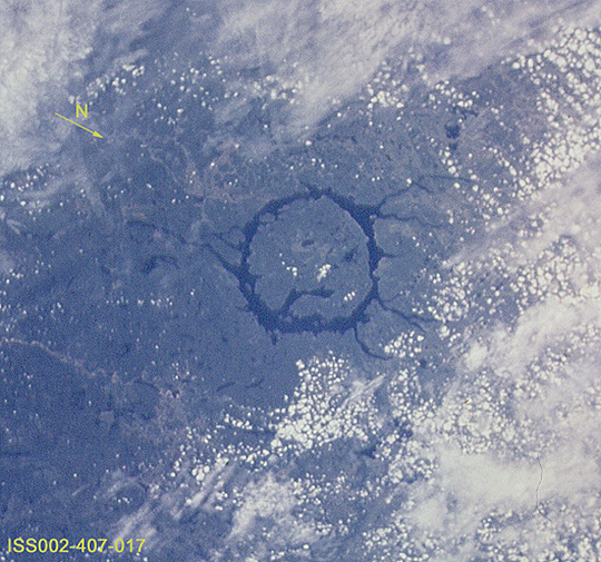
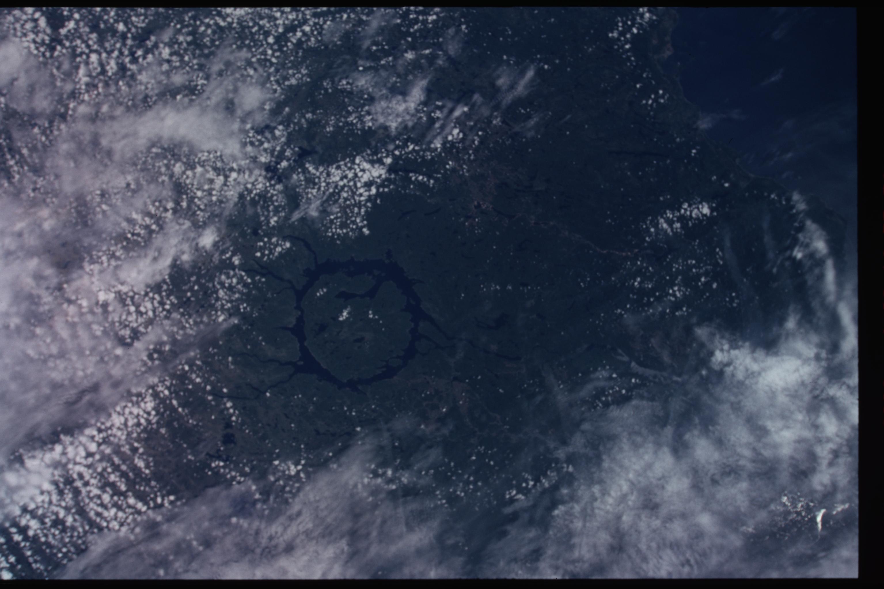
ISS002-407-17

| NASA Photo ID | ISS002-407-17 |
| Focal Length | 110mm |
| Date taken | 2001.06.28 |
| Time taken | 16:16:51 GMT |
Resolutions offered for this image:
540 x 505 pixels 822 x 768 pixels 3070 x 2044 pixels 515 x 342 pixels 839 x 553 pixels
540 x 505 pixels 822 x 768 pixels 3070 x 2044 pixels 515 x 342 pixels 839 x 553 pixels


Cloud masks available for this image:
Spacecraft nadir point: 46.7° N, 73.7° W
Photo center point: 51.0° N, 68.5° W
Photo center point by machine learning:
Photo center point: 51.0° N, 68.5° W
Photo center point by machine learning:
Nadir to Photo Center: Northeast
Spacecraft Altitude: 206 nautical miles (382km)
Country or Geographic Name: | CANADA-Q |
Features: | MANICOUAGAN RESERVOIR |
| Features Found Using Machine Learning: | |
Cloud Cover Percentage: | 75 (51-75)% |
Sun Elevation Angle: | 65° |
Sun Azimuth: | 157° |
Camera: | |
Focal Length: | 110mm |
Camera Tilt: | High Oblique |
Format: | |
Film Exposure: | |
| Additional Information | |
| Width | Height | Annotated | Cropped | Purpose | Links |
|---|---|---|---|---|---|
| 540 pixels | 505 pixels | Photographic Highlights | Download Image | ||
| 822 pixels | 768 pixels | Photographic Highlights | Download Image | ||
| 3070 pixels | 2044 pixels | No | No | Download Image | |
| 515 pixels | 342 pixels | No | No | Download Image | |
| 839 pixels | 553 pixels | No | No | Download Image |
Download Packaged File
Download a Google Earth KML for this Image
View photo footprint information
Download a GeoTIFF for this photo
Image Caption: none
