ISS001-E-5316

| NASA Photo ID | ISS001-E-5316 |
| Focal Length | mm |
| Date taken | 2001.01.23 |
| Time taken | GMT |
Resolutions offered for this image:
540 x 405 pixels 1530 x 1018 pixels 640 x 425 pixels 225 x 149 pixels 961 x 639 pixels
540 x 405 pixels 1530 x 1018 pixels 640 x 425 pixels 225 x 149 pixels 961 x 639 pixels

Cloud masks available for this image:
Spacecraft nadir point:
Photo center point: 19.0° N, 98.5° W
Photo center point by machine learning:
Photo center point: 19.0° N, 98.5° W
Photo center point by machine learning:
Nadir to Photo Center:
Spacecraft Altitude: nautical miles (0km)
Country or Geographic Name: | MEXICO |
Features: | POPOCATEPETL VOL., PLUME |
| Features Found Using Machine Learning: | |
Cloud Cover Percentage: | 10 (1-10)% |
Sun Elevation Angle: | ° |
Sun Azimuth: | ° |
Camera: | Kodak DCS460 Electronic Still Camera |
Focal Length: | mm |
Camera Tilt: | |
Format: | 3060E: 3060 x 2036 pixel CCD, RGBG array |
Film Exposure: | |
| Additional Information | |
| Width | Height | Annotated | Cropped | Purpose | Links |
|---|---|---|---|---|---|
| 540 pixels | 405 pixels | Yes | Yes | Earth From Space collection | Download Image |
| 1530 pixels | 1018 pixels | No | No | Download Image | |
| 640 pixels | 425 pixels | No | No | Download Image | |
| 225 pixels | 149 pixels | No | No | Download Image | |
| 961 pixels | 639 pixels | No | No | Download Image |
Download Packaged File
Download a Google Earth KML for this Image
View photo footprint information
Download a GeoTIFF for this photo
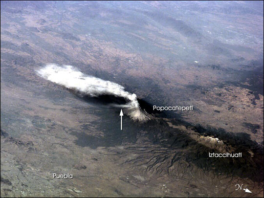
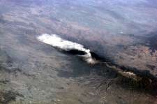
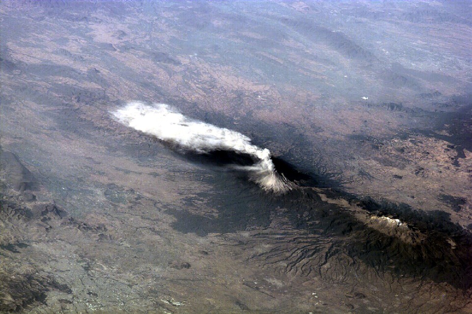
Image Caption: Popocatepetl, or Popo, the active volcano located about 70 km southeast of Mexico City, sends a plume south on January 23, 2001. The astronaut crew on the International Space Station Alpha observed and recorded this image as they orbited to the northeast of the volcano. Popo has been frequently active for six years. On this day, the eruption plume reportedly rose to more than 9 km above sea level [for reference, Popo's summit elevation is 5426 m (17,800 feet)]. Note the smaller ash plume below the main plume (arrow). The perspective from the ISS allowed the astronauts this unique 3 dimensional view.
Popo is situated between two large population centers: Mexico City (more than 18 million people, and just off the image to the right) and Puebla (about 1.2 million people). The region's dense population provides the potential for extreme impacts from volcanic hazards. Recent eruptions have been frequent, and have resulted in evacuations around the mountain.
Popo is situated between two large population centers: Mexico City (more than 18 million people, and just off the image to the right) and Puebla (about 1.2 million people). The region's dense population provides the potential for extreme impacts from volcanic hazards. Recent eruptions have been frequent, and have resulted in evacuations around the mountain.
