ISS001-E-5113
| NASA Photo ID | ISS001-E-5113 |
| Focal Length | 400mm |
| Date taken | 2000.12.__ |
| Time taken | GMT |
Resolutions offered for this image:
3056 x 2036 pixels 540 x 360 pixels 3056 x 2036 pixels 3060 x 2092 pixels 640 x 437 pixels
3056 x 2036 pixels 540 x 360 pixels 3056 x 2036 pixels 3060 x 2092 pixels 640 x 437 pixels


Cloud masks available for this image:
Spacecraft nadir point:
Photo center point: 47.5° S, 72.0° W
Photo center point by machine learning:
Photo center point: 47.5° S, 72.0° W
Photo center point by machine learning:
Nadir to Photo Center:
Spacecraft Altitude: nautical miles (0km)
Country or Geographic Name: | ARGENTINA |
Features: | SAN LORENZO PEAK, LAKES |
| Features Found Using Machine Learning: | |
Cloud Cover Percentage: | 25 (11-25)% |
Sun Elevation Angle: | ° |
Sun Azimuth: | ° |
Camera: | Kodak DCS460 Electronic Still Camera |
Focal Length: | 400mm |
Camera Tilt: | |
Format: | 3060E: 3060 x 2036 pixel CCD, RGBG array |
Film Exposure: | |
| Additional Information | |
| Width | Height | Annotated | Cropped | Purpose | Links |
|---|---|---|---|---|---|
| 3056 pixels | 2036 pixels | No | No | Earth From Space collection | Download Image |
| 540 pixels | 360 pixels | Yes | No | Earth From Space collection | Download Image |
| 3056 pixels | 2036 pixels | No | No | NASA's Earth Observatory web site | Download Image |
| 3060 pixels | 2092 pixels | No | No | Download Image | |
| 640 pixels | 437 pixels | No | No | Download Image |
Download Packaged File
Download a Google Earth KML for this Image
View photo footprint information
Download a GeoTIFF for this photo
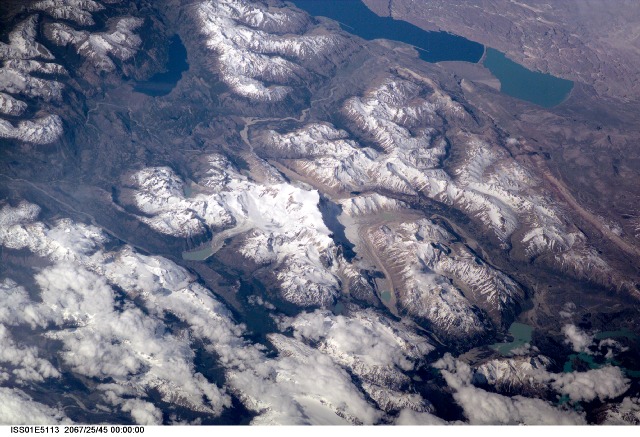
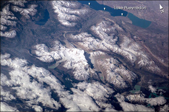
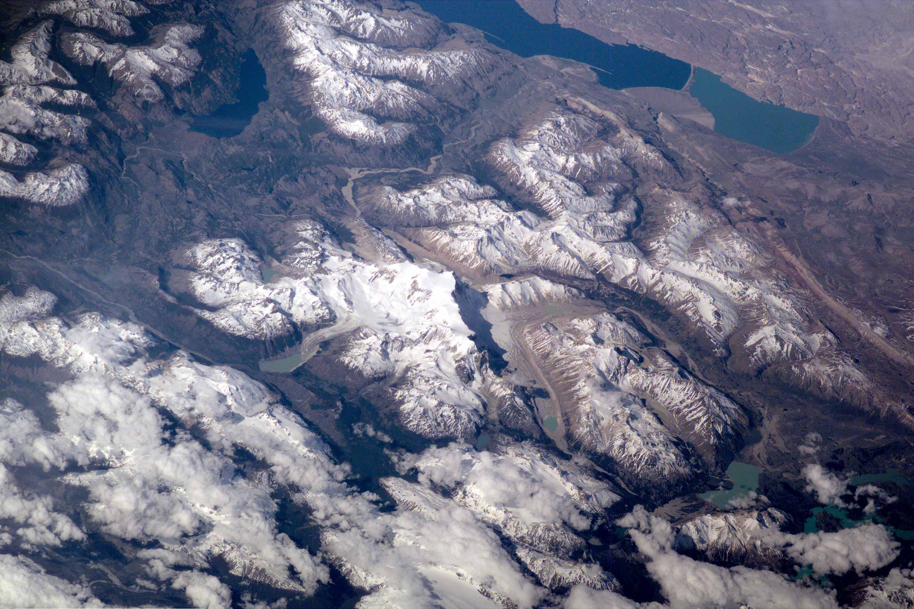
Image Caption: Erosion by Ice and Water in the Southern Andes
This scene on the remote, rugged Argentine/Chilean border in the far southern Andes Mountains offers numerous, dramatic examples of both erosional processes and features of ice and water. The sharp, glaciated crest of the Cerro San Lorenzo (center) exceeds 12,000 feet and casts a long shadow southeastward. Glaciers on its western flank flow into the valley.
Lago Pueyrredon, and the other lakes visible here, have been excavated by geologically recent episodes of glacier erosion, when glaciers extended all the way onto the lowland plains (top right). Since the last melting of the glaciers (~15,000 years ago) three distinct "fan-deltas" (semicircular features-arrows) have formed where rivers flow into the lake. Counterclockwise currents in the lake-driven by strong winds from the west-have generated thin sand spits from each fan-delta. The largest spit (attached to the largest fan-delta, see right arrow) has isolated an approximately 10-kilometer long segment of the south end of the lake. This river, which has constructed the large fan, presently discharges turbid water to this isolated basin, giving it a lighter color than the rest of the lake.
This Electronic Still Camera photo was taken from the International Space Station, in December 2000 (late spring) when most of the previous winter's snow had melted below an altitude of 6,000 feet. Little evidence of man's presence can be found in this rough, desolate region.
Glacial data collected over the past 50 years indicate that small ice bodies are disappearing at accelerated rates. (EOS, vol 81, no. 24, June 13, 2000) Predictions are that large fluctuations in land ice, with significant implications to society, are possible in the coming decades and centuries due to natural and anthropogenic climate change. Before glacial data can be used to address critical problems pertaining to the world's economic and environmental health, more detailed information about such glaciers is needed. Images like this from the International Space Station can be added to those taken from satellites (Landsat-7, instruments on the Terra satellite launched in 1999) to build data sets of glaciers in remote areas around the world.
