ISS001-E-5107

| NASA Photo ID | ISS001-E-5107 |
| Focal Length | 400mm |
| Date taken | 2000.12.__ |
| Time taken | GMT |
Cloud masks available for this image:
Spacecraft nadir point:
Photo center point: 47.0° S, 73.5° W
Photo center point by machine learning:
Photo center point: 47.0° S, 73.5° W
Photo center point by machine learning:
Nadir to Photo Center:
Spacecraft Altitude: nautical miles (0km)
Camera: | Kodak DCS460 Electronic Still Camera |
Focal Length: | 400mm |
Camera Tilt: | |
Format: | 3060E: 3060 x 2036 pixel CCD, RGBG array |
Film Exposure: | |
| Additional Information | |
| Width | Height | Annotated | Cropped | Purpose | Links |
|---|---|---|---|---|---|
| 3060 pixels | 2092 pixels | No | No | Download Image | |
| 640 pixels | 437 pixels | No | No | Download Image |
Download Packaged File
Download a Google Earth KML for this Image
View photo footprint information
Download a GeoTIFF for this photo
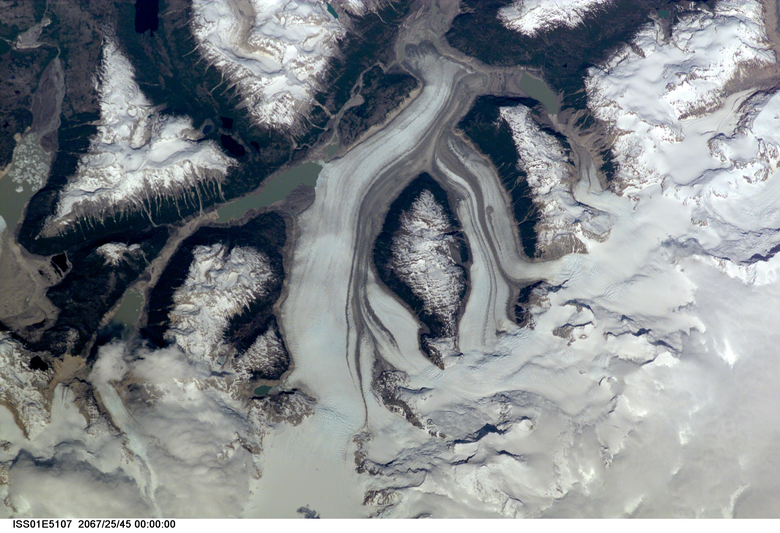
Image Caption: RIO DE LA COLONIA, CHILE
The remote headwaters of the Rio de la Colonia are located on the
eastern flank of the Cerro Pared Norte, a high, coastal range of the
Andes in southern Chile. This is a but a portion of a larger glaciated
region of the Chilean coast located at only 47 degrees South. The river
actually begins its flow just off the top of this scene at the foot of
the two large, converging, valley glaciers near the center. Some of the
numerous lake visible are tinted by the fine glacial sediments suspended
in their waters. Note the shards of ice that have calved from the
glaciers into the lakes on the left. Also note the shadows of the crest
of the over 14,000-foot mountains (lower center).
